Safety Score: 2,7 of 5.0 based on data from 9 authorites. Meaning we advice caution when travelling to United States.
Travel warnings are updated daily. Source: Travel Warning United States. Last Update: 2024-04-28 08:22:10
Explore Hillside
Hillside in Lehigh County (Pennsylvania) is a city in United States about 141 mi (or 227 km) north-east of Washington DC, the country's capital.
Local time in Hillside is now 03:45 PM (Sunday). The local timezone is named America / New York with an UTC offset of -4 hours. We know of 12 airports in the vicinity of Hillside, of which 5 are larger airports. The closest airport in United States is Lehigh Valley International Airport in a distance of 9 mi (or 14 km), East. Besides the airports, there are other travel options available (check left side).
There are two Unesco world heritage sites nearby. The closest heritage site in United States is Independence Hall in a distance of 60 mi (or 97 km), South-East. Also, if you like golfing, there are multiple options in driving distance. If you need a place to sleep, we compiled a list of available hotels close to the map centre further down the page.
Depending on your travel schedule, you might want to pay a visit to some of the following locations: Allentown, Jim Thorpe, Easton, Reading and Norristown. To further explore this place, just scroll down and browse the available info.
Local weather forecast
Todays Local Weather Conditions & Forecast: 18°C / 65 °F
| Morning Temperature | 8°C / 47 °F |
| Evening Temperature | 23°C / 73 °F |
| Night Temperature | 16°C / 61 °F |
| Chance of rainfall | 2% |
| Air Humidity | 77% |
| Air Pressure | 1021 hPa |
| Wind Speed | Gentle Breeze with 9 km/h (5 mph) from North-East |
| Cloud Conditions | Overcast clouds, covering 96% of sky |
| General Conditions | Light rain |
Sunday, 28th of April 2024
25°C (76 °F)
17°C (63 °F)
Moderate rain, light breeze, scattered clouds.
Monday, 29th of April 2024
23°C (74 °F)
17°C (62 °F)
Moderate rain, gentle breeze, overcast clouds.
Tuesday, 30th of April 2024
18°C (65 °F)
11°C (52 °F)
Broken clouds, gentle breeze.
Hotels and Places to Stay
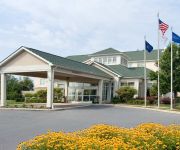
HOWARD JOHNSON INN & SUITES AL
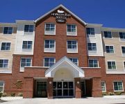
Homewood Suites by Hilton Allentown-West Fogelsville
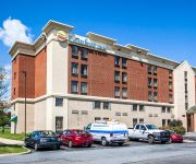
Comfort Inn Lehigh Valley West
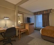
Comfort Suites Allentown
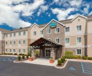
Staybridge Suites ALLENTOWN WEST
Hilton Garden Inn Allentown West
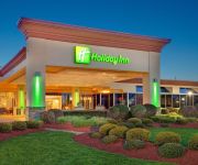
Holiday Inn ALLENTOWN-I-78 (LEHIGH VALLEY)
Fairfield Inn & Suites Allentown West
Motel 6 Allentown PA
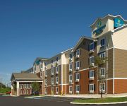
WOODSPRING SUITES ALLENTOWN
Videos from this area
These are videos related to the place based on their proximity to this place.
Snow Geese phonescoped at the Fogelsville Quarry with IPhone 5S and Opticron MM3 50 mm
via YouTube Capture.
Goodwill Store & Donation Center Fogelsville, PA - non-profit thrift store
Goodwill Keystone Area thrift store & donation center located at 7720 Main St. Fogelsville, PA 18051. Learn how your purchases & donations help people seekin...
Golden Tee Great Shot on Celtic Shores!
TMS hit an amazing shot at FOGELSVILLE HOTEL, FOGELSVILLE, PA!
The Truck Blew a Turbo Trucking Across the USA
http://www.TruckDriverDiary.com - Your source for a windshield view of the daily life of an over the road truck driver.
Videos provided by Youtube are under the copyright of their owners.
Attractions and noteworthy things
Distances are based on the centre of the city/town and sightseeing location. This list contains brief abstracts about monuments, holiday activities, national parcs, museums, organisations and more from the area as well as interesting facts about the region itself. Where available, you'll find the corresponding homepage. Otherwise the related wikipedia article.
Lehigh County, Pennsylvania
Lehigh County is a county located in the Lehigh Valley region of the eastern part of the U.S. state of Pennsylvania. As of the 2010 U.S. Census, the county's population was 349,497. Its county seat is Allentown, the state's third largest city behind Philadelphia and Pittsburgh. In addition to Allentown, the county includes the western section of the city of Bethlehem, six boroughs and 14 townships. Of 67 Pennsylvania counties, it is the 11th most populous.
Fogelsville, Pennsylvania
Fogelsville is a village in Lehigh County, Pennsylvania, in the United States. It is a suburb of Allentown, in Upper Macungie Township, in the Lehigh Valley region of the state. Fogelsville is named after Judge John Fogel, who built the first building in the area, a hotel, in 1798. Fogelsville surrounds a number of large industrial parks and corporate centers. The town is known as a large regional trucking hub. Major roads servicing Fogelsville include Interstate 78 and Pennsylvania Route 100.
Orefield, Pennsylvania
Orefield is a small unincorporated community in Lehigh County, Pennsylvania, United States, split between North Whitehall and South Whitehall township. Located along Pennsylvania Route 309, Orefield has the zip code of 18069. Its name is derived from the extensive deposits of limonite once mined here. It was once the terminus of the Siegersville Branch of the Ironton Railroad, which was extended here to haul the ore. Orefield is the former home to Parkland High School.
Kuhnsville, Pennsylvania
Kuhnsville is a small unincorporated village in Upper Macungie Township, Lehigh County, Pennsylvania. Along with the adjacent villages of Chapmans (immediately west) and Ruppsville (southwest), Kuhnsville forms the eastern edge of the transportation and warehousing business district centered on Fogelsville. It uses the Allentown zip code of 18104. http://www. hipcodes. com/18106/ Kuhnsville is perhaps best known as the western terminus of the Lehigh Valley Thruway.
Wescosville, Pennsylvania
Wescosville is a census-designated place located in Lehigh County, Pennsylvania, United States. The town is located between Allentown, Pennsylvania and Trexlertown, Pennsylvania in Lower Macungie Township. It is split between the Allentown zip codes of 18103, 18104, and 18106. http://www. hipcodes. com/18106/ As of the 2010 census the population was 5,872 residents.
Orefield Middle School
Orefield Middle School has a half-century serving the students in the Parkland School District in Pennsylvania. Built as the Parkland Junior Senior High School in 1953, the school opened in 1954 for 1,157 students in grades seven through twelve. As enrollment grew, seventh and eighth grade students were re-assigned to Troxell. Upon completion of Springhouse Junior High School in 1971, seventh, eighth, and ninth grade students were assigned to each of the junior high schools.
Westfield Hospital
Westfield Hospital is an acute care general hospital in Allentown, Pennsylvania. The hospital was created by Yasin Khan, M.D. in 2007 to serve the needs of the community. The hospital is a 26-bed facility with operating rooms, full diagnostic department, and Emergency Department. The ER doctor sees patients within minutes of arrival. In 2009, Jeffrey D. Gould, M.D. became the Chief of Medicine. In 2010, an ICU was added and a Sleep Disorders Center was opened. www. WestfieldHospital. com
Walbert, Pennsylvania
Walbert, Pennsylvania is a small village that hosts the municipal offices of South Whitehall Township, Lehigh County. It is located on Route 309 and has easy access to 22, 78, and 476. It is split between the Allentown zip code of 18104 and the Orefield zip code of 18069. http://www. hipcodes. com/18069/ It is drained by the Jordan Creek into the Lehigh River.


