Safety Score: 2,7 of 5.0 based on data from 9 authorites. Meaning we advice caution when travelling to United States.
Travel warnings are updated daily. Source: Travel Warning United States. Last Update: 2024-05-08 08:04:21
Discover Lyttonsville
Lyttonsville in Montgomery County (Maryland) is a place in United States a little north of Washington DC, the country's capital city.
Current time in Lyttonsville is now 06:38 AM (Wednesday). The local timezone is named America / New York with an UTC offset of -4 hours. We know of 8 airports near Lyttonsville, of which 4 are larger airports. The closest airport in United States is Ronald Reagan Washington National Airport in a distance of 10 mi (or 17 km), South. Besides the airports, there are other travel options available (check left side).
There is one Unesco world heritage site nearby. It's Monticello and the University of Virginia in Charlottesville in a distance of 71 mi (or 114 km), South. Also, if you like playing golf, there are a few options in driving distance. We encountered 10 points of interest in the vicinity of this place. If you need a hotel, we compiled a list of available hotels close to the map centre further down the page.
While being here, you might want to pay a visit to some of the following locations: Washington DC, Rockville, Arlington, Falls Church and Alexandria. To further explore this place, just scroll down and browse the available info.
Local weather forecast
Todays Local Weather Conditions & Forecast: 29°C / 84 °F
| Morning Temperature | 18°C / 65 °F |
| Evening Temperature | 26°C / 79 °F |
| Night Temperature | 21°C / 69 °F |
| Chance of rainfall | 1% |
| Air Humidity | 51% |
| Air Pressure | 1005 hPa |
| Wind Speed | Gentle Breeze with 7 km/h (4 mph) from East |
| Cloud Conditions | Overcast clouds, covering 90% of sky |
| General Conditions | Light rain |
Wednesday, 8th of May 2024
21°C (70 °F)
20°C (69 °F)
Light rain, moderate breeze, overcast clouds.
Thursday, 9th of May 2024
21°C (70 °F)
13°C (56 °F)
Scattered clouds, moderate breeze.
Friday, 10th of May 2024
19°C (65 °F)
13°C (56 °F)
Light rain, gentle breeze, scattered clouds.
Hotels and Places to Stay
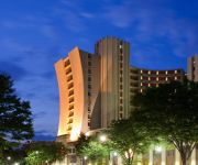
Sheraton Silver Spring Hotel
Bethesda Marriott
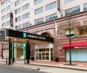
Embassy Suites by Hilton Washington DC Chevy Chase Pavilion
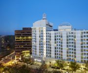
DoubleTree by Hilton Washington DC - Silver Spring
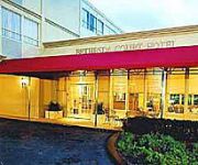
Bethesda Court Hotel
DoubleTree by Hilton Bethesda - Washington DC
ExecuStay at Wisconsin Place
Eden Park Guest House
Courtyard Chevy Chase
Global Luxury Suites at Woodmont Triangle South
Videos from this area
These are videos related to the place based on their proximity to this place.
Bethesda Row - A Visit
This is a video slideshow of photographs taken in 2009 in the Bethesda Row section of Bethesda, MD (a northern suburb of Washington, DC).
Kathleen B. Larkin of Chevy Chase MD
Kathleen Bennett Larkin 94 was married to Lawrence Clark Larkin for 70 years. They lived in the town of Chevy Chase Maryland for 55 years and both are now deceased. They have had 10 Children,...
Chevy Chase MD Jones Mill Rd and Park View Estates
Chevy Chase MD along Jones Mill Road near the Audubon Society's Woodend nature preserve and the Park View Estates neighborhood on LeVelle and Park View Roads ...
Forest Glen - National Park Seminary - Nov 17, 2013 - Part 3 of 4
Meandering through Forest Glen, as it slowly gets too dark to film any more.
Forest Glen - National Park Seminary - Nov 17, 2013 - Part 1 of 4
Meandering through Forest Glen, as it slowly gets too dark to film any more.
Forest Glen - National Park Seminary - Nov 17, 2013 - Part 2 of 4
Meandering through Forest Glen, as it slowly gets too dark to film any more.
Forest Glen - National Park Seminary - Nov 17, 2013 - Part 4 of 4
Meandering through Forest Glen, as it slowly gets too dark to film any more.
Lola giving a tour of the Bungalow
Lola giving a tour of the excavation at the American (Alpha) Bungalow at National Park Seminary. (Also at our blog, http://alphabungalow.blogspot.com)
Videos provided by Youtube are under the copyright of their owners.
Attractions and noteworthy things
Distances are based on the centre of the city/town and sightseeing location. This list contains brief abstracts about monuments, holiday activities, national parcs, museums, organisations and more from the area as well as interesting facts about the region itself. Where available, you'll find the corresponding homepage. Otherwise the related wikipedia article.
Forest Glen (WMATA station)
Forest Glen is a side platformed Washington Metro station in Forest Glen, Maryland, United States. The station was opened on September 22, 1990, and is operated by the Washington Metropolitan Area Transit Authority (WMATA). Its opening coincided with the completion of 3.2 miles of rail north of the Silver Spring station and the opening of the Wheaton station. Providing service for the Red Line, the station is located at Georgia Avenue and Forest Glen Road.
WWRC
WWRC—branded 1260 WRC—is a news/talk radio station licensed to Washington, D.C. and serving the Washington metro area. It operates with 25,000 watts during the day and 5,000 watts at night with studios and transmitters both located in the city proper. The station is owned and operated by Salem Communications. Its callsign is a four-letter version of the famous WRC callsign in Washington, and is a name-only descendant of the former NBC Radio Network owned-and-operated station.
Capital Crescent Trail
The Capital Crescent Trail (CCT) is an 11-mile long, shared-use rail trail that runs from Georgetown in Washington, D.C. , to Silver Spring, Maryland. The portion from Bethesda to Silver Spring is also called the Georgetown Branch Trail but is recognized as the Future Capital Crescent Trail. The Capital Crescent Trail is the most heavily used rail trail in the United States and is used by more than 1 million walkers, joggers, bikers, and rollerbladers each year.
National Park Seminary
National Park Seminary — later called National Park College — was a private girls' school open from 1894 to 1942. Located in Forest Glen, Maryland, its name alludes to nearby Rock Creek Park. The historic campus is to be preserved as the center of a new housing development.
North Portal Estates
North Portal Estates is an affluent residential neighborhood in Washington, D.C. that forms the northernmost corner of the District of Columbia. North Portal Estates is bounded by North Portal Drive to the south, East Beach drive to the west and northwest, and Rock Creek Park to the northeast. It is not set on any major thoroughfare in the city, although North Portal Drive is accessible via a rotary intersection on 16th Street NW.
Colonial Village
Colonial Village is an affluent residential neighborhood in northwest Washington, D.C. It is bounded by Portal Drive to the north, 16th Street to the east, and Rock Creek Park to the west and south. Colonial Village and the rest of Ward 4 are represented in the Council of the District of Columbia by Muriel Bowser. The neighborhood is suburban in character, full of winding streets, detached houses on large lots, and open space.
Rock Creek Gardens
Rock Creek Gardens is an affluent residential neighborhood in northwest Washington, D.C. , bounded by West Beach Drive to the east and northeast, Parkside Drive to the south and southwest, and Rock Creek Park to the northeast. West Beach and Parkside also abut the park, making Rock Creek Gardens the only neighborhood in the city to be surrounded entirely by Rock Creek Park, hence its name.
Forest Glen Annex
The Forest Glen Annex is a 136-acre U.S. Army installation in the Forest Glen neighborhood of Silver Spring, Maryland, USA. It is situated between Brookville Road and Linden Lane. Since 1999, the Annex has been the site of the Walter Reed Army Institute of Research (WRAIR) and the Naval Medical Research Center (NMRC), along with smaller units. In addition to the large research laboratories located in the Annex’s "Daniel K.
Woodside (Silver Spring, Maryland)
Woodside is a neighborhood located in Silver Spring, Maryland, in the United States.
Yeshiva of Greater Washington
The Yeshiva of Greater Washington is an all boys, Orthodox community based Jewish Day School, that is located in Silver Spring, Maryland. It was originally founded in 1964 by Rabbi Gedaliah Anemer. It consists of a high school and beis medrash.
Walter Reed Tropical Medicine Course
The Walter Reed Tropical Medicine Course at Walter Reed Army Institute of Research (WRAIR) is one of the many Tropical Medicine Training Courses available in the US and worldwide. It is an intensive 5-day course created to familiarize students with tropical diseases they may encounter overseas. The course is open to Physicians, Physician Assistants, Nurse Practitioners, ESO, 18D, or other medical personnel.
1996 Silver Spring, Maryland train collision
The 1996 Silver Spring, Maryland train collision occurred on February 16, 1996, when a MARC commuter train collided with Amtrak's Capitol Limited passenger train in Silver Spring, Maryland. There were 175 passengers and 16 crew members on the Amtrak train and 20 passengers and 3 crew members on board the MARC train at the time of the accident. The collision killed 11 people on the MARC train including 8 passengers and 3 crew.


