Safety Score: 2,7 of 5.0 based on data from 9 authorites. Meaning we advice caution when travelling to United States.
Travel warnings are updated daily. Source: Travel Warning United States. Last Update: 2024-04-26 08:02:42
Discover Fort Davis
Fort Davis in Washington County (District of Columbia) is a place in United States a little east of Washington DC, the country's capital city.
Current time in Fort Davis is now 02:52 AM (Saturday). The local timezone is named America / New York with an UTC offset of -4 hours. We know of 8 airports near Fort Davis, of which 4 are larger airports. The closest airport in United States is Ronald Reagan Washington National Airport in a distance of 5 mi (or 8 km), West. Besides the airports, there are other travel options available (check left side).
There is one Unesco world heritage site nearby. It's Monticello and the University of Virginia in Charlottesville in a distance of 65 mi (or 104 km), South-West. Also, if you like playing golf, there are a few options in driving distance. We encountered 10 points of interest in the vicinity of this place. If you need a hotel, we compiled a list of available hotels close to the map centre further down the page.
While being here, you might want to pay a visit to some of the following locations: Washington DC, Alexandria, Arlington, Upper Marlboro and Falls Church. To further explore this place, just scroll down and browse the available info.
Local weather forecast
Todays Local Weather Conditions & Forecast: 12°C / 54 °F
| Morning Temperature | 10°C / 49 °F |
| Evening Temperature | 10°C / 50 °F |
| Night Temperature | 10°C / 50 °F |
| Chance of rainfall | 1% |
| Air Humidity | 70% |
| Air Pressure | 1032 hPa |
| Wind Speed | Gentle Breeze with 6 km/h (4 mph) from North |
| Cloud Conditions | Overcast clouds, covering 100% of sky |
| General Conditions | Light rain |
Saturday, 27th of April 2024
24°C (74 °F)
18°C (65 °F)
Light rain, light breeze, broken clouds.
Sunday, 28th of April 2024
31°C (88 °F)
20°C (68 °F)
Overcast clouds, light breeze.
Monday, 29th of April 2024
28°C (82 °F)
19°C (67 °F)
Light rain, gentle breeze, scattered clouds.
Hotels and Places to Stay
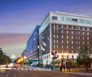
Liaison Capitol Hill DC
Kimpton George Hotel
Sleeps 5-6 Guests Capitol Hill Fully Furnished Apartments
Hilton Garden Inn Washington DC-US Capitol
Malolo Bed and Breakfast
Courtyard Washington DC/U.S. Capitol
Phoenix Park Hotel
Homewood Suites by Hilton Washington DC NoMa Union Station
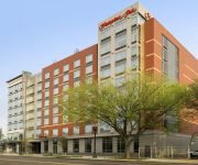
Hampton Inn Washington DC NoMa Union Station
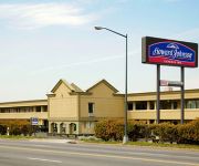
HOWARD JOHNSON INN WASHINGTON
Videos from this area
These are videos related to the place based on their proximity to this place.
How Vaginal Steaming Can Help Your Health: The Womb Sauna, Suitland, MD 888-576-9662
http://www.thewombsauna.com 3522 Silver Park Dr, Suitland, MD 20746 (888) 576-9662 Thema Azize Serwa founder and CEO of The Womb Sauna discusses the health benefits of vaginal steaming. ...
Best Eyebrows Suitland Md, Lashes DC, Make-Up Artist, Beauty Salon, Bundles, Infusion, Cosmetics
Best Eyebrows Suitland Md, Lash Services DC, Make-Up Artist, Top Beauty Salon, Bundles, Infusion, Cosmetics DMV, Stylist Md http://www.blueblisshairstudio.com/ Blue Bliss Hair Studio ...
Sisterlocks: retighten after 6 weeks suitland maryland
sisterlocks in suitland maryland call 3014231799 www.organiknordaz.com.
Worst Fight Ever - 2010 DC101 Chili Cook-Off
Some drunk showing off his poor self defense skills at the 2010 DC101 Chili Cookoff.
Shooting Gilmore
Shooting video of Gilmore, the lion mascot of aviator Roscoe Turner, at the National Air and Space Museum's Paul E. Garber Restoration Facility, for a television program on animals and aviation,...
NEW 4309 BYERS ST CAPITOL HEIGHTS MD - PROPERTY PREVIEW
NEW PROPERTY FOR SALE IN CAPITOL HEIGHTS!!! Take a tour of this gourgeous newly renovated 5br 2ba located at Byers St, Capitol Heights MD More info at: www.
DC Prep - Snapshot of a Pre-k Read Aloud Lesson
DC Prep Benning Elementary Campus - Ashley (Wilbon) Tyson (Pre-k Teacher in 2013-14 School Year) Funding provided by Denver Public Schools.
4500 CLAY STREET NORTHEAST, WASHINGTON, DC Presented by Michael Kilner.
Click to see more: http://www.searchallproperties.com/listings/2060792/4500-CLAY-STREET-NORTHEAST-WASHINGTON-DC/auto?reqpage=video 4500 CLAY STREET NORTHEAST WASHINGTON, ...
Videos provided by Youtube are under the copyright of their owners.
Attractions and noteworthy things
Distances are based on the centre of the city/town and sightseeing location. This list contains brief abstracts about monuments, holiday activities, national parcs, museums, organisations and more from the area as well as interesting facts about the region itself. Where available, you'll find the corresponding homepage. Otherwise the related wikipedia article.
Naylor Road (WMATA station)
Naylor Road is an island platformed Washington Metro station in unincorporated Prince George's County, Maryland, United States. The station was opened on January 13, 2001, and is operated by the Washington Metropolitan Area Transit Authority (WMATA). Providing service for only the Green Line, the station is located between Naylor Road, Branch Avenue and Suitland Parkway.
Hillcrest, Washington, D.C
Hillcrest is a neighborhood in the southeast quadrant of Washington, D.C. , United States. Hillcrest is located in Ward 7, east of the Anacostia River. Hillcrest is a rather affluent and well-kept neighborhood. Former mayor Marion Barry is a former resident. Current residents include Mayor Vincent C. Gray. Hillcrest is bounded by Pennsylvania Avenue SE to the northeast, Southern Avenue to the southeast, and 32nd Street to the west. Branch Avenue is its main thoroughfare.
Randle Circle
Randle Circle is a traffic circle located at the intersection of Massachusetts, Minnesota and Branch avenues, K and 32nd streets, and Fort DuPont Drive in Southeast Washington, D.C. The entrance to Fort Dupont is located on the circle.
Benning Heights
Benning Heights is a residential neighborhood located in Northeast Washington, D.C. It is bounded by East Capitol Street to the south, Brooks Street NE to the north, 44th Street NE and Benning Road to the west, and Division Avenue NE to the east. It is served by the Benning Road station on the Blue Line of the Washington Metro. Politically, Benning Heights is in Ward 7.
Benning Ridge
Benning Ridge is a residential neighborhood located in Southeast Washington, D.C. It is bounded by Fort Chaplin Park to the northwest, Southern Avenue to the south, Benning Road to the east, and Ridge Road SE to the west.
Fairfax Village
Fairfax Village is a small neighborhood of garden apartments and townhouses located in southeast Washington, D. C in the Hillcrest area. It is bound by Alabama Avenue SE to the northwest, Pennsylvania Avenue SE to the northeast, Suitland Road to the southwest, and Southern Avenue to the east. At one time, former mayor Marion Barry lived close to here. Also see article on Anacostia.
Fort Davis (Washington, D.C.)
Fort Davis is a residential neighborhood located in southeast Washington, D. C, on the border of Prince George's County, Maryland. It is bounded by Southern Avenue to the southeast, Pennsylvania Avenue SE to the southwest, and Alabama Avenue and Bowen Road SE to the north and west. Former mayor Marion Barry lived nearby while mayor.
Dupont Park
Dupont Park is a residential neighborhood located in southeast Washington, D.C. It is bounded by Fort Dupont Park to the north, Pennsylvania Avenue SE to the south, Branch Avenue to the west, and Fort Davis Park to the east. Dupont Park is nestled into the parkland of Fort Davis and Fort Dupont Parks, the grounds of two Civil War-era forts that were constructed for the defense of Washington. The year-round Fort Dupont ice- skating rink is also located in this area.
Penn Branch
Penn Branch is a neighborhood in Southeast Washington, D.C. , east of the Anacostia River. It is bounded by Pennsylvania Avenue SE to the south; Pope Branch Park and Pope Creek to the north; Branch Avenue to the west; and Fort Davis Park to the east.
Cedar Hill Cemetery (Maryland)
Cedar Hill Cemetery, previously known as Forest Lake Cemetery, and also formerly Nonesuch Plantation, is a cemetery located in Suitland, Maryland. Its current name was implemented in 1913. It is over 150 acres in size and the oldest tombstone reads "Philenia W. Patte, Nov. 19, 1871, 58 years". There is a mass grave for the victims of the Terra Cotta Railroad wreck at this cemetery. One person of note buried at Cedar Hill Cemetery is George Keefe, a one-time professional baseball player.
Kimball Elementary School
Kimball Elementary School is a kindergarten to fifth grade school part of the District of Columbia public school system. It is located at the corner of Minnesota Avenue and Ely Place S.E. The brick building was originally built in 1950s has had two additions.
Southern Avenue (Washington, D.C.)
Southern Avenue is one of three boundary streets between Washington, D.C. , and the state of Maryland. Following a southeast-to-northeast line, Southern Avenue begins at the intersection of South Capitol Street, Southeast and Indian Head Highway on the Maryland side. It runs for approximately seven miles to its other end at Eastern Avenue in Northeast, Washington, D.C..


