Safety Score: 2,7 of 5.0 based on data from 9 authorites. Meaning we advice caution when travelling to United States.
Travel warnings are updated daily. Source: Travel Warning United States. Last Update: 2024-05-23 08:16:57
Explore Newberry Corner
Newberry Corner in Litchfield County (Connecticut) is located in United States about 286 mi (or 461 km) north-east of Washington DC, the country's capital.
Local time in Newberry Corner is now 09:20 AM (Thursday). The local timezone is named America / New York with an UTC offset of -4 hours. We know of 11 airports in the wider vicinity of Newberry Corner, of which 4 are larger airports. The closest airport in United States is Bradley International Airport in a distance of 26 mi (or 41 km), North-East. Besides the airports, there are other travel options available (check left side).
There is one Unesco world heritage site nearby. It's Statue of Liberty in a distance of 87 mi (or 140 km), South-West. Also, if you like golfing, there are multiple options in driving distance. If you need a place to sleep, we compiled a list of available hotels close to the map centre further down the page.
Depending on your travel schedule, you might want to pay a visit to some of the following locations: Hartford, Carmel, Poughkeepsie, Hudson and Catskill. To further explore this place, just scroll down and browse the available info.
Local weather forecast
Todays Local Weather Conditions & Forecast: 27°C / 81 °F
| Morning Temperature | 18°C / 65 °F |
| Evening Temperature | 21°C / 70 °F |
| Night Temperature | 17°C / 63 °F |
| Chance of rainfall | 2% |
| Air Humidity | 55% |
| Air Pressure | 1011 hPa |
| Wind Speed | Gentle Breeze with 5 km/h (3 mph) from South-East |
| Cloud Conditions | Overcast clouds, covering 100% of sky |
| General Conditions | Light rain |
Thursday, 23rd of May 2024
24°C (75 °F)
15°C (60 °F)
Light rain, gentle breeze, few clouds.
Friday, 24th of May 2024
24°C (75 °F)
16°C (60 °F)
Overcast clouds, gentle breeze.
Saturday, 25th of May 2024
24°C (76 °F)
16°C (60 °F)
Light rain, light breeze, scattered clouds.
Hotels and Places to Stay
TOLLGATE HILL INN
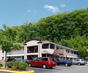
Rodeway Inn & Suites Torrington
Rodeway Inn & Suites
YANKEE PEDLAR INN
DAYS INN TORRINGTON
Royal Inn Torrington
LITCHFIELD INN
Videos from this area
These are videos related to the place based on their proximity to this place.
LP Sonic Boom Rise Of Lyric - Episode 20 - City In The Sky
Patreon page; http://www.patreon.com/chibikage89 Please Subscribe: http://www.youtube.com/subscription_center?add_user=chibikage89 Follow Me On; Twitter: http://twitter.com/chibikage89 Twitch:...
Vacation Home Speed Building #35 ChibiKage89 Minecraft Adventures
In order to get my vacation house closer to being finished I decided to do more of it in a timelapse video. Please Subscribe: http://www.youtube.com/subscribe_widget?p=ChibiKage89 Follow Me...
7 Days To Die - Welcome to The Big City - Day 5 [FaceCam] (NEW GAME)
75 likes to keep this series alive! Become a GG Gamer by Subscribing ➜ http://www.youtube.com/palmerater Follow me on Twitter ➜ https://twitter.com/palmerater 2nd Channel Http://www.youtube.co...
100% Super Mario Sunshine Playthrough -Part 4- Pianta Village Early
In this video I go to Pianta Village way earlier then you are supposed to. Please Subscribe: http://www.youtube.com/subscribe_widget?p=ChibiKage89 Follow Me On Twitter: http://twitter.com/chibikag...
Energy Fitness (Torrington, CT) Step Aerobics Class
Step with Laura at Energy Fitness in Torrington, CT.
Journey To Milk - Minecraft Parkour Map w ChibiKage89
Download the map here; http://www.planetminecraft.com/project/journey-to-milk/ Welcome to my second parkour course, Journey To Milk. In this map you must complete the parkour course so you...
The Adventures Of ChibiKage89 #1 - The Epic Journey Begins - Minecraft Modded Survival
Now to begin my greatest adventure ever. This series is about my epic adventures in the world of Minecraft, I'll be taking on dungeons hundreds of enemy monsters, and building awesome bases,...
Donkey Kong Country Tropical Freeze - Episode 1 - The Invaders From The North
The epic platforming adventure is here, Donkey Kong Country Topical Freeze for the Wii U. I'm going to have fun playing through this game. Playlist; http://www.youtube.com/playlist?list=PLlKWO9_...
Hero of Kakariko Village - Episode 11 - The Legend Of Zelda Twilight Princess Walkthrough
The secret to defeating the Gorons has been discovered, now I must return to Kakariko Village to begin my climb up Death Mountain Trail. Please Subscribe: ...
Videos provided by Youtube are under the copyright of their owners.
Attractions and noteworthy things
Distances are based on the centre of the city/town and sightseeing location. This list contains brief abstracts about monuments, holiday activities, national parcs, museums, organisations and more from the area as well as interesting facts about the region itself. Where available, you'll find the corresponding homepage. Otherwise the related wikipedia article.
WAPJ
WAPJ is a non-commercial FM radio station in the United States, operated by the Torrington Community Radio Foundation, Inc. The station first went on the air in 1997 and currently operates on 89.9 MHz with a translator in downtown Torrington, Connecticut on 105.1 MHz. The station offers an eclectic mix of music and spoken word programming targeted for the Torrington area and produced by area volunteers.
Torrington High School
Torrington High School is the lone public high school in the city of Torrington, Connecticut. The high school opened in 1963 and was renovated in 2000. The school strives to live up to its four A's: academics, activities, arts, and athletics. Address: Major Besse Drive, Torrington, CT 06790 Phone: (860) 489-2294 Fax: (860) 489-2853 Guidance: (860) 489-2291 Fax: (860) 489-4085
WZBG
WZBG is a radio station broadcasting an Adult Contemporary format. Licensed to Litchfield, Connecticut, USA, it serves the Litchfield area. The station is currently owned by Local Girls And Boys Broadcasting Corporation.
Coe Memorial Park
Coe Memorial Park is located in Torrington, Connecticut.
Fuessenich Park
Fuessenich Park is a baseball field located in downtown Torrington, Connecticut, USA, with a capacity of 1,500 fans. It is the home of the Torrington Titans of the Futures Collegiate Baseball League.
St. Mary Parish, Torrington
St. Mary Parish - designated for Polish immigrants in Torrington, Connecticut, United States. Founded on October 26, 1919. It is one of the Polish-American Roman Catholic parishes in New England in the Archdiocese of Hartford.
Topsmead State Forest
Topsmead State Forest is located in Litchfield, Connecticut. It was formally the summer residence of Edith Morton Chase, daughter of Henry Sabin Chase, first president of the Chase Brass and Copper Company. She left the house and its grounds to the state of Connecticut on her death in 1972.


!['7 Days To Die - Welcome to The Big City - Day 5 [FaceCam] (NEW GAME)' preview picture of video '7 Days To Die - Welcome to The Big City - Day 5 [FaceCam] (NEW GAME)'](https://img.youtube.com/vi/xOxKyfQgRYM/mqdefault.jpg)


