Safety Score: 3,0 of 5.0 based on data from 9 authorites. Meaning we advice caution when travelling to United Kingdom.
Travel warnings are updated daily. Source: Travel Warning United Kingdom. Last Update: 2024-04-26 08:02:42
Delve into Trudoxhill
Trudoxhill in Somerset (England) is located in United Kingdom about 99 mi (or 159 km) west of London, the country's capital town.
Current time in Trudoxhill is now 08:27 AM (Saturday). The local timezone is named Europe / London with an UTC offset of one hour. We know of 9 airports close to Trudoxhill, of which 5 are larger airports. The closest airport in United Kingdom is RNAS Yeovilton in a distance of 18 mi (or 28 km), South-West. Besides the airports, there are other travel options available (check left side).
There are several Unesco world heritage sites nearby. The closest heritage site in United Kingdom is City of Bath in a distance of 34 mi (or 54 km), North-East. Also, if you like playing golf, there are some options within driving distance. We encountered 1 points of interest near this location. If you need a hotel, we compiled a list of available hotels close to the map centre further down the page.
While being here, you might want to pay a visit to some of the following locations: Kilmington, Corsley, Chapmanslade, Wellow and Hinton Charterhouse. To further explore this place, just scroll down and browse the available info.
Local weather forecast
Todays Local Weather Conditions & Forecast: 7°C / 44 °F
| Morning Temperature | 4°C / 39 °F |
| Evening Temperature | 7°C / 44 °F |
| Night Temperature | 6°C / 43 °F |
| Chance of rainfall | 1% |
| Air Humidity | 93% |
| Air Pressure | 1003 hPa |
| Wind Speed | Moderate breeze with 12 km/h (7 mph) from South-West |
| Cloud Conditions | Overcast clouds, covering 100% of sky |
| General Conditions | Light rain |
Sunday, 28th of April 2024
6°C (43 °F)
4°C (39 °F)
Heavy intensity rain, fresh breeze, overcast clouds.
Monday, 29th of April 2024
12°C (54 °F)
7°C (45 °F)
Light rain, moderate breeze, broken clouds.
Tuesday, 30th of April 2024
14°C (56 °F)
10°C (50 °F)
Light rain, fresh breeze, broken clouds.
Hotels and Places to Stay
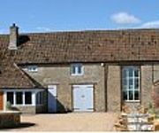
Stay at Penny's Mill
The Lighthouse
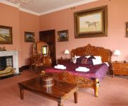
Orchardleigh House
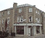
The Cornerhouse
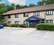
TRAVELODGE BECKINGTON
Frome
BABINGTON HOUSE
Videos from this area
These are videos related to the place based on their proximity to this place.
Frome, Somerset
Time-lapse video of Frome Town Centre. Frome is in Somerset and is located near the Mendip Hills and the City of Bath. Frome is also where Taking Pictures is based.
Remembrance Day 2014
Frome Film & Video Makers was formed in 1974 and continues frome strength to strength. Remembrance day 11th November 2013 was held at the Memorial Theatre in Frome and was filmed and ...
THE RUTLES
LIVE AT THE CHEESE AND GRAIN , FROME ON SATURDAY 10th MAY 2014 PLAYING THE MIGHTY "JOE PUBLIC."
Frome, Somerset - A great place for independent shops
Catherine Hill, Cheap Street, Frome, Frome Independent Market, Shopping.
Frome Christmas Extravaganza 2014
Frome Town Centre became an Edwardian fairground on Friday 28 November 2014 for the town's Christmas light switch on. Produced by Frome Town Council with performances by The Renegade ...
Carlton lift at Frome leisure Center (Retake)
This time, it did not fail, so you can actually watch it.
The Floyd Effect, Run Like Hell, Frome.
The best Pink Floyd tribute out there bar none. I should know, I've seen a few. This is the amazing Floyd Effect at the Cheese and Grain in Frome.
Videos provided by Youtube are under the copyright of their owners.
Attractions and noteworthy things
Distances are based on the centre of the city/town and sightseeing location. This list contains brief abstracts about monuments, holiday activities, national parcs, museums, organisations and more from the area as well as interesting facts about the region itself. Where available, you'll find the corresponding homepage. Otherwise the related wikipedia article.
Whatley, Mendip
Whatley is a small rural village and civil parish near Frome in the English county of Somerset.
Witham (Somerset) railway station
This station in Somerset is closed. For the open station in East Anglia, see Witham railway station. Witham (Somerset) railway station was a station serving the Somerset village of Witham Friary and was located on the Frome to Yeovil section of the Wilts, Somerset and Weymouth Railway that opened in 1856.
Whatley Quarry
Whatley Quarry, grid reference ST731479 is a limestone quarry owned by Hanson plc, near the village of Whatley on the Mendip Hills, Somerset, England. The quarry exhibits pale to dark grey Carboniferous Limestone with small area of overlying horizontally bedded buff-coloured Jurassic oolitic limestone forming an angular unconformity, with extensive dolomitisation of top of the Black Rock Limestone.
Colemans Quarry
Colemans Quarry, grid reference ST726452 is a limestone quarry at Holwell, near Nunney on the Mendip Hills, Somerset, England. The Colemans Quarry complex comprises four pits separated by three roads (including the A361) The quarry exhibits pale to dark grey Black Rock, Vallis and Clifton Down Groups of Carboniferous Limestone with overlying buff-coloured Jurassic oolitic limestone forming an angular unconformity.
Wanstrow railway station
Wanstrow railway station was a small station on the East Somerset Railway serving the village of Wanstrow in Somerset. The East Somerset Railway opened between its junction with the Wilts, Somerset and Weymouth Railway at Witham and Shepton Mallet in 1858, but the railway company did not build a station at Wanstrow. Local people paid for a small building, and a platform was built later. The station opened on 1 January 1860.
Church of All Saints, Nunney
The Church of All Saints at Nunney, Somerset, England, is a Grade I listed building dating from the 12th century. It was probably built on the site of an earlier Saxon or Norman church from which a Saxon cross and Norman font can still be seen. A 15th century wagon or Barrel vault used to cover the nave however the timber rotted and it was demolished in 1957. A temporary roof was installed and hidden by a suspended ceiling.
Frome Rural District
Frome was a rural district in Somerset, England, from 1894 to 1974. It was created in 1894 under the Local Government Act 1894. In 1974 it was abolished under the Local Government Act 1972 when it became part of Mendip.
Blatchbridge
Blatchbridge is a hamlet situated on the B3092 road from Frome to Maiden Bradley. It formerly had a Blacksmith's Shop, situated on the Frome side of the river. It has a public House called the Cross Keys. A former Methodist Chapel, now converted to a private dwelling, is situated halfway up the hill towards Frome. http://en. wikipedia. org/wiki/Frome_Rural_District


