Safety Score: 3,0 of 5.0 based on data from 9 authorites. Meaning we advice caution when travelling to United Kingdom.
Travel warnings are updated daily. Source: Travel Warning United Kingdom. Last Update: 2024-04-28 08:22:10
Touring Kilnhurst
Kilnhurst in Rotherham (England) is a town located in United Kingdom about 144 mi (or 232 km) north of London, the country's capital place.
Time in Kilnhurst is now 03:19 AM (Monday). The local timezone is named Europe / London with an UTC offset of one hour. We know of 10 airports nearby Kilnhurst, of which 5 are larger airports. The closest airport in United Kingdom is Robin Hood Doncaster Sheffield Airport in a distance of 12 mi (or 19 km), East. Besides the airports, there are other travel options available (check left side).
There are several Unesco world heritage sites nearby. The closest heritage site in United Kingdom is Liverpool – Maritime Mercantile City in a distance of 13 mi (or 21 km), East. Also, if you like the game of golf, there are several options within driving distance. Need some hints on where to stay? We compiled a list of available hotels close to the map centre further down the page.
Being here already, you might want to pay a visit to some of the following locations: Whiston, Bramley, Rotherham, Ulley and Little Houghton. To further explore this place, just scroll down and browse the available info.
Local weather forecast
Todays Local Weather Conditions & Forecast: 13°C / 55 °F
| Morning Temperature | 7°C / 44 °F |
| Evening Temperature | 11°C / 52 °F |
| Night Temperature | 10°C / 51 °F |
| Chance of rainfall | 0% |
| Air Humidity | 73% |
| Air Pressure | 1010 hPa |
| Wind Speed | Fresh Breeze with 13 km/h (8 mph) from North |
| Cloud Conditions | Overcast clouds, covering 91% of sky |
| General Conditions | Light rain |
Tuesday, 30th of April 2024
15°C (59 °F)
10°C (50 °F)
Light rain, moderate breeze, broken clouds.
Wednesday, 1st of May 2024
16°C (60 °F)
12°C (54 °F)
Light rain, gentle breeze, overcast clouds.
Thursday, 2nd of May 2024
14°C (57 °F)
11°C (52 °F)
Overcast clouds, gentle breeze.
Hotels and Places to Stay
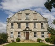
Hellaby Hall Hotel
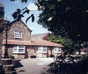
Stonecroft Hotel
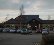
Best Western Pastures
Holiday Inn Express ROTHERHAM - NORTH
Carlton Park
JCT.33 Holiday Inn ROTHERHAM-SHEFFIELD M1
Mercure Sheffield Parkway
Rotherham East (M18/M1)
ibis Rotherham East - (M18 / M1)
Restover Lodge
Videos from this area
These are videos related to the place based on their proximity to this place.
Mexborough in old postcards
A few images taken from my vintage postcard collection. This time it features postcard images of Mexborough. Please feel free to view my other video showing vintage postcard images of local...
Trains through Swinton Railway Station 2002
A brief look at Swinton Station in 2002 - with Northern Spirit Class144 and Class158 DMU (Diesel Multiple Unit) - plus a Virgin CrossCountry HST Class43. Virgin have now lost the Cross Country...
Swinton in old postcards
A little sample of my collection showing postcards of Swinton For more old postcard and photo images of the South Yorkshire area, why not come visit us on our web page or our facebook pages?....
TV Mexborough
TV Mexborough http://www.adi-tvaerialsmexborough.co.uk Fitting Aerials and Satellites in Mexborough. We are fully qualified, professional and are able to offer you the following services...
Videos provided by Youtube are under the copyright of their owners.
Attractions and noteworthy things
Distances are based on the centre of the city/town and sightseeing location. This list contains brief abstracts about monuments, holiday activities, national parcs, museums, organisations and more from the area as well as interesting facts about the region itself. Where available, you'll find the corresponding homepage. Otherwise the related wikipedia article.
Roman Rig
The Roman Rig (also known as Roman Ridge, Scotland Balk, or Barber Balk) is the name given to a series of earthworks to the north east of Sheffield in South Yorkshire, England that are believed to originally have formed a single Dyke running from near Wincobank in Sheffield to Mexborough. Its purpose and date of construction are unknown.
Aldwarke Junction
Aldwarke Junction at Parkgate near Rotherham, South Yorkshire, England is a major railway junction. It was constructed in 1965 as a part of the Sheffield district rail rationalisation plan.
Mexborough engine shed
Mexborough engine shed was an engine shed in Swinton, in South Yorkshire, England. It was built by the Great Central Railway The shed was built next to Mexborough station; it had 15 dead end roads, and could handle about 150 steam locomotives, mainly for use on freight trains. The London and North Eastern Railway operated the shed from 1923. In 1948, on the formation of British Railways Eastern Region, Mexborough bore the shed code 36B, then 41F from 1958. It closed in February 1964.
Kilnhurst Colliery
Kilnhurst Colliery, formerly known as either Thrybergh or Thrybergh Hall Colliery, was situated on the southern side of the village of Kilnhurst, near Rotherham, South Yorkshire, England. The earliest colliery on the site, known as Thrybergh or Thrybergh Hall Colliery, worked the Barnsley seam from 1858, and was the site of a serious accident in 1863.
Warren Vale Colliery
Warren Vale Colliery was a coal mine, also known as Piccadilly Colliery, situated alongside Warren Vale Road, between Rawmarsh and Swinton, South Yorkshire, England, in the valley of the Collier Brook, which runs east, for about two miles towards Kilnhurst. Sinking of the colliery commenced in the late 1840s with production commencing towards the end of 1850. The colliery was owned by Earl Fizwilliam, and was worked by Wakefield–based agents J. & J. Charlesworth & Company.
Roundwood Colliery
Roundwood Colliery was a coal mine situated in the Don Valley, about 2 miles north of Rotherham, South Yorkshire, England on the borders of Rotherham and Rawmarsh.
Hooton Roberts
Hooton Roberts is a village and civil parish in the Metropolitan Borough of Rotherham in South Yorkshire, England. It has a population of 181.
Don Pottery
The Don Pottery was a 19th century manufacturer of porcelain, whose factory was located in the town of Swinton in South Yorkshire, England.


