Safety Score: 3,0 of 5.0 based on data from 9 authorites. Meaning we advice caution when travelling to United Kingdom.
Travel warnings are updated daily. Source: Travel Warning United Kingdom. Last Update: 2024-04-27 08:23:39
Touring Wadenhoe
Wadenhoe in Northamptonshire (England) is a town located in United Kingdom about 67 mi (or 107 km) north of London, the country's capital place.
Time in Wadenhoe is now 09:50 PM (Saturday). The local timezone is named Europe / London with an UTC offset of one hour. We know of 12 airports nearby Wadenhoe, of which 5 are larger airports. The closest airport in United Kingdom is Sywell Aerodrome in a distance of 15 mi (or 24 km), South-West. Besides the airports, there are other travel options available (check left side).
There are several Unesco world heritage sites nearby. The closest heritage site in United Kingdom is Derwent Valley Mills in a distance of 41 mi (or 65 km), North. Also, if you like the game of golf, there are several options within driving distance. Need some hints on where to stay? We compiled a list of available hotels close to the map centre further down the page.
Being here already, you might want to pay a visit to some of the following locations: Wansford, Swineshead, Thornhaugh, Wittering and Ketton. To further explore this place, just scroll down and browse the available info.
Local weather forecast
Todays Local Weather Conditions & Forecast: 8°C / 46 °F
| Morning Temperature | 3°C / 37 °F |
| Evening Temperature | 8°C / 47 °F |
| Night Temperature | 6°C / 43 °F |
| Chance of rainfall | 2% |
| Air Humidity | 100% |
| Air Pressure | 1005 hPa |
| Wind Speed | Moderate breeze with 12 km/h (8 mph) from South-West |
| Cloud Conditions | Overcast clouds, covering 100% of sky |
| General Conditions | Light rain |
Sunday, 28th of April 2024
6°C (43 °F)
4°C (39 °F)
Moderate rain, moderate breeze, overcast clouds.
Monday, 29th of April 2024
12°C (54 °F)
8°C (47 °F)
Overcast clouds, fresh breeze.
Tuesday, 30th of April 2024
14°C (58 °F)
9°C (48 °F)
Scattered clouds, fresh breeze.
Hotels and Places to Stay
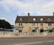
The Woolpack Inn
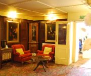
Bridge
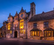
The Talbot
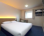
TRAVELODGE KETTERING THRAPSTON
Videos from this area
These are videos related to the place based on their proximity to this place.
Kayaks, Cows & Sunshine.
Donny & Matt take a paddle on the Nene from Wadenhoe to Thorpe Waterville. Lots of cows, cups of tea, good paddling!
Oundle Classic sprint race and crashes
Oundle town classic car and bike sprint race show and shine and crashes.
Oundle Classic Sprint 2014 sjcam sj4000 gopro
few of the cars from the first ever classic sprint in Oundle Northamptonshire 28th jan 2014 all footage is from a sjcam sj4000 its my first time using and editing will also make a longer...
Plumber Oundle - Call: 07939 886 041
Plumber Oundle - Call 07939 886 041 for a free no-obligation quotation if you're looking for a plumber in Oundle. Fully insured and Gas-Safe registered means that our company has undertaken...
The Oundle Prisioner in the Courthouse Cells
A clip of the prisoner who can be found in the Oundle Courthouse Cells located at Oundle Museum in Northamptonshire. http://www.oundlemuseum.org.uk/
Part 14: Autograph: Box & Whisker Diagram
Autograph Trainer, Christine Dickinson, uses Autograph to display a box and whisker diagram at the TSM Workshop in Oundle, UK.
Part 11: Autograph: Displaying a Table of Values
Autograph Trainer, Christine Dickinson, uses Autograph to display a table of values at the TSM Workshop in Oundle, UK.
Cheryl Lee - Im with you
the amazing cheryl lee signing at an open mic night in oundle, the video really does not do this girls voice any justice.
Part 01: Customizing Autograph
Autograph Trainer, Christine Dickinson, customizes Autograph at the TSM Workshop in Oundle, UK.
Videos provided by Youtube are under the copyright of their owners.
Attractions and noteworthy things
Distances are based on the centre of the city/town and sightseeing location. This list contains brief abstracts about monuments, holiday activities, national parcs, museums, organisations and more from the area as well as interesting facts about the region itself. Where available, you'll find the corresponding homepage. Otherwise the related wikipedia article.
East Northamptonshire
East Northamptonshire (officially "The District of East Northamptonshire") is a local government district in Northamptonshire, England. Its council is based in Thrapston and Rushden. Other towns include Oundle, Raunds, Irthlingborough and Higham Ferrers. The town of Rushden is the largest settlement in the district and the smallest settlement is the hamlet of Shotley.
Corby (UK Parliament constituency)
Corby is a constituency represented in the House of Commons of the UK Parliament since November 2012 by Andy Sawford of the Labour Party.
Oundle Rural District
Oundle was a rural district in England from 1894 to 1935. It was formed under the Local Government Act 1894 from the Oundle rural sanitary district. It was one of only a few such districts to cross a county border, with parishes in both Northamptonshire and Huntingdonshire. In 1935 it was abolished, under the Local Government Act 1929.
Harpers Brook
Harpers Brook is a tributary of the river Nene which runs through Northamptonshire. According to sources (ordnance survey sheet 141) it originates close to the Leicestershire town of Market Harborough and meanders through the north of the county of Northamptonshire, passing through the town of Corby and on until it joins the River Nene just North of Thrapston.
Lilford-cum-Wigsthorpe and Thorpe Achurch
Lilford-cum-Wigsthorpe and Thorpe Achurch is the name of a civil parish in the English county of Northamptonshire. Forming part of the district of East Northamptonshire its main settlements are Achurch, Thorpe Waterville and Wigsthorpe. The parish includes Lilford Hall.
Thorpe railway station
Thorpe railway station is a former railway station in Thorpe Waterville, Northamptonshire on the former Northampton and Peterborough Railway line which connected Peterborough and Northampton. In 1846 the line, along with the London and Birmingham, became part of the London and North Western Railway. At grouping in 1923 it became part of the London Midland and Scottish Railway.
Lilford Park (Northamptonshire)
Lilford Park is located in the eastern part of the County of Northamptonshire in the United Kingdom, south of Oundle and north of Thrapston. The Park comprises a parkland of 350 acres mainly located around the village of Lilford, part of the parish of Lilford-cum-Wigsthorpe and Thorpe Achurch. The land which was turned into the parkland was mentioned in the Domesday Book, and owned by King David I of Scotland at that time.
All Saints Church, Aldwincle
All Saints Church, Aldwincle, is a redundant Anglican church in the village of Aldwincle, Northamptonshire, England. It has been designated by English Heritage as a Grade I listed building, and is under the care of the Churches Conservation Trust.


