Safety Score: 3,0 of 5.0 based on data from 9 authorites. Meaning we advice caution when travelling to United Kingdom.
Travel warnings are updated daily. Source: Travel Warning United Kingdom. Last Update: 2024-04-28 08:22:10
Discover Syresham
Syresham in Northamptonshire (England) with it's 711 citizens is a city in United Kingdom about 56 mi (or 91 km) north-west of London, the country's capital city.
Local time in Syresham is now 01:16 AM (Monday). The local timezone is named Europe / London with an UTC offset of one hour. We know of 10 airports in the vicinity of Syresham, of which 5 are larger airports. The closest airport in United Kingdom is Oxford (Kidlington) Airport in a distance of 19 mi (or 30 km), South-West. Besides the airports, there are other travel options available (check left side).
There are several Unesco world heritage sites nearby. The closest heritage site in United Kingdom is Blenheim Palace in a distance of 25 mi (or 39 km), South-East. Also, if you like golfing, there are a few options in driving distance. Looking for a place to stay? we compiled a list of available hotels close to the map centre further down the page.
When in this area, you might want to pay a visit to some of the following locations: Stony Stratford, Calverton, Castlethorpe, Hanslope and Northampton. To further explore this place, just scroll down and browse the available info.
Local weather forecast
Todays Local Weather Conditions & Forecast: 12°C / 54 °F
| Morning Temperature | 4°C / 40 °F |
| Evening Temperature | 11°C / 51 °F |
| Night Temperature | 8°C / 46 °F |
| Chance of rainfall | 0% |
| Air Humidity | 70% |
| Air Pressure | 1014 hPa |
| Wind Speed | Fresh Breeze with 14 km/h (9 mph) from North |
| Cloud Conditions | Overcast clouds, covering 85% of sky |
| General Conditions | Overcast clouds |
Tuesday, 30th of April 2024
14°C (58 °F)
9°C (47 °F)
Light rain, moderate breeze, broken clouds.
Wednesday, 1st of May 2024
15°C (60 °F)
10°C (51 °F)
Light rain, gentle breeze, broken clouds.
Thursday, 2nd of May 2024
10°C (50 °F)
10°C (49 °F)
Moderate rain, gentle breeze, overcast clouds.
Hotels and Places to Stay
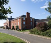
Whittlebury Hall Hotel & Spa
Snoozebox Silverstone Hotel
The Bartholomew Arms
Kendal House
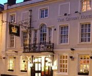
The Crown Hotel
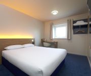
TRAVELODGE TOWCESTER SILVERSTONE
Silverstone
Videos from this area
These are videos related to the place based on their proximity to this place.
Alexander Sims - On board Radical SR3 @ Silverstone GP
Having a bit of fun in a Radical SR3 at Silverstone GP. Cracking little car that is :)
BRACKLEY Under 17 driving lessons from Driving Ambition between Brackley + Silverstone Northants
http://www.drivingambition.info This week's photos - Dec 8th 2012 Under 17 off road driving lessons with Driving Ambition at Turweston Aerodrome near Brackley and Silverstone Northamptonshire...
Driving Ambition provides under 17 driving lessons Towcester, Silverstone, Brackley,Bicester,Banbury
http://www.drivingambition.info Our latest photos showing who's passed and our latest off road drivers at Turweston Aerodrome. Covering Towcester Silverstone Brackley Buckingham Bicester.
Landing at Turweston (EGBT) on runway 27 grass on 29/05/2012
Landing a C172, G-ROLY at Turweston airfield next to Silverstone race circuit not far from Milton Keynes. This was for a fuel stop on our return trip to Netherthorpe (EGNF) from Bembridge (EGHJ)...
Take off from Turweston (EGBT) on runway 27 grass on 29/05/2012
Taking off in a C172, G-ROLY at Turweston airfield next to Silverstone race circuit not far from Milton Keynes. This was for a fuel stop on our return trip to Netherthorpe (EGNF) from Bembridge...
VAC Spring Rally 25th March 2012
Some of my footage from this years Vintage Aircraft Club Spring Rally fly-in .
Turweston Wings & Wheels 19th Sept 2010
Its great watching this show grow year on year , heres to the 2011 Wings and Wheels :)
Lee Family Trip on the Grand Union Canal part 1
We had a 4-night voyage during which we negotiated the Stckton Locks which are a flight of 8 locks in the vicinity of Warwick which drop 55 feet over a distance of 1/2 mile. This is part...
Fran applies for STA Travel's World Travel Internship
Ok, he can't apply, but he felt left out with everyone else making videos. So he decided to make one anyway. It's unbelievably good. I think 'lyrical genius' is an often overused term, however...
Day trips from London
Pictures of Knowle, the childhood home of Vita Sackville-West. Pictures of Castle Combe, Bath and Avebury.
Videos provided by Youtube are under the copyright of their owners.
Attractions and noteworthy things
Distances are based on the centre of the city/town and sightseeing location. This list contains brief abstracts about monuments, holiday activities, national parcs, museums, organisations and more from the area as well as interesting facts about the region itself. Where available, you'll find the corresponding homepage. Otherwise the related wikipedia article.
South Northamptonshire
South Northamptonshire is a district in Northamptonshire, England. Its council is based in the town of Towcester, first established as a settlement in Roman Britain. The largest town in the district is Brackley, which has a population of 14,000 in 2008 followed by Towcester which has a population of nearly 10,000. Other significant settlements in size include Deanshanger, Bugbrooke, Roade, King's Sutton, Silverstone and Middleton Cheney.
Ouse Valley Way
The Ouse Valley Way is a 150-mile footpath in England, following the River Great Ouse from its source near Syresham in Northamptonshire to its mouth in The Wash near King's Lynn. The path begins outside the King's Head pub in Syresham and ends on the Green Quay in King's Lynn . There is a long-term plan to complete remaining gaps in the path, meanwhile it is possible to walk the entire route, although in places the footpath and river temporarily part company.
South Northamptonshire (UK Parliament constituency)
South Northamptonshire is a constituency represented in the House of Commons of the UK Parliament since its 2010 recreation by Andrea Leadsom, a Conservative.
Biddlesden Abbey
Biddlesden was a Cistercian abbey founded in 1147 by Arnold de Bosco (de Bois), steward to the Earl of Leicester. An abbot was deposed for now unknown reasons in 1192 and in the 14th to 15th centuries there was a long running dispute with the parish of Wappenham concerning the collection of tithes. It was never a wealthy house for most of its history and would have been dissolved in 1536 if the monks had not petitioned, and paid, for its continuation.
Astwell Castle
Astwell Castle is a manor house in Northamptonshire, England about 1.5 miles south-west of Wappenham. It is a listed building and part of the parish of Helmdon, a village 1 mile west.


