Safety Score: 3,0 of 5.0 based on data from 9 authorites. Meaning we advice caution when travelling to United Kingdom.
Travel warnings are updated daily. Source: Travel Warning United Kingdom. Last Update: 2024-04-28 08:22:10
Discover Brockhall
Brockhall in Northamptonshire (England) is a town in United Kingdom about 66 mi (or 106 km) north-west of London, the country's capital city.
Current time in Brockhall is now 05:53 AM (Monday). The local timezone is named Europe / London with an UTC offset of one hour. We know of 11 airports near Brockhall, of which 5 are larger airports. The closest airport in United Kingdom is Sywell Aerodrome in a distance of 12 mi (or 20 km), East. Besides the airports, there are other travel options available (check left side).
There are several Unesco world heritage sites nearby. The closest heritage site in United Kingdom is Blenheim Palace in a distance of 34 mi (or 55 km), South-East. Also, if you like playing golf, there are a few options in driving distance. Looking for a place to stay? we compiled a list of available hotels close to the map centre further down the page.
When in this area, you might want to pay a visit to some of the following locations: Northampton, Hanslope, Castlethorpe, Stony Stratford and Calverton. To further explore this place, just scroll down and browse the available info.
Local weather forecast
Todays Local Weather Conditions & Forecast: 12°C / 54 °F
| Morning Temperature | 4°C / 40 °F |
| Evening Temperature | 11°C / 51 °F |
| Night Temperature | 9°C / 48 °F |
| Chance of rainfall | 0% |
| Air Humidity | 76% |
| Air Pressure | 1013 hPa |
| Wind Speed | Fresh Breeze with 15 km/h (9 mph) from North |
| Cloud Conditions | Broken clouds, covering 83% of sky |
| General Conditions | Light rain |
Tuesday, 30th of April 2024
14°C (57 °F)
10°C (49 °F)
Light rain, moderate breeze, broken clouds.
Wednesday, 1st of May 2024
14°C (58 °F)
11°C (52 °F)
Light rain, gentle breeze, overcast clouds.
Thursday, 2nd of May 2024
9°C (49 °F)
8°C (47 °F)
Moderate rain, moderate breeze, overcast clouds.
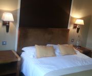
Hotels and Places to Stay
Narrow Boat at Weedon
The Worlds End
JCT 16 Holiday Inn NORTHAMPTON WEST M1
Days Inn Watford Gap
Videos from this area
These are videos related to the place based on their proximity to this place.
A Drive round Nether Heyford
Middle Street Watery Lane Weedon Road Furnace Lane Hillside Road Hillside Crescent.
leicester wedding photographer
Hi my names Ben, and i run a Wedding Photography buisness, www.shutterhappy.co.uk I travel to most places in the UK but operate predominentely in the Leicester. This is a small selection of...
FRIENDLY URBAN FOX
My new friend Urban foxes, for 60 years they have lived alongside us humans. They have become the equivalent of wild dogs in our cities. Post mortem inspection has revealed that most of their...
A Week in the life of the Forex Black Panther
Take a glimpse at the world's first major-league Forex automated trading robot. Fast-forward a Week in the life of the Forex Black Panther Expert Advisor. Courtesy of www.Forex-BlackPanther.com.
disillusioned saddler: in search of a lost football soul
the introduction to a season long attempt to fall back in love with the beautiful game.
X-Ray in South Woodham
We have had a mobile breast unit in South Woodham recently - which has been much appreciated by all our patients with mobile breasts. Despite vigorous campaigning, we have not been able to...
Videos provided by Youtube are under the copyright of their owners.
Attractions and noteworthy things
Distances are based on the centre of the city/town and sightseeing location. This list contains brief abstracts about monuments, holiday activities, national parcs, museums, organisations and more from the area as well as interesting facts about the region itself. Where available, you'll find the corresponding homepage. Otherwise the related wikipedia article.
Bannaventa
Bannaventa was a Romano British Fortified Town which was situated on the Roman road of Watling Street, which today is known as the A5 trunk road. Bannaventa is 1 mile northeast of the village of Norton in the English county of Northamptonshire. The Ordnance Survey grid reference for the centre of the town is SP612645.
Whilton Locks
Whilton Locks is the name of a flight of seven locks on the Grand Union Canal near Daventry, in the county of Northamptonshire, England. They are also referred to as Buckby Lock Flight.
Daventry (UK Parliament constituency)
Daventry is a constituency represented in the House of Commons of the UK Parliament since 2010 by Chris Heaton-Harris of the Conservative Party
Long Buckby railway station
Long Buckby railway station is a small railway station next to the village of Long Buckby, Northamptonshire, England. It is the nearest railway station for the town of Daventry, 4 miles away. The station is on the Northampton loop of the West Coast Main Line. It is served by London Midland services to Birmingham New Street and Northampton. For Virgin Trains inter-city services passengers should change at Rugby, the next station to the west.
Long Buckby A.F.C
Long Buckby A.F.C. is a football club based in Long Buckby, near Northampton, Northamptonshire, England. The club plays its home fixtures at Long Buckby Sportsfield (Station Road). In the 2012–13 season, the club is playing in the United Counties League Premier Division, being led by manager Scott Goodwin, following the departure of the previous manager Glenn Botterill.
European route E13
European route E13 is part of the International E-road network. It runs most of the length of the M1 motorway in the United Kingdom (which runs from West Yorkshire through to its southern terminus in London). Although the United Kingdom Government participates fully in activities concerning the E-routes, E-routes are not signposted within the United Kingdom. The E13 follows the route Doncaster – Sheffield - Nottingham – Leicester – Northampton – Luton – London, and is 277 km long.
Weedon rail crashes
Weedon, Northamptonshire on the West Coast Main Line has been the site of two serious derailments in 1915 and 1951, killing 10 and 15 people respectively.
Weedon railway station
Weedon railway station was a railway station situated to the north of and serving the village of Weedon and the Weedon Royal Ordnance Depot in Northamptonshire, England. On the West Coast Main Line the station was also the start of the Weedon to Leamington Spa line. The station also housed a busy goods depot which was attacked by German aircraft during the Second World War. The station was the site of two serious derailments in 1915 and 1951, killing 10 and 15 people respectively.


