Safety Score: 3,0 of 5.0 based on data from 9 authorites. Meaning we advice caution when travelling to United Kingdom.
Travel warnings are updated daily. Source: Travel Warning United Kingdom. Last Update: 2024-05-06 08:04:52
Delve into South Milford
South Milford in North Yorkshire (England) with it's 1,995 habitants is a city located in United Kingdom about 164 mi (or 263 km) north of London, the country's capital town.
Current time in South Milford is now 11:04 AM (Monday). The local timezone is named Europe / London with an UTC offset of one hour. We know of 11 airports closer to South Milford, of which 5 are larger airports. The closest airport in United Kingdom is Leeds Bradford Airport in a distance of 18 mi (or 29 km), West. Besides the airports, there are other travel options available (check left side).
There are several Unesco world heritage sites nearby. The closest heritage site in United Kingdom is Liverpool – Maritime Mercantile City in a distance of 27 mi (or 44 km), South. Also, if you like playing golf, there are some options within driving distance. In need of a room? We compiled a list of available hotels close to the map centre further down the page.
Since you are here already, you might want to pay a visit to some of the following locations: Ledsham, Ledston, Darrington, Aberford and Featherstone. To further explore this place, just scroll down and browse the available info.
Local weather forecast
Todays Local Weather Conditions & Forecast: 17°C / 63 °F
| Morning Temperature | 10°C / 51 °F |
| Evening Temperature | 15°C / 59 °F |
| Night Temperature | 11°C / 53 °F |
| Chance of rainfall | 2% |
| Air Humidity | 63% |
| Air Pressure | 1008 hPa |
| Wind Speed | Light breeze with 5 km/h (3 mph) from North-West |
| Cloud Conditions | Overcast clouds, covering 100% of sky |
| General Conditions | Light rain |
Tuesday, 7th of May 2024
15°C (59 °F)
10°C (51 °F)
Light rain, gentle breeze, broken clouds.
Wednesday, 8th of May 2024
15°C (60 °F)
12°C (54 °F)
Overcast clouds, light breeze.
Thursday, 9th of May 2024
18°C (65 °F)
14°C (57 °F)
Light rain, light breeze, overcast clouds.
Hotels and Places to Stay
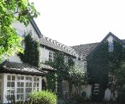
HAZLEWOOD CASTLE AND SPA
The Old Vicarage
Monk Fryston Hall
The Oddfellows Arms
South Milford Hotel
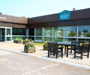
QUALITY HOTEL LEEDS SELBY FORK
Best Western Plus Milford
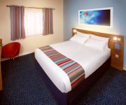
TRAVELODGE PONTEFRACT FERRYBRIDGE A1-M62
Pontefract North
Videos from this area
These are videos related to the place based on their proximity to this place.
CLASS 09201 ON TRIP WORKING A PAIR OF COAL WAGONS
CLASS 09201 ON TRIP WORKING A PAIR OF COAL WAGONS ON THE 1/1/09. CLASS 09201 IS GOING THOUGH BURTON SALMON TOWARDS MILFORD SIDINGS.
(HD) Freight at Sherburn-In-Elmet | Feat: 7 class 20's & More - 3rd October 2014
Filmed in full 1080p HD! Seen in this eventful day at Sherburn-In-Elmet are: 20142 & 20189, 6Y85 Chaddesden Sidings - York Engineers Yard; 66148, Doncaster Up Decoy - Tyne S.S.; DR80209, York.
Landing on runway 24 Sherburn In Elmet
Landing back at Sherburn in Elmet airfield on runway 24 grass on 14/05/2010 in a PA28 G-BODE after returning from Humberside airport. Slightly too fast and too high on the last part of the...
Landing at Sherburn in Elmet runway 01 on 21042010
Returning from Leeds Bradford airport on 21042010 following the initial flight to Full Sutton. This landing involves a normal left hand circuit onto Sherburns shortest runway, 01 which is 585x18...
Landing at Sherburn In Elmet runway 06 on 04052010
Landing back at Sherburn after retruning from Sandtoft on 04th May 2010. Runway 06 at Sherburn involves a dog leg approach on the right hand circuit for noise abatement. Filmed on Nokia N86...
Take off from Sherburn on 05/07/2014 in G-BODB
Departure from Sherburn in Elmet (EGCJ) for a flight to the Isle of Man (EGNS) on Saturday 5th July 2014 in a PA28, G-BODB with Terry and Peter. Peter was flying the outbound leg. Runway 29...
Taking off from Sherburn EGCJ en route to Durham Tees Valley EGNV in a PA28 on 30072010
Taking off on a 55 minute flight to Durham Tees Valley from Sherburn in Elmet EGCJ in a PA28 G-BNOE.
Eclipse footage
Filmed near Sherburn in Elmet using the onboard camera system. Please view muted as there is some white noise which may be irritating.
Videos provided by Youtube are under the copyright of their owners.
Attractions and noteworthy things
Distances are based on the centre of the city/town and sightseeing location. This list contains brief abstracts about monuments, holiday activities, national parcs, museums, organisations and more from the area as well as interesting facts about the region itself. Where available, you'll find the corresponding homepage. Otherwise the related wikipedia article.
Barkston Ash Wapentake
Barkston Ash was a wapentake of the West Riding of Yorkshire, named after the meeting-place at the village of Barkston. It included the parishes of Birkin, Bramham cum Oglethorpe, Brayton, Drax, Kirk Fenton, Ledsham, Monk Fryston, Saxton with Scarthingwell and Sherburn-in-Elmet and parts of Brotherton, Kirkby Wharfe, Ryther, Snaith and Tadcaster.
Saxton, North Yorkshire
Saxton is a small, affluent village in North Yorkshire, England, about 15 miles from York and about 12 miles from Leeds. The resident population is about 250. It is close to the battlefield of Towton. Saxton is home to All Saints C of E church, a primary school, a village hall, one pub, the Greyhound, a cricket club and the surviving medieval motte of Saxton Castle.


