Safety Score: 3,0 of 5.0 based on data from 9 authorites. Meaning we advice caution when travelling to United Kingdom.
Travel warnings are updated daily. Source: Travel Warning United Kingdom. Last Update: 2024-04-18 08:12:24
Discover Fenwick
Fenwick in Doncaster (England) is a place in United Kingdom about 153 mi (or 246 km) north of London, the country's capital city.
Current time in Fenwick is now 01:42 PM (Thursday). The local timezone is named Europe / London with an UTC offset of one hour. We know of 10 airports near Fenwick, of which 5 are larger airports. The closest airport in United Kingdom is Robin Hood Doncaster Sheffield Airport in a distance of 11 mi (or 19 km), South. Besides the airports, there are other travel options available (check left side).
There are several Unesco world heritage sites nearby. The closest heritage site in United Kingdom is Liverpool – Maritime Mercantile City in a distance of 16 mi (or 27 km), South. Also, if you like playing golf, there are a few options in driving distance. If you need a hotel, we compiled a list of available hotels close to the map centre further down the page.
While being here, you might want to pay a visit to some of the following locations: Moss, Pollington, Stainforth, Norton and Hatfield. To further explore this place, just scroll down and browse the available info.
Local weather forecast
Todays Local Weather Conditions & Forecast: 12°C / 53 °F
| Morning Temperature | 2°C / 36 °F |
| Evening Temperature | 7°C / 45 °F |
| Night Temperature | 10°C / 49 °F |
| Chance of rainfall | 5% |
| Air Humidity | 51% |
| Air Pressure | 1022 hPa |
| Wind Speed | Fresh Breeze with 14 km/h (8 mph) from East |
| Cloud Conditions | Overcast clouds, covering 97% of sky |
| General Conditions | Moderate rain |
Friday, 19th of April 2024
10°C (50 °F)
4°C (39 °F)
Light rain, fresh breeze, broken clouds.
Saturday, 20th of April 2024
11°C (52 °F)
7°C (44 °F)
Few clouds, gentle breeze.
Sunday, 21st of April 2024
10°C (49 °F)
8°C (46 °F)
Overcast clouds, light breeze.
Hotels and Places to Stay
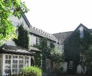
The Old Vicarage
Videos from this area
These are videos related to the place based on their proximity to this place.
North Durham Winter League on the Stainforth & Keadby Canal around 1994
A few minutes of film showing some of the competitors in this long gone league - this match was held on the Kirk Bramwith length of the canal. Teams including Stanley Vickers, Catch Match,...
Thorpe Marsh Power Station - Abandoned building 1
Abandoned structure near the cooling towers of Thorpe Marsh Power Station.
Thorpe Marsh Power Station - Do you believe in ghosts?
Some abandoned outbuildings on the edge of the Thorpe Marsh Power Station site.
60019 Bittern as LNER 4492 Dominion Of NewZealand (April 16th 2011)
For the full video: http://www.youtube.com/watch?v=NjoPvL1746A&feature=channel_video_title A short video of A4 'Bittern' no 60019 on the Great Britain IV tour. Having been back dated 'Bittern',...
Trains passing Joan Croft Level Crossing - 2005 - 1
To watch part 2, click here - http://www.youtube.com/watch?v=uo2D9a6-4VY.
Trains passing Fenwick Level Crossing
High Speed Trains passing Fenwick Level Crossing - between Doncaster and York on the East Coast Main Line (ECML). Class 43 locos speeding through include examples from Grand Central and...
The Great Britain VII - LMS 46233 Duchess of Sutherland at Fenwick.
Here we see the Great Britain VII Day 9 Rail tour on the Edinburgh Waverley - London Kings Cross which is ran by London Midland Scotland (LMS) 46233 Duchess of Sutherland. This trains was ...
A1 no.60163 'Tornado' with 'The Cathedrals Express' Saturday 13th April 2013
A1 no.60163 'Tornado' is seen in two clips, one on each leg, with a Steam Dreams tour 'The Cathedrals Express' from London Kings Cross to York. The tour was originally due to run to Durham...
60163 Tornado at Joan Croft Junction 30/06/12
60163 Tornado on the Catherdrals Express -London Kings Cross - Durham & back. The return leg at Joan Croft Junction running aprox 40mins late.
Videos provided by Youtube are under the copyright of their owners.
Attractions and noteworthy things
Distances are based on the centre of the city/town and sightseeing location. This list contains brief abstracts about monuments, holiday activities, national parcs, museums, organisations and more from the area as well as interesting facts about the region itself. Where available, you'll find the corresponding homepage. Otherwise the related wikipedia article.
Sykehouse
The civil parish of Sykehouse is a civil parish in the Metropolitan Borough of Doncaster in South Yorkshire, England, on the border with the East Riding of Yorkshire. It had a population of 438 in 2001.
Fenwick, South Yorkshire
Fenwick is a small village and civil parish in the Metropolitan Borough of Doncaster, on the border with North Yorkshire. It is located at an elevation of around 6 metres above sea level and has a population of 113. The northern boundary of the parish is marked by the River Went.
Moss, South Yorkshire
Moss is a village and civil parish in the Metropolitan Borough of Doncaster in South Yorkshire, England. It has a population of 290.
Topham, South Yorkshire
Topham is a small rural hamlet upon the River Went in rural Yorkshire within the Metropolitan Borough of Doncaster in northern England. The hamlet runs along the Trans-Pennine Trail.
RAF Snaith
Royal Air Force Station Snaith or RAF Snaith is a former Royal Air Force station which was located 7 miles south west of Goole, Yorkshire, England and close to the village of Pollington. The airfield opened 1941 before closing in 1946.


