Safety Score: 3,0 of 5.0 based on data from 9 authorites. Meaning we advice caution when travelling to United Kingdom.
Travel warnings are updated daily. Source: Travel Warning United Kingdom. Last Update: 2024-05-04 08:22:41
Discover Frampton
Frampton in Lincolnshire (England) is a city in United Kingdom about 99 mi (or 159 km) north of London, the country's capital city.
Local time in Frampton is now 08:27 AM (Sunday). The local timezone is named Europe / London with an UTC offset of one hour. We know of 13 airports in the vicinity of Frampton, of which 5 are larger airports. The closest airport in United Kingdom is RAF Coningsby in a distance of 12 mi (or 20 km), North-West. Besides the airports, there are other travel options available (check left side).
There are several Unesco world heritage sites nearby. The closest heritage site in United Kingdom is Derwent Valley Mills in a distance of 21 mi (or 34 km), West. Also, if you like golfing, there are a few options in driving distance. Looking for a place to stay? we compiled a list of available hotels close to the map centre further down the page.
When in this area, you might want to pay a visit to some of the following locations: Thimbleby, Thorney, Newborough, Eye and Peakirk. To further explore this place, just scroll down and browse the available info.
Local weather forecast
Todays Local Weather Conditions & Forecast: 16°C / 60 °F
| Morning Temperature | 8°C / 47 °F |
| Evening Temperature | 13°C / 56 °F |
| Night Temperature | 10°C / 50 °F |
| Chance of rainfall | 1% |
| Air Humidity | 68% |
| Air Pressure | 1008 hPa |
| Wind Speed | Gentle Breeze with 6 km/h (4 mph) from West |
| Cloud Conditions | Broken clouds, covering 64% of sky |
| General Conditions | Light rain |
Monday, 6th of May 2024
14°C (58 °F)
10°C (49 °F)
Overcast clouds, moderate breeze.
Tuesday, 7th of May 2024
16°C (60 °F)
8°C (46 °F)
Scattered clouds, gentle breeze.
Wednesday, 8th of May 2024
13°C (55 °F)
7°C (45 °F)
Broken clouds, gentle breeze.
Hotels and Places to Stay
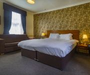
Best Western White Hart
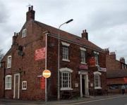
The Kings Arms
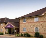
Boston
Videos from this area
These are videos related to the place based on their proximity to this place.
Boston United 2 Worcester City 0 Vanarama Conference North 28-2-15
Boston United v Worcester City Vanarama Conference North Saturday 28th March 2015.
River Witham, Boston UK, boat 1
Podvečer u řeky Witham kousek po proudu pod přístavem města Boston v Lincolnshire, Anglie na podzim 2008.
Boston Feb 1987
Short video of Boston, the town centre, St Botolph's church, harbour and river Witham. Taken on a cold day in February 1987 with lying snow on the ground.
Boston Grammar School U15's Basketball (Training Session 1) 2012
We have improved so much in the space of 4 months proud of you guys!!! Dont leave no hate comments y'all youtube viewers! COMMENT RATE SUBSCRIBE!
Boston United v Worcester City
Blue Square North - Saturday 27th October 2012 Boston United 1 Worcester City 2.
OPENING OF MUNICIPAL BUILDINGS, BOSTON 1904
OPENING OF MUNICIPAL BUILDINGS, BOSTON Boston, Lincolnshire, UK. 1904 Local dignitaries and their wives, together with distinguished visitors including the Lord Mayor of Sheffield, arrive...
River Witham, Boston UK, boat 2
Podvečer u řeky Witham kousek po proudu pod přístavem města Boston v Lincolnshire, Anglie na podzim 2008.
Videos provided by Youtube are under the copyright of their owners.
Attractions and noteworthy things
Distances are based on the centre of the city/town and sightseeing location. This list contains brief abstracts about monuments, holiday activities, national parcs, museums, organisations and more from the area as well as interesting facts about the region itself. Where available, you'll find the corresponding homepage. Otherwise the related wikipedia article.
Boston Guildhall
The ancient Boston Guildhall of St Mary's Guild in Boston, Lincolnshire, England was built in the 1390s. It was previously thought to have been built in 1450, but during its recent restoration and analysis of the roof timbers, experts have dated the building much earlier. The Guildhall is also one of the earliest brick buildings in Lincolnshire.
Boston Rural District
Boston was a rural district in Holland, Lincolnshire from 1894 to 1974. It was formed from the Boston rural sanitary district by the Local Government Act 1894. It did not include the municipal borough of Boston. The part of Boston RSD which was in Lindsey formed the Sibsey Rural District. In 1974, under the Local Government Act 1972, it was merged with Boston in a new borough of Boston.
York Street
York Street, currently styled as The Jakemans Stadium for sponsorship purposes, is a football stadium in Boston, England, and is the home ground of Boston United. Originally called Shodfriars Lane, football has been played on the site since the late 19th century by a variety of Boston teams, but it has been used by Boston United since 1933. In the late 1970s the ground was rebuilt. Although the ground currently has a maximum capacity of 6,643, the record crowd is 11,000 against Derby County.
Kirton railway station
Kirton railway station was a station in Kirton, Lincolnshire. It closed to passenger traffic on 11 September 1961. Preceding station Disused railways Following station Boston Great Northern Railway Algarkirk & Sutterton
Black Sluice
The Black Sluice is the name given to the structure that controls the flow of the South Forty-Foot Drain into The Haven, at Boston, Lincolnshire, England.
Boston Friary
Boston Friary refers to any one of four friaries that existed in Boston, Lincolnshire, England.
Endeavour Radio
Endeavour Radio is the local community radio station covering the area of Boston, Lincolnshire in England. Previously the station has been called Endeavour Online and Stump Radio. The name comes from the ship HMS Endeavour, which has been involved in various periods of history with the local town.
Macmillan Way
The Macmillan Way is a long-distance footpath in England that links Boston, Lincolnshire to Abbotsbury in Dorset. The route's distance is 290 miles . It is promoted to raise money for the charity Macmillan Cancer Relief. The fully waymarked route follows existing footpaths, bridleways and byways, and small stretches of minor roads when these are unavoidable.


