Safety Score: 3,0 of 5.0 based on data from 9 authorites. Meaning we advice caution when travelling to United Kingdom.
Travel warnings are updated daily. Source: Travel Warning United Kingdom. Last Update: 2024-05-14 08:25:02
Explore Woolland
Woolland in Dorset (England) is located in United Kingdom about 105 mi (or 169 km) south-west of London, the country's capital.
Local time in Woolland is now 06:31 PM (Tuesday). The local timezone is named Europe / London with an UTC offset of one hour. We know of 9 airports in the wider vicinity of Woolland, of which 5 are larger airports. The closest airport in United Kingdom is RNAS Yeovilton in a distance of 17 mi (or 28 km), North-West. Besides the airports, there are other travel options available (check left side).
There are several Unesco world heritage sites nearby. The closest heritage site in United Kingdom is City of Bath in a distance of 46 mi (or 75 km), North-East. Also, if you like golfing, there are multiple options in driving distance. We found 1 points of interest in the vicinity of this place. If you need a place to sleep, we compiled a list of available hotels close to the map centre further down the page.
Depending on your travel schedule, you might want to pay a visit to some of the following locations: Dorchester, Mere, Kilmington, Hindon and Ansty. To further explore this place, just scroll down and browse the available info.
Local weather forecast
Todays Local Weather Conditions & Forecast: 14°C / 58 °F
| Morning Temperature | 12°C / 53 °F |
| Evening Temperature | 14°C / 57 °F |
| Night Temperature | 12°C / 53 °F |
| Chance of rainfall | 1% |
| Air Humidity | 90% |
| Air Pressure | 998 hPa |
| Wind Speed | Fresh Breeze with 14 km/h (8 mph) from North-West |
| Cloud Conditions | Overcast clouds, covering 100% of sky |
| General Conditions | Light rain |
Wednesday, 15th of May 2024
15°C (59 °F)
10°C (50 °F)
Broken clouds, moderate breeze.
Thursday, 16th of May 2024
15°C (60 °F)
12°C (54 °F)
Light rain, gentle breeze, overcast clouds.
Friday, 17th of May 2024
15°C (59 °F)
11°C (52 °F)
Light rain, gentle breeze, overcast clouds.
Hotels and Places to Stay
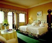
PLUMBER MANOR
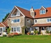
Arnewood House
Videos from this area
These are videos related to the place based on their proximity to this place.
A Ride Through West Wiltshire, Somerset & Dorset (CRF450X, 26.01.13)
Subscribe for the love of bikes: http://www.youtube.com/subscription_center?add_user=wiltshirebyways Please click 'S H O W M O R E' for route info: ↓↓↓↓↓↓↓↓↓ Channel home...
Yew, Venijnboom, Taxus, Taxus baccata. Woolland, Dorset, UK. 29-05-'09
Een geweldige eeuwenoude Taxus boom. Op een kerkhof in een klein plaatsje. De omtrek is 10 meter en de boom is 2000 jaar oud. Een organisatie genaamd: The Yew Tree Campain, heeft dat vast...
First Uplift Day @ UK Bike Park 2.6.12.wmv
Me and Mike take a day trip down to Dorset for our first uplift downhill session @ UK Bike Park.
Trail Riding (The Hard Way) Part 3
Riding another long-forgotten overgrown ORPA (Whitmore Cross) in Fifehead St. Quintin, Dorset with salisburyplain998. The width and depth of gully (not to mention the fallen trees) prohibit...
Bulbarrow Hill Dorset.MOV
Bulbarrow Hill, Dorset (15 September 1011), looking west & north towards the Quantocks, Blackdown hills and Glastonbury Tor. Unedited, filmed using a canon SX30is.
A Ride Through Milton Abbas, Dorset
Subscribe for the love of bikes: http://www.youtube.com/subscription_center?add_user=wiltshirebyways Please click 'S H O W M O R E' for route info: ↓↓↓↓↓↓↓↓↓ Channel home...
Consciousness within a new quantum theory an artist view.
The paradoxes of quantum mechanics have nothing to do with consciousness. It is the conscious idea that leads to the physical act but it is the physical action itself that collapses the wave...
Lifters Antigravity and the Physics of a new Quantum Theory
Lifters create lift by driving the ionized air downwards forming an upward force. Some people say that it is easy to see that Lifters do not form anti-gravity because it generates this force...
Videos provided by Youtube are under the copyright of their owners.
Attractions and noteworthy things
Distances are based on the centre of the city/town and sightseeing location. This list contains brief abstracts about monuments, holiday activities, national parcs, museums, organisations and more from the area as well as interesting facts about the region itself. Where available, you'll find the corresponding homepage. Otherwise the related wikipedia article.
Dorset
Dorset, is a county in South West England on the English Channel coast. The ceremonial county comprises the non-metropolitan county, which is governed by Dorset County Council, and the unitary authorities of Poole and Bournemouth. Covering an area of 2,653 square kilometres, Dorset borders Devon to the west, Somerset to the north-west, Wiltshire to the north-east, and Hampshire to the east. The county town is Dorchester which is situated in the south.
Milton Abbey School
Milton Abbey school is an independent school in Milton Abbas, Dorset, England. It has 212 pupils as of January 2012, in five houses: Athelstan, Damer, Hambro, Hodgkinson and Tregonwell. The school was founded in 1954 and is coeducational.
Belchalwell
Belchalwell is a village in the civil parish of Okeford Fitzpaine in the Blackmore Vale, North Dorset, and lies two and a half miles south of Sturminster Newton and six miles north-west of Blandford. The village lies under the north slopes of Bell Hill, part of the Dorset Downs, and is Saxon in origin, with a medieval church, much renovated.
Bulbarrow Hill
Bulbarrow Hill is a 274 metre (899 feet) hill near Woolland, five miles west of Blandford Forum and ten miles (16 km) north of Dorchester in Dorset, England. The chalk hill is part of the scarp of Dorset Downs, which form the western end of the Southern England Chalk Formation. Part of the hill is used for arable agriculture, but most is calcareous grassland. The hill overlooks the Blackmore Vale, and offers views of Dorset, Somerset, Wiltshire and Devon.
Ansty, Dorset
Ansty is a village in Dorset, England, north of Cheselbourne and west of Milton Abbas. It consists of the settlements of Higher Ansty, Lower Ansty, Pleck (also known as Little Ansty) and Ansty Cross. The most imposing building in Ansty is the village hall which was converted from the 18th century malt-house, part of the brewery.
Stoke Wake
Stoke Wake is a very small hamlet, originally part of the Whiteway hundred in north Dorset, England, situated in the Blackmore Vale under Bulbarrow Hill west of Blandford Forum.


