Safety Score: 3,0 of 5.0 based on data from 9 authorites. Meaning we advice caution when travelling to United Kingdom.
Travel warnings are updated daily. Source: Travel Warning United Kingdom. Last Update: 2024-05-21 08:19:37
Delve into Scarcliffe
Scarcliffe in Derbyshire (England) is located in United Kingdom about 127 mi (or 205 km) north-west of London, the country's capital town.
Current time in Scarcliffe is now 09:10 AM (Tuesday). The local timezone is named Europe / London with an UTC offset of one hour. We know of 10 airports close to Scarcliffe, of which 5 are larger airports. The closest airport in United Kingdom is Robin Hood Doncaster Sheffield Airport in a distance of 21 mi (or 34 km), North-East. Besides the airports, there are other travel options available (check left side).
There are several Unesco world heritage sites nearby. The closest heritage site in United Kingdom is Liverpool – Maritime Mercantile City in a distance of 17 mi (or 27 km), North-East. Also, if you like playing golf, there are some options within driving distance. If you need a hotel, we compiled a list of available hotels close to the map centre further down the page.
While being here, you might want to pay a visit to some of the following locations: Wales, Todwick, Ulley, Orgreave and Whiston. To further explore this place, just scroll down and browse the available info.
Local weather forecast
Todays Local Weather Conditions & Forecast: 14°C / 58 °F
| Morning Temperature | 9°C / 49 °F |
| Evening Temperature | 14°C / 57 °F |
| Night Temperature | 12°C / 54 °F |
| Chance of rainfall | 12% |
| Air Humidity | 72% |
| Air Pressure | 1010 hPa |
| Wind Speed | Gentle Breeze with 8 km/h (5 mph) from South |
| Cloud Conditions | Overcast clouds, covering 99% of sky |
| General Conditions | Moderate rain |
Wednesday, 22nd of May 2024
14°C (57 °F)
12°C (53 °F)
Moderate rain, moderate breeze, overcast clouds.
Thursday, 23rd of May 2024
14°C (56 °F)
10°C (50 °F)
Overcast clouds, moderate breeze.
Friday, 24th of May 2024
15°C (60 °F)
11°C (52 °F)
Light rain, light breeze, broken clouds.
Hotels and Places to Stay
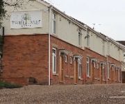
Twin Oaks Hotel
ibis Chesterfield North - Barlborough
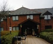
TRAVELODGE MANSFIELD
Days Inn Chesterfield Tibshelf
Videos from this area
These are videos related to the place based on their proximity to this place.
Piantings and photographs of The Bolsover District, Derbyshire, England, by Markijnr
How beautiful the English countryside can be if we only open our eyes and look a little more closer. How wonderful it was to have had the opportunity to go out and paint this wonderful landscape....
Bolsover Castle, Derby, England, Suzie trip 2014
Suzie's visit to Bolsover Castle in Derbyshire, England June 2014.
Stedman Triples at Bolsover
In north Derbyshire, in the Peak District, one particular family made its mark. The Cavendish family have ruled the area as the Dukes of Devonshire. Despite their title, their lands have...
Bolsover - Clash of Knights - 20140601 131646
English Heritage Clash of Knights event at Bolsover Castle.
Bolsover Castle. June 2014
Had a great time looking around Bolsover Castle, Derbyshire. It's set in magnificent surroundings with amazing panoramic view. Its a medieval fortress dating back to 1612. There are an abundance...
Videos provided by Youtube are under the copyright of their owners.
Attractions and noteworthy things
Distances are based on the centre of the city/town and sightseeing location. This list contains brief abstracts about monuments, holiday activities, national parcs, museums, organisations and more from the area as well as interesting facts about the region itself. Where available, you'll find the corresponding homepage. Otherwise the related wikipedia article.
Bolsover District
Bolsover is a local government district in Derbyshire, England. Its main town is Bolsover.
Bolsover Cundy House
Bolsover Cundy House is a recently restored 17th century conduit house that was used to supply water to the nearby Bolsover Castle. It is located near Houfton Road in Bolsover. In the middle of the building is the brick water tank, which still collects water. It was built in the early 17th century and supplied water to the cistern house of Bolsover Castle until the 1920s. The roof is a solid stone vault to make it secure and impervious to decay, unlike timber.
Pleasley Colliery
Pleasley Colliery is a former English coal mine. It is located to the NW of Pleasley village which sits astride the River Meden on the Nottinghamshire/Derbyshire border. The colliery is located to the NW of Pleasley village which sits astride the River Meden on the Nottinghamshire/Derbyshire border. It lies 3 miles (4.8 km) north of Mansfield and 9 miles (14.5 km) south of Chesterfield.
Langwith, Derbyshire
Langwith is a close group of four villages crossing the Derbyshire-Nottinghamshire border, on the river Poulter only about two miles from Warsop, and about four miles from Bolsover, on the A632 road, south of Whaley Thorns. These consist of Langwith, Langwith Maltings, Nether Langwith, and Upper Langwith. Dale close is a big part of Langwith.
Old Bolsover Town Council
Old Bolsover Town Council is a political/governmental area, within Bolsover (district), representing and administrating the town of Bolsover. The Town Council has been meeting in the Town Hall on Cotton Street since 1976. The Townhall has had a chequered history. Built as a Primitive Methodist Chapel, it later transferred to the Salvation Army and in 1911 first became council offices.
Old Bolsover
Old Bolsover is the zone between Bolsover Castle, and the Eastern edge of the town, at Moor Hall, in Bolsover, Derbyshire, that is represented by Old Bolsover Town Council. This chiefly consists of Bolsover town centre, some council estates to the east of the centre, as well as houses in the Hill Top area, and on the road to Shuttlewood.
Scarcliffe railway station
Scarcliffe railway station was a former railway station in Scarcliffe, Derbyshire. It was opened by the Lancashire, Derbyshire and East Coast Railway (later part of the Great Central Railway and subsequently the LNER) in March 1897. As originally planned, this was a highly ambitious scheme, as its name suggests, but only the central section between Chesterfield and Lincoln, together with a branch from Langwith Junction to the outskirts of Sheffield, were ever built.
Over Woodhouse
Over Woodhouse is a suburban area lying just North-West of Bolsover Towncentre, Derbyshire, just to the North of Bolsover Castle, on a hill facing it. The whole area is hemed-in by the A632, the B6419 to Shuttlewood, and two other roads which join together and lead to B6418 to Shuttlewood,lying just East of the former Bolsover Colliery. It consists primarily of one large Post-World War II housing estate. Though there are some older properties within it.


