Safety Score: 3,0 of 5.0 based on data from 9 authorites. Meaning we advice caution when travelling to Slovakia.
Travel warnings are updated daily. Source: Travel Warning Slovakia. Last Update: 2024-04-25 08:17:04
Delve into Mliečno
Mliečno in Trnava is located in Slovakia about 14 mi (or 22 km) south-east of Bratislava, the country's capital town.
Current time in Mliečno is now 09:23 AM (Friday). The local timezone is named Europe / Bratislava with an UTC offset of 2 hours. We know of 11 airports close to Mliečno, of which 5 are larger airports. The closest airport in Slovakia is M. R. Štefánik Airport in a distance of 12 mi (or 19 km), North-West. Besides the airports, there are other travel options available (check left side).
There are several Unesco world heritage sites nearby. The closest heritage site is Fertö / Neusiedlersee Cultural Landscape in Austria at a distance of 35 mi (or 56 km). The closest in Slovakia is Historic Town of Banská Štiavnica and the Technical Monuments in its Vicinity in a distance of 78 mi (or 56 km), South-West. If you need a hotel, we compiled a list of available hotels close to the map centre further down the page.
While being here, you might want to pay a visit to some of the following locations: Mosonmagyarovar, Senec, Deutsch Jahrndorf, Bratislava and Nickelsdorf. To further explore this place, just scroll down and browse the available info.
Local weather forecast
Todays Local Weather Conditions & Forecast: 14°C / 57 °F
| Morning Temperature | 7°C / 44 °F |
| Evening Temperature | 14°C / 57 °F |
| Night Temperature | 9°C / 48 °F |
| Chance of rainfall | 0% |
| Air Humidity | 56% |
| Air Pressure | 1012 hPa |
| Wind Speed | Moderate breeze with 11 km/h (7 mph) from North |
| Cloud Conditions | Clear sky, covering 7% of sky |
| General Conditions | Sky is clear |
Saturday, 27th of April 2024
17°C (62 °F)
12°C (54 °F)
Sky is clear, fresh breeze, clear sky.
Sunday, 28th of April 2024
19°C (67 °F)
14°C (58 °F)
Broken clouds, fresh breeze.
Monday, 29th of April 2024
20°C (68 °F)
14°C (58 °F)
Broken clouds, moderate breeze.
Hotels and Places to Stay
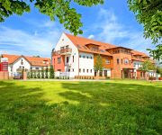
Diamant
Videos from this area
These are videos related to the place based on their proximity to this place.
Systém klima - Šamorín Dunajská ul. 23.10.2014
Mont AL, s.r.o. 0915896514 www.zasklievania.sk zasklievanie@azet.sk.
S C E A R 2011 Šamorín
Prvé samostatné verejné vystúpenie vojensko historickej skupiny S.C.E.A.R v máji 2011 počas dňa rodiny v Šamoríne. Scear sa špecializuje na rímske pomocné jednotky umiestnené na...
Ploubuter Park
Koronczi Endre: Ploubuter Park AT HOME GALLERY, Somorja / Samorin 2013. március - április http://www.koronczi.hu/ploubuterpark/ http://www.athomegallery.org/
Stories / Gschichtä
Installations and Objects, AT HOME GALLERY, Synagogue Samorin 2009, with Liliane Csuka (CH), Paolo Rossi (CH), Margrit Schärli (CH), Maria Eitle-Vozar (CH),
river-writing
Because the jewisch community has emigrated, the synagogue in Samorin has not been used for decades. For about ten years now, it is being used as an international gallery. The synagogue is...
Staré koryto Dunaja - A Duna régi medre - Alte Bett der Donau
Old bed of the Danube Video taken with the Nokia N8.
nocna burka v Samorine
pekna burka s poriadnym dazdom, co sa v noci 24.07.2010 vyblaznila aj nad Samorinom (ano, samozrejme ze boli vypadky prudu, bez nich to nejde)
Videos provided by Youtube are under the copyright of their owners.
Attractions and noteworthy things
Distances are based on the centre of the city/town and sightseeing location. This list contains brief abstracts about monuments, holiday activities, national parcs, museums, organisations and more from the area as well as interesting facts about the region itself. Where available, you'll find the corresponding homepage. Otherwise the related wikipedia article.
Gothic church, Šamorín
The Gothic church of Šamorín (Slovak: Stredoveký farský kostol Šamorína) is a church in the district of Šamorín in Bratislava.
Pomlé Stadium
Pomlé Stadium is a home football stadium in Šamorín, Slovakia. It serves as home stadium for football club FC ŠTK 1914 Šamorín. The stadium has a capacity of 1,950 (750 seats).


