Safety Score: 3,0 of 5.0 based on data from 9 authorites. Meaning we advice caution when travelling to Germany.
Travel warnings are updated daily. Source: Travel Warning Germany. Last Update: 2024-04-29 08:03:39
Discover Heinrichshöhe
Heinrichshöhe in Free State of Thuringia is a town in Germany about 168 mi (or 270 km) south-west of Berlin, the country's capital city.
Current time in Heinrichshöhe is now 01:14 PM (Monday). The local timezone is named Europe / Berlin with an UTC offset of 2 hours. We know of 11 airports near Heinrichshöhe, of which 5 are larger airports. The closest airport in Germany is Hof-Plauen Airport in a distance of 16 mi (or 26 km), South-East. Besides the airports, there are other travel options available (check left side).
There are several Unesco world heritage sites nearby. The closest heritage site in Germany is Margravial Opera House Bayreuth in a distance of 31 mi (or 51 km), South. Looking for a place to stay? we compiled a list of available hotels close to the map centre further down the page.
When in this area, you might want to pay a visit to some of the following locations: Tschirn, Schlegel, Geroldsgrun, Reichenbach and Harra. To further explore this place, just scroll down and browse the available info.
Local weather forecast
Todays Local Weather Conditions & Forecast: 17°C / 63 °F
| Morning Temperature | 9°C / 49 °F |
| Evening Temperature | 15°C / 58 °F |
| Night Temperature | 10°C / 51 °F |
| Chance of rainfall | 0% |
| Air Humidity | 55% |
| Air Pressure | 1021 hPa |
| Wind Speed | Gentle Breeze with 6 km/h (4 mph) from South-West |
| Cloud Conditions | Overcast clouds, covering 100% of sky |
| General Conditions | Overcast clouds |
Tuesday, 30th of April 2024
23°C (73 °F)
13°C (55 °F)
Sky is clear, gentle breeze, clear sky.
Wednesday, 1st of May 2024
21°C (71 °F)
13°C (55 °F)
Scattered clouds, moderate breeze.
Thursday, 2nd of May 2024
16°C (61 °F)
10°C (51 °F)
Light rain, gentle breeze, overcast clouds.
Hotels and Places to Stay
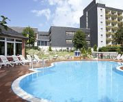
Am Rennsteig Familienhotel
Videos from this area
These are videos related to the place based on their proximity to this place.
Traditionszug Sormitztal-Express auf Viadukt nahe Wurzbach Thüringen
Der Traditionszug "Sormitztalexpress hier aufgenommen auf dem Viadukt nahe Wurzbach (Heinrichshütte, Bärenmühle). Entstanden ist die Aufnahme am 5. Oktober 2014 vom "Charlottenfels".
FFW Wurzbach/ Einsatzfahrt TLF 16/24-Rauchentwicklung ehemalige Kaserne in Rodacherbrunn.
Einsatzfahrt mit TLF16/24 durch das Stadtgebiet Wurzbach zum Übungseinsatz nach Rodacherbrunn!! Rauchentwicklung ehemalige Kaserne. Am Freitag 13. Juli 2012.
FFW Wurzbach/ Übungsbrandeinsatz Oßla
Anlässlich des Jübiläums der "Freiwilligen Feuerwehr Oßla" führte die Feuerwehrwehr Wurzbach einen Übungsbrandeinsatz durch!
BR 41 1144-9 - Sormitztal-Express 20.10.2012
Bahnnostalgie Thüringen - Sormitztal-Express 20.10.2012 Erfurt - Leutenberg - Blankenstein - Leutenberg - Erfurt mehr Videos und Bilder auf www.Schmalspurbahn-Freunde.de.
2012-05-18 Thomas' Nose Cam Franken
Motorradstrecke bei Nordhalben, Franken, Bayern Motorbike ride close to Nordhalben, Franken, Bavaria.
Clubsport Slalom Nordhalben 24 05 09 2. Lauf Martin Corsa Tr
Mein 2. Slalom. Start in Gruppe H bis 1600ccm mit normalen Strassenreifen. 2. Platz von 5 :-)
Пещера FeenGrotten в Германии, 2014 год
В один из дней нашей поездки по Германии в июне 2014 года, нас пригласили посетить одну из красивейших пещер,...
Videos provided by Youtube are under the copyright of their owners.
Attractions and noteworthy things
Distances are based on the centre of the city/town and sightseeing location. This list contains brief abstracts about monuments, holiday activities, national parcs, museums, organisations and more from the area as well as interesting facts about the region itself. Where available, you'll find the corresponding homepage. Otherwise the related wikipedia article.
Dürrenwaid station
Dürrenwaid station is a former railway station on the Rodach Valley railway or Rodachtalbahn in southern Germany. It was built in 1901 at kilometre 23.37, about 3 kilometres outside the village of Dürrenwaid in the area of the market town of Nordhalben in Bavaria. The station building is a single-storey, wooden-boarded affair. It is topped with a flat, slate-covered, saddleback roof.


