Safety Score: 3,0 of 5.0 based on data from 9 authorites. Meaning we advice caution when travelling to Germany.
Travel warnings are updated daily. Source: Travel Warning Germany. Last Update: 2024-05-18 08:26:29
Explore Dienstedt
The district Dienstedt of Dienstedt-Hettstedt in Free State of Thuringia is located in Germany about 153 mi south-west of Berlin, the country's capital.
If you need a place to sleep, we compiled a list of available hotels close to the map centre further down the page.
Depending on your travel schedule, you might want to pay a visit to some of the following locations: Witzleben, Rittersdorf, Hohenfelden, Nauendorf and Tonndorf. To further explore this place, just scroll down and browse the available info.
Local weather forecast
Todays Local Weather Conditions & Forecast: 17°C / 63 °F
| Morning Temperature | 12°C / 53 °F |
| Evening Temperature | 16°C / 60 °F |
| Night Temperature | 11°C / 52 °F |
| Chance of rainfall | 10% |
| Air Humidity | 73% |
| Air Pressure | 1010 hPa |
| Wind Speed | Gentle Breeze with 8 km/h (5 mph) from East |
| Cloud Conditions | Broken clouds, covering 82% of sky |
| General Conditions | Moderate rain |
Monday, 20th of May 2024
21°C (69 °F)
13°C (56 °F)
Light rain, light breeze, scattered clouds.
Tuesday, 21st of May 2024
22°C (71 °F)
15°C (60 °F)
Light rain, moderate breeze, overcast clouds.
Wednesday, 22nd of May 2024
13°C (55 °F)
12°C (53 °F)
Moderate rain, gentle breeze, overcast clouds.
Hotels and Places to Stay
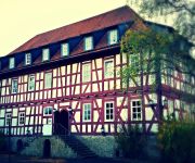
Burg Edelhof
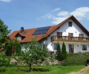
Grünes Herz Pension
Videos from this area
These are videos related to the place based on their proximity to this place.
Einsatzfahrt zur Übung in Elleben
Dieser kurze Ausschnitt zeigt die Anfahrten mit Sondersignal der Feuerwehren Elleben, Losheim am See, Elxleben, Rimlingen Weitere Informationen auf http://www.feuerwehrelxleben.de Bitte Kanal...
Mastermind to Success
How to combine de-luxe travel and pleasure with successful networking and masterminding (brainstorming), see www.thetobebook.com/mastermind.
Speeddays 2009 Volvo S60R vs. Volvo 850 T5-RR
Speeddays 2009 Quartermile Race Weekend 12 June 2009 - 14 June 2009, Volvo S60R 12,51 sek. & Volvo 850 T5-RR 13,52 sek.
Kinderlieder zum Mitsingen, Kranichfeld, Rosenfest, Niederburg, Thomas Koppe, Kinderlied Oh lalala
Kinderlieder zum Mitsingen, Kranichfeld, Rosenfest, Niederburg, Thomas Koppe, Kinderlied Oh lalala, Lied bei Amazon.de kaufen: ...
Romeo&Julia2012 - Aufbauvideo Oberschloss Kranichfeld vom 11. August 2012
Thüringer Sommertheater: Romeo&Julia2012 Das Aufbauvideo von der vierten Vorstellung auf Oberschloss Kranichfeld vom 11. August 2012. Wir sehen "Ausladen", "Abmessen", "Aufbauen", ...
Kranichfeld Thüringen
Schon vor 100 Jahren wurde für Konsumprodukte geworben. Damals nannte man die Werbung jedoch Reklame und jede Firma welche was auf sich hielt, produzierte kleine briefmarkenähnliche ...
134. Rosenfest & 11. Thüringer Tanzfest, 22.-24.6.2012
24.6.2012 Festumzug zum 134. Rosenfest & 11. Thüringer Tanzfest durch Kranichfelds Innenstadt mit Mitgliedern des Thüringer Tanzverbandes, Seniorentanzgruppen, Kinder- und ...
Kletterwald Hohenfelden - Beitrag vom Hochschulfernsehen UNIcut
Wer eine herausfordernde und sportliche Abwechslung zum Uni-Alltag sucht, sollte sich den Kletterwald Hohenfelden vormerken. UNIcut-Reporter Peter hat bei seinem Besuch im Hochseilgarten ...
We Are Scientists - Can't Lose (live @ Highfield 2008)
We Are Scientists performing "Can't Lose" at the Highfield festival 2008. Awesome show! last refrain missing :-/
Videos provided by Youtube are under the copyright of their owners.
Attractions and noteworthy things
Distances are based on the centre of the city/town and sightseeing location. This list contains brief abstracts about monuments, holiday activities, national parcs, museums, organisations and more from the area as well as interesting facts about the region itself. Where available, you'll find the corresponding homepage. Otherwise the related wikipedia article.
Ilm-Kreis
Ilm-Kreis is a district in Thuringia, Germany. It is bounded by (from the north and clockwise) the city of Erfurt, the districts of Weimarer Land, Saalfeld-Rudolstadt and Hildburghausen, the city of Suhl, and the districts of Schmalkalden-Meiningen and Gotha. It is named after the river Ilm, flowing through the district.
Saalfeld-Rudolstadt
Saalfeld-Rudolstadt is a Kreis in the south of Thuringia, Germany. Neighboring districts are (from the north clockwise) the districts Weimarer Land, Saale-Holzland, Saale-Orla, the district Kronach in Bavaria, and the districts Sonneberg, Hildburghausen and Ilm-Kreis.
Bauhaus University, Weimar
The Bauhaus University is a university located in Weimar, Germany and specializes in the artistic and technical fields. Established in 1860 as the Great Ducal Saxon Art School, it gained collegiate status on 3 June 1910. In 1919 the school was renamed Bauhaus by its new director Walter Gropius and it received its present name in 1996. Approximately 4,000 students are enrolled at the university today.
Heidecksburg
The castle Heidecksburg was the residence of the princes to Schwarzburg-Rudolstadt in Rudolstadt. The castle is located approximately 60 m above the old town of Rudolstadt. It was not destroyed during World War II.
Haus am Horn
The Haus am Horn was built for the Weimar Bauhaus's exhibition of July through September 1923. It was designed by Georg Muche, a painter and a teacher at the Bauhaus. Other Bauhaus instructors, such as Adolf Meyer and Walter Gropius, assisted with the technical aspects of the house's design.
Steigerwaldstadion
Steigerwaldstadion is a multi-purpose stadium in Erfurt, Germany. The stadium is able to hold 19,439 people and was built in 1931. It is currently used mostly for football matches and is the home stadium of FC Rot-Weiß Erfurt. From 1948 to 1991 (the time of the German Democratic Republic), Steigerwaldstadion was known as the Georgij-Dimitroff-Stadion, after Bulgarian communist leader Georgi Dimitrov (1882–1949).
Schwarza (Saale)
The Schwarza is a left tributary of the Saale in Thuringia, Germany, and 53 km long. Its source is in the Thuringian Forest, near Neuhaus am Rennweg. It flows into the Saale in Rudolstadt. Other towns on the Schwarza are Schwarzburg and Bad Blankenburg. It has 50 tributaries, the largest being the Lichte, the Sorbitz, the Werre and the Rinne. Its name, meaning "black river", comes from its dark colour in its upper course and the thick forest which originally overshadowed the narrow valley.
Erfurt Cathedral
The Catholic Erfurt Cathedral is a 1200 year old church located on Cathedral Hill of Erfurt, in Thuringia, Germany. It is of an International Gothic style, and is also known as St Mary's Cathedral, and is located, uniquely, on a hillside. It is the episcopal see of the Roman Catholic Diocese of Erfurt.
Erfurt Central Station
Erfurt Central Station (Erfurt Hauptbahnhof) is the central railway station of Erfurt in Germany. It is an important junctions of the German railways and is served by numerous local and long-distance rail services. Immediately north of the station, is Erfurt's city center. It had approximately 12.5 million passengers in 2006, that is an average of about 34,000 per day. The station lies on the Thüringer Bahn, which connects Halle to Bebra.
Grammetal
Grammetal is a Verwaltungsgemeinschaft in the district Weimarer Land in Thuringia, Germany. The seat of the Verwaltungsgemeinschaft is in Isseroda. The Verwaltungsgemeinschaft Grammetal consists of the following municipalities: Bechstedtstraß Daasdorf am Berge Hopfgarten Isseroda Mönchenholzhausen Niederzimmern Nohra Ottstedt am Berge
Kranichfeld (Verwaltungsgemeinschaft)
Kranichfeld is a Verwaltungsgemeinschaft in the district Weimarer Land in Thuringia, Germany. The seat of the Verwaltungsgemeinschaft is in Kranichfeld. The Verwaltungsgemeinschaft Kranichfeld consists of the following municipalities: Hohenfelden Klettbach Kranichfeld Nauendorf Rittersdorf
Langer Berg
Langer Berg is a Verwaltungsgemeinschaft ("collective municipality") in the district Ilm-Kreis, in Thuringia, Germany. The seat of the Verwaltungsgemeinschaft is in Gehren. The Verwaltungsgemeinschaft Langer Berg consists of the following municipalities: Gehren Herschdorf Möhrenbach Neustadt am Rennsteig
Oberes Geratal
Oberes Geratal is a Verwaltungsgemeinschaft ("collective municipality") in the district Ilm-Kreis, in Thuringia, Germany. The seat of the Verwaltungsgemeinschaft is in Gräfenroda. The Verwaltungsgemeinschaft Oberes Geratal consists of the following municipalities: Frankenhain Gehlberg Geschwenda Gossel Gräfenroda Liebenstein
Riechheimer Berg
Riechheimer Berg is a Verwaltungsgemeinschaft ("collective municipality") in the district Ilm-Kreis, in Thuringia, Germany. The seat of the Verwaltungsgemeinschaft is in Kirchheim. The Verwaltungsgemeinschaft Riechheimer Berg consists of the following municipalities: Alkersleben Bösleben-Wüllersleben Dornheim Elleben Elxleben Kirchheim Osthausen-Wülfershausen Rockhausen
Mittleres Schwarzatal
Mittleres Schwarzatal is a Verwaltungsgemeinschaft ("municipal association") in the district Saalfeld-Rudolstadt, in Thuringia, Germany. The seat of the Verwaltungsgemeinschaft is in Sitzendorf. The Verwaltungsgemeinschaft Mittleres Schwarzatal consists of the following municipalities: Allendorf Bechstedt Döschnitz Dröbischau Mellenbach-Glasbach Meura Oberhain Rohrbach Schwarzburg Sitzendorf Unterweißbach
Landtag of Thuringia
The Landtag of Thuringia is the state diet of the German federal state of Thuringia. It convenes in Erfurt and currently consists of 88 members of three Parties. Currently, the Christian Democratic Union is in a 'grand coalition' with the Social Democratic Party (SPD), aupporting a cabinet led by Minister-President Christine Lieberknecht. The primary functions of the Landtag are to pass laws, elect the Minister-President and control the government of Thuringia.
Russian Orthodox Chapel, Weimar
The Russian Orthodox Chapel is a funerary chapel built in Weimar in 1860 for Grand Duchess Maria Pavlovna of Russia. It was constructed in the Historical Cemetery behind the Weimarer Fürstengruft, to which it is connected by an underground passage. Maria Pavlovna's coffin is located in the passage, with her husband Charles Frederick's coffin placed directly beside it. A spiral staircase leads to another underground connection to the Fürstengruft, though this is now closed by a metal plate.
Weimarer Fürstengruft
The Fürstengruft is the ducal burial chapel of Saxe-Weimar-Eisenach, located in the Historical Cemetery in Weimar. It also houses the tombs of Goethe and Schiller. It is part of the Klassik Stiftung Weimar and since 1998 it and the cemetery have also been part of the Classical Weimar World Heritage Site.
Historical Cemetery, Weimar
The Historical Cemetery (Historischer Friedhof Weimar) is the main cemetery of Weimar. It includes the Weimarer Fürstengruft, with which it forms part of the Classical Weimar World Heritage Site.
Wipfra (river)
Wipfra is a river of Thuringia, Germany.
Blambach
Blambach is a river of Thuringia, Germany.
Schobse
Schobse is a river of Thuringia, Germany.
Wohlrose
Wohlrose is a river of Thuringia, Germany.
DomStufen-Festspiele
DomStufen-Festspiele is a theatre festival in Germany.
Erfurt Formation
The Erfurt Formation is a stratigraphic formation of the Keuper group and the Germanic Trias supergroup. It was deposited during the Ladinian. It lies above the Upper Muschelkalk and below the Middle Keuper.


