Safety Score: 3,0 of 5.0 based on data from 9 authorites. Meaning we advice caution when travelling to Germany.
Travel warnings are updated daily. Source: Travel Warning Germany. Last Update: 2024-04-25 08:17:04
Delve into Laiming
Laiming in Upper Bavaria (Bavaria) is a town located in Germany about 316 mi (or 509 km) south of Berlin, the country's capital town.
Time in Laiming is now 03:37 AM (Friday). The local timezone is named Europe / Berlin with an UTC offset of 2 hours. We know of 12 airports closer to Laiming, of which 5 are larger airports. The closest airport in Germany is Munich International Airport in a distance of 30 mi (or 49 km), North-West. Besides the airports, there are other travel options available (check left side).
There are several Unesco world heritage sites nearby. The closest heritage site is Historic Centre of the City of Salzburg in Austria at a distance of 42 mi (or 68 km). The closest in Germany is Pilgrimage Church of Wies in a distance of 64 mi (or 68 km), East. In need of a room? We compiled a list of available hotels close to the map centre further down the page.
Since you are here already, you might want to pay a visit to some of the following locations: Griesstatt, Ramerberg, Edling, Eiselfing and Schonstett. To further explore this place, just scroll down and browse the available info.
Local weather forecast
Todays Local Weather Conditions & Forecast: 14°C / 57 °F
| Morning Temperature | 1°C / 33 °F |
| Evening Temperature | 12°C / 54 °F |
| Night Temperature | 5°C / 41 °F |
| Chance of rainfall | 0% |
| Air Humidity | 44% |
| Air Pressure | 1007 hPa |
| Wind Speed | Gentle Breeze with 7 km/h (4 mph) from West |
| Cloud Conditions | Overcast clouds, covering 90% of sky |
| General Conditions | Overcast clouds |
Saturday, 27th of April 2024
16°C (61 °F)
8°C (46 °F)
Few clouds, gentle breeze.
Sunday, 28th of April 2024
19°C (66 °F)
11°C (52 °F)
Overcast clouds, gentle breeze.
Monday, 29th of April 2024
20°C (67 °F)
12°C (54 °F)
Overcast clouds, light breeze.
Hotels and Places to Stay
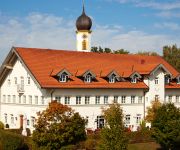
Fletzinger-Bräu
Pfaffinger Hof
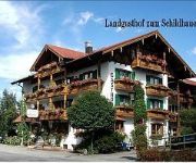
Land-gut-Hotel Zum Schildhauer
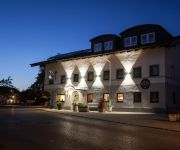
Egger-Stüberl Landgasthotel
Videos from this area
These are videos related to the place based on their proximity to this place.
Porsche 911 (997) - Landstrasse
Kurzer Trip auf einer Landstrasse zwischen Wasserburg und Rosenheim mit einem 997 C2. Tolles Wetter, tolle Strasse aber zu viel Verkehr. Sorry, sound ist nicht top - Fenster war auf.
-Tierqualen- 6.1.2011
Zur weiteren Vorbereitung von Schwimmbaggerarbeiten im Bereich des Inns zwischen Wasserburg und Attel wurden seit einigen Tagen so genannte Lotstreifen gefahren. Das heißt dass mit einem ...
Orangensaft aus dem Boden (DSCF0889) VEROCKERUNG am Inn
Völlig verockerter nördlicher Zulauf zum Pumpwerk "Altermanngraben" bei Ramerberg/Sendling an der B15. Das "Abwasser tangiert das NSG 7939-401 Laienhafte Beschreibung des seit 1982 ...
Caritas Schulen in Altenhohenau - Altenpflege - Heilerziehungspflege
Berufsfachschule für Altenpflege - Altenhilfe - Fachschule für Heilerziehungspflege - Fachschule für Heilerziehungspflegehilfe Herausgeber u. V.i.S.d.P. Berufliche Schulen der Caritas...
Bio-Landhof Auental! Biolandbau aus Leidenschaft 1/3 http://www.bio-landhof-auental.de
Lorenz Reindl führt durch den biologischen Anbau von Gemüse! Kisten-Liefer-Service! Mischkultur! Gewächshäuser! Der Verkaufsladen mit einigen seiner Produkte! Nützlingspflanzen! http://www.bi...
Biberrevier Laimbach Streifl 20.12.2014 MAH07159
Einer der abgebrochenen Biberdämme wird nun von den Tieren wieder neu aufgebaut. Der nun mit dem grünen Rohr unfachmännisch überbrückte Damm war längst überflüssig geworden, da er ...
Abwasser-Ockerbrühe am Pumpwerk Zainach DSCF8597
Seit Dekaden ein ähnlicher Zustand. Ein Drecksbrühe verseucht das NSG 7939-401.
Verockerte Drainage am Pumpwerkspolder Altermanngraben 27.10.12
Eisenhaltiges Wasser quillt aus einem Draiangerohr in den Polder.
Schadenskontrolle -Sendlinger Lacken am 29.8.2005
Prüfung der Hochwasserfolgen im Bereich der Sendlinger Lacken und des Katzbachs am 29.8.2005 Das Jahrhunderthochwasser vom 8.8.1985 hatte schwere Verlandungsschäden gebracht, ...
Videos provided by Youtube are under the copyright of their owners.
Attractions and noteworthy things
Distances are based on the centre of the city/town and sightseeing location. This list contains brief abstracts about monuments, holiday activities, national parcs, museums, organisations and more from the area as well as interesting facts about the region itself. Where available, you'll find the corresponding homepage. Otherwise the related wikipedia article.
Attel Abbey
Attl or Attel Abbey (Kloster Attl or Attel) was a monastery, originally of the Benedictines, later of the Brothers Hospitallers, in the village of Attel near Wasserburg am Inn in Bavaria, Germany.
Attel
Attel is a river of Bavaria, Germany.


