Safety Score: 2,8 of 5.0 based on data from 9 authorites. Meaning we advice caution when travelling to Canada.
Travel warnings are updated daily. Source: Travel Warning Canada. Last Update: 2024-04-26 08:02:42
Discover Quarries
Quarries in Ontario is a town in Canada a little north-east of Ottawa, the country's capital city.
Current time in Quarries is now 08:13 PM (Friday). The local timezone is named America / Toronto with an UTC offset of -4 hours. We know of 8 airports near Quarries, of which 4 are larger airports. The closest airport in Canada is Ottawa / Rockcliffe Seaplane Base in a distance of 1 mi (or 2 km), North-West. Besides the airports, there are other travel options available (check left side).
There is one Unesco world heritage site nearby. It's Rideau Canal in a distance of 75 mi (or 120 km), South-East. Also, if you like playing golf, there are a few options in driving distance. Looking for a place to stay? we compiled a list of available hotels close to the map centre further down the page.
When in this area, you might want to pay a visit to some of the following locations: Ottawa, Canton, Saint-Polycarpe, Malone and Watertown. To further explore this place, just scroll down and browse the available info.
Local weather forecast
Todays Local Weather Conditions & Forecast: 15°C / 59 °F
| Morning Temperature | 2°C / 36 °F |
| Evening Temperature | 10°C / 50 °F |
| Night Temperature | 9°C / 49 °F |
| Chance of rainfall | 5% |
| Air Humidity | 54% |
| Air Pressure | 1026 hPa |
| Wind Speed | Moderate breeze with 10 km/h (6 mph) from North |
| Cloud Conditions | Overcast clouds, covering 100% of sky |
| General Conditions | Moderate rain |
Saturday, 27th of April 2024
15°C (58 °F)
10°C (49 °F)
Moderate rain, gentle breeze, overcast clouds.
Sunday, 28th of April 2024
9°C (47 °F)
9°C (48 °F)
Moderate rain, gentle breeze, overcast clouds.
Monday, 29th of April 2024
8°C (46 °F)
7°C (44 °F)
Moderate rain, gentle breeze, overcast clouds.
Hotels and Places to Stay
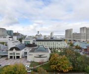
Novotel Ottawa
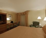
Ottawa Embassy Hotel & Suites
Holiday Inn OTTAWA EAST
Courtyard Ottawa Downtown
Byward Blue Inn
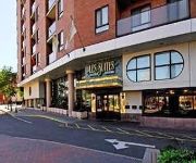
Les Suites Hotel Ottawa
50 Laurier Apartments by CorporateStays
Ottawa Furnished Apartment Rentals
Benner's Bed & Breakfast
Hampton Inn by Hilton Ottawa
Videos from this area
These are videos related to the place based on their proximity to this place.
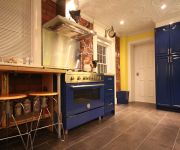
Magnificent 5 Bedroom in Rothwell Heights
For more details click here: http://www.visualtour.com/showvt.asp?t=2644683 12 Bracken Court Ottawa, ON K1J 8N6 5 bed, 5.0 bath, SF Magnificent 5 bedroom residence remodelled in 2003-04!...
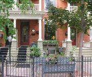
The Right Address!!
For more details click here: http://www.visualtour.com/showvt.asp?t=3019959 1934 Oakdean Beacon Hill North, ON K1J 6H3 $584900, 6 bed, 3.0 bath, SF, MLS# 864447 One of the very best location...
A day at the water park
Took my kids along with my sons best friend and our neighbour with his daughter to the water park in the local area, it was amusing to say the least...just watch out for what the blonde kid says LOL!
Départ de Toronto, enroute et arrivée à Rockcliffe Ottawa [FarNorthEast'12 ep.12]
Encore une superbe météo. Tellement superbe que Georges et moi profitons de 30 kts de vent dans le dos pour exploser notre record de vitesse de croisière. C'était facile avec toutes ces...
C172 Landing @ Ottawa's Rockcliffe Airport (CYRO)
Landing on runway 27 at Ottawa's Rockcliffe Airport (CYRO)
Yamaha Majesty 400 - Short ride on Rockliffe Parkway in Ottawa
A short ride on the Rockliffe Parkway in Ottawa. Video taken with helmet cam.
The City of Ottawa, La ville d'Ottawa - aerial shots
Ottawa is de hoofdstad van Canada. De stad ligt aan de rivier Ottawa in het zuidoosten van de provincie Ontario Ottawa is the capital of Canada and a municipality within the Province of...
Capital City Derby Dolls - Roller Derby - B&W Novice Scrimmage
CCDD hosted a black and white scrimmage for less experienced skaters and invited participants from other Ottawa leagues, Renfrew, and Cornwall to participate. Players stepped up to ref, a couple...
Videos provided by Youtube are under the copyright of their owners.
Attractions and noteworthy things
Distances are based on the centre of the city/town and sightseeing location. This list contains brief abstracts about monuments, holiday activities, national parcs, museums, organisations and more from the area as well as interesting facts about the region itself. Where available, you'll find the corresponding homepage. Otherwise the related wikipedia article.
National Research Council (Canada)
The National Research Council (NRC) is an agency of the Government of Canada which conducts scientific research and development.
Canadian Security Intelligence Service
The Canadian Security Intelligence Service is Canada's primary national intelligence service. It is responsible for collecting, analyzing, reporting and disseminating intelligence on threats to Canada's national security, and conducting operations, covert and overt, within Canada and abroad. Its headquarters is located in Ottawa, Ontario, in a purpose-built facility completed in 1995.
CISTI
The Canada Institute for Scientific and Technical Information (commonly NRC-CISTI or simply CISTI) began in 1924 as the library of the National Research Council of Canada (NRC), the leading agency for research and development in Canada. This library took on the role of national science library unofficially in 1957 and became the official National Science Library in 1967.
Canada Aviation and Space Museum
The Canada Aviation and Space Museum (French: Musée de l'Aviation et de l'Espace du Canada) (formerly the Canada Aviation Museum) is Canada's national aviation history museum. The museum is located in Ottawa, Ontario, Canada, at the Ottawa/Rockcliffe Airport.
La Cité collégiale
La Cité collégiale is the largest French-language college in Ontario. Created in 1989, in Ottawa (with a satellite campus in Hawkesbury and a business office in Toronto) it offers more than 90 programs to some 5000 full-time students from Ontario, other parts of Canada and foreign countries.
Montfort Hospital
The Montfort Hospital is a francophone hospital in Ottawa, Canada offering bilingual medical care to patients in the National Capital Region. The hospital was founded in 1953 by the Filles de la Sagesse Catholic order and was named after one of its founders Saint Louis-Marie Grignion de Montfort. It was secularized in 1970. In the late 1980s it was rebuilt with a large modern section added.
Rideau High School
(March 2013) 40x40pxThis sections of this article in the contents box below may contain original research. Please improve it by verifying the claims made and adding inline citations. Statements consisting only of original research may be removed. Rideau High School Website] is an Ottawa-Carleton District School Board high school in Ottawa, Ontario, Canada . It is located at 815 St. Laurent Boulevard in the east end of the city on the edge of Vanier.
Collège catholique Samuel-Genest
Collège catholique Samuel-Genest (CCSG) is a French Catholic junior high and high school (Grade 7 to Grade 12) in Ottawa, Ontario, under the Conseil des écoles catholiques du Centre-Est (CECCE). Both junior high and high school sides were combined in 2004 with the fusion of the CCSG with the junior high schools of Pauline-Vanier and Vision Jeunesse (both in Ottawa, ON). A school uniform is mandatory for the students.
CFB Rockcliffe
Canadian Forces Base Rockcliffe (also CFB Rockcliffe) is a former Canadian Forces Base located in the eastern part of Ottawa, Ontario, now used for Ottawa/Rockcliffe Airport and the Canada Aviation and Space Museum. It was formerly known as CFB Ottawa North.
Rideau-Rockcliffe Ward
Rideau-Rockcliffe Ward is a city ward in Ottawa, Ontario. Located in the city's east end, the ward covers the neighbourhoods of New Edinburgh, Manor Park, Rockcliffe Park, CFB Rockcliffe, Overbrook, Lindenlea, Viscount Alexander Park, Finter Quarries, Forbes, Castle Heights and part of Carson Grove. Prior to amalgamation, the area was part of Rideau Ward. The name "Rideau Ward" has been applied to this area since New Edinburgh was annexed by Ottawa in 1887.
Viscount Alexander Park
Viscount Alexander Park is a neighbourhood in the northeastern corner of Ottawa, Canada. At its maximum extent, the neighbourhood has a population of 5,686 according to the Canada 2006 Census. The neighbourhood includes much of the Rockcliffe Airport and the CFB Ottawa (North). It also includes the Montfort Hospital. Its bounded on the north by the Ottawa River, on the east by Blair Road, on the south by Montreal Road and on the west by St.
Carson Grove, Ottawa
Carson Grove is a neighbourhood in Ottawa, Ontario, Canada. It is bounded on the west by the Aviation Parkway, on the East by Bathgate Drive, on the North by Montreal Road and on the South by Highway 174.






!['Départ de Toronto, enroute et arrivée à Rockcliffe Ottawa [FarNorthEast'12 ep.12]' preview picture of video 'Départ de Toronto, enroute et arrivée à Rockcliffe Ottawa [FarNorthEast'12 ep.12]'](https://img.youtube.com/vi/6zUj4zn2PLE/mqdefault.jpg)


