Safety Score: 2,7 of 5.0 based on data from 9 authorites. Meaning we advice caution when travelling to United States.
Travel warnings are updated daily. Source: Travel Warning United States. Last Update: 2024-04-26 08:02:42
Delve into Johnsontown
Johnsontown in Northampton County (Virginia) is located in United States about 118 mi (or 191 km) south-east of Washington DC, the country's capital town.
Current time in Johnsontown is now 08:33 AM (Friday). The local timezone is named America / New York with an UTC offset of -4 hours. We know of 8 airports close to Johnsontown, of which 6 are larger airports. The closest airport in United States is Newport News Williamsburg International Airport in a distance of 38 mi (or 61 km), South-West. Besides the airports, there are other travel options available (check left side).
There is one Unesco world heritage site nearby. It's Monticello and the University of Virginia in Charlottesville in a distance of 96 mi (or 155 km), North-West. Also, if you like playing golf, there are some options within driving distance. If you need a hotel, we compiled a list of available hotels close to the map centre further down the page.
While being here, you might want to pay a visit to some of the following locations: Eastville, Accomac, Mathews, Poquoson and Virginia Beach. To further explore this place, just scroll down and browse the available info.
Local weather forecast
Todays Local Weather Conditions & Forecast: 13°C / 56 °F
| Morning Temperature | 11°C / 51 °F |
| Evening Temperature | 12°C / 54 °F |
| Night Temperature | 12°C / 54 °F |
| Chance of rainfall | 0% |
| Air Humidity | 68% |
| Air Pressure | 1030 hPa |
| Wind Speed | Moderate breeze with 12 km/h (7 mph) from South-West |
| Cloud Conditions | Overcast clouds, covering 89% of sky |
| General Conditions | Overcast clouds |
Friday, 26th of April 2024
14°C (58 °F)
15°C (59 °F)
Overcast clouds, moderate breeze.
Saturday, 27th of April 2024
22°C (72 °F)
20°C (69 °F)
Scattered clouds, moderate breeze, broken clouds.
Sunday, 28th of April 2024
24°C (75 °F)
19°C (67 °F)
Broken clouds, moderate breeze.
Hotels and Places to Stay
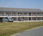
BUDGET INN NASSAWADOX
Videos from this area
These are videos related to the place based on their proximity to this place.
Eastern Shore Railroad Train Runs Over My Camera On Bad Track
This is a video I made and the last one on the Eastern Shore Of Virginia of the Eastern Shore Railroad a train running over my camera over bad old tracks in Eastville.
house ad 2.wmv
Eastern Shore Virginia .. house for sale.. Northampton County .. near Exmore .. craftsman home.
Why does a Crown Royal bottle cap fit on a Captain Morgan bo
Happy New Years 2011 Just a Little Drunk Video for Youtube.
Followers of Jesus - Pastor Milton Bunting
Pastor Bunting preaching "Followers of Jesus" from the series, "Preparing For The Cross" during Sunday Morning Worship.
From Now On - Pastor Milton Bunting
Pastor Bunting preaching "From Now On" from the series, "Preparing For The Cross" during Mid-Week Worship.
Videos provided by Youtube are under the copyright of their owners.
Attractions and noteworthy things
Distances are based on the centre of the city/town and sightseeing location. This list contains brief abstracts about monuments, holiday activities, national parcs, museums, organisations and more from the area as well as interesting facts about the region itself. Where available, you'll find the corresponding homepage. Otherwise the related wikipedia article.
Campbell Field Airport
Campbell Field Airport {{#invoke:InfoboxImage|InfoboxImage|image=CampbellField. JPG|size=250|sizedefault=frameless|alt=}} Aerial view of Campbell Field Airport (9VG) IATA: none – ICAO: none – FAA LID: 9VG Summary Owner/Operator Campbell Field, Inc. Serves Eastern Shore of Virginia Location Weirwood, Virginia Elevation AMSL 40 ft / 12 m Coordinates {{#invoke:Coordinates|coord}}{{#coordinates:37|27|30|N|075|52|44|W|type:airport name= }} Website www. campbellfieldairport.
Bayleys Neck Farm, Virginia
Bayleys Neck Farm is an unincorporated community in Northampton County, Virginia, United States.
Church Creek Point, Virginia
Church Creek Point is an unincorporated community in Northampton County, Virginia, United States.
Johnsontown, Virginia
Johnsontown is an unincorporated community in Northampton County, Virginia, United States.
Machipongo, Virginia
Machipongo is an unincorporated community in Northampton County, Virginia, United States.
Martins Siding, Virginia
Martins Siding is an unincorporated community in Northampton County, Virginia, United States. It is on the eastern shore of Virginia, on the Delmarva peninsula. A short drive away from Martins Siding is the Chesapeake Bay Bridge-Tunnel, which you can take over to the 'mainland'. The bridge begins in Kiptopeke.
Shadyside, Virginia
Shadyside is an unincorporated community in Northampton County, Virginia, United States.
Treherneville, Virginia
Treherneville is an unincorporated community in Northampton County, Virginia, United States.


