Safety Score: 2,7 of 5.0 based on data from 9 authorites. Meaning we advice caution when travelling to United States.
Travel warnings are updated daily. Source: Travel Warning United States. Last Update: 2024-04-27 08:23:39
Touring West Torresdale
West Torresdale in Philadelphia County (Pennsylvania) is a town located in United States about 136 mi (or 219 km) north-east of Washington DC, the country's capital place.
Time in West Torresdale is now 01:04 PM (Saturday). The local timezone is named America / New York with an UTC offset of -4 hours. We know of 11 airports nearby West Torresdale, of which 4 are larger airports. The closest airport in United States is Trenton Mercer Airport in a distance of 17 mi (or 27 km), North-East. Besides the airports, there are other travel options available (check left side).
There are two Unesco world heritage sites nearby. The closest heritage site in United States is Independence Hall in a distance of 11 mi (or 18 km), South-East. Also, if you like the game of golf, there are several options within driving distance. We collected 2 points of interest near this location. Need some hints on where to stay? We compiled a list of available hotels close to the map centre further down the page.
Being here already, you might want to pay a visit to some of the following locations: Camden, Philadelphia, Mount Holly, Doylestown and Trenton. To further explore this place, just scroll down and browse the available info.
Local weather forecast
Todays Local Weather Conditions & Forecast: 16°C / 61 °F
| Morning Temperature | 6°C / 42 °F |
| Evening Temperature | 11°C / 52 °F |
| Night Temperature | 10°C / 50 °F |
| Chance of rainfall | 0% |
| Air Humidity | 27% |
| Air Pressure | 1033 hPa |
| Wind Speed | Gentle Breeze with 8 km/h (5 mph) from North-East |
| Cloud Conditions | Overcast clouds, covering 100% of sky |
| General Conditions | Light rain |
Saturday, 27th of April 2024
20°C (68 °F)
19°C (65 °F)
Light rain, light breeze, overcast clouds.
Sunday, 28th of April 2024
27°C (81 °F)
22°C (72 °F)
Light rain, gentle breeze, clear sky.
Monday, 29th of April 2024
20°C (69 °F)
12°C (54 °F)
Moderate rain, gentle breeze, broken clouds.
Hotels and Places to Stay
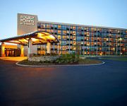
Four Points by Sheraton Philadelphia Northeast
Holiday Inn Express PHILADELPHIA NE - BENSALEM
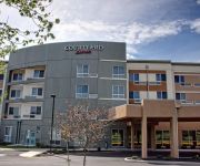
Courtyard Philadelphia Bensalem
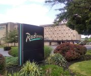
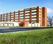
Radisson Hotel Philadelphia Northeast
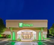
Holiday Inn BENSALEM-PHILADELPHIA AREA
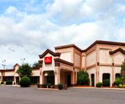
RAMADA PHILADELPHIA NE
BEST WESTERN PLUS PHILADELPHIA BENSALEM
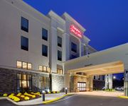
Hampton Inn - Suites Philadelphia-Bensalem
Lincoln Motel
Garden State Inn
Videos from this area
These are videos related to the place based on their proximity to this place.
Philadelphia Liberty Bell Glass Christmas Ornament
Available at http://www.NYCwebStore.com Philadelphia Liberty Bell Ornaments Whether a native or just a fond visitor of Philadelphia, these hand-painted renditions of the famous Philadelphia's...
Skyrim (RP/Modded) - Episode 7: Journey to Windhelm
If you like my videos click here to subscribe: http://bit.ly/GM7GzV My full Skyrim Series 1 playlist: http://bit.ly/19xHPJ0 ------------------------------------------------------------------------...
Skyrim (RP/Modded) - S2E08: An Unpleasant Journey to Whiterun
If you like my videos click here to subscribe: http://bit.ly/GM7GzV My full Skyrim Series 2 playlist: http://bit.ly/ID36Fm Mod List: http://bit.ly/1ghJp4Q -----------------------------------------...
Inbound SEPTA R7 regional rail at Torresdale station
Inbound SEPTA regional rail train from Trenton to Center City Philadelphia as it arrives at SEPTA's Torresdale station. Streamed by John McGready. More at http://qik.com/jmcgready Help us...
2008 Chrysler Town & Country Used Cars Philadelphia PA
http://www.eugensauto.com This 2008 Chrysler Town & Country is available from Eugen's Auto Sales. For details, call us at 215-543-9603.
Mt Airy Church
This video was taken with a Sony HX300__ hand held. It is depicting a pretty country church and some wetlands where beavers were spotted.
Fishin Philly Episode 1 - Fishing Tips and Spots in Philadelphia
This is the first episode of Fishin Philly, an online fishing show that highlights fishing spots around philadelphia and the surrounding areas. In this episode were fishing in Poquessing Creek...
01/18/2011 - Snowfall - Northeast Philadelphia - Morrell Park
Wet snowfall (it almost sounds like rain). Recorded just past midnight on Tuesday, 01/18/2011 Shot with a Sanyo Xacti VPC-CG10 Help us caption & translate this video! http://amara.org/v/CGmM/
Happy St. Paddy's Day from Andalusia, PA.
The Andalusian ospreys are back in 2015 for another action-packed spring and summer on the #DelawareRiver, arriving just in time—as always—to help celebrate St. Patrick's Day with joy and...
Nie boi pan się o swoje bezpieczeństwo? (do Krzysztofa Wyszkowskiego)
Spotkanie w Domu Polskim przy Academy Rd w sobotę 4 maja 2013 r., zorganizowane przez Klub Gazety Polskiej w Filadelfii.
Videos provided by Youtube are under the copyright of their owners.
Attractions and noteworthy things
Distances are based on the centre of the city/town and sightseeing location. This list contains brief abstracts about monuments, holiday activities, national parcs, museums, organisations and more from the area as well as interesting facts about the region itself. Where available, you'll find the corresponding homepage. Otherwise the related wikipedia article.
Holy Family University
Holy Family University is a Roman Catholic liberal arts university in Philadelphia, Pennsylvania. It was founded in 1954 by the Congregation of the Sisters of the Holy Family of Nazareth. In addition to the main Torresdale campus, there are satellite locations in Newtown, on Bristol Pike in Bensalem, and in Quakertown. In 2012, there were nearly 3,100 students enrolled in the university.
Academy Gardens, Philadelphia
Academy Gardens is a neighborhood located in the The Northeast section of Philadelphia, Pennsylvania, United States. It is located on the eastern side of the Far Northeast. Its approximate boundaries are Pennypack Park, Grant Avenue, the John F. Byrne Golf Course, and Holme Avenue. Originally farm land, it was part of the holdings of Thomas Holme, surveyor for Pennsylvania's founder, William Penn.
Morrell Park, Philadelphia
Morrell Park is a neighborhood located in the Northeast section of Philadelphia, Pennsylvania, United States. It is located on the eastern side of the Far Northeast, north of Grant Avenue and east of Northeast Philadelphia Airport.
Byberry Creek
Byberry Creek is a 6.0-mile-long tributary of Poquessing Creek in northeastern Philadelphia, Pennsylvania in the United States. Byberry Creek is formed from two branches that flow through Northeast Philadelphia, Wilsons Run and Waltons Run. Waltons Run, the western stream, flows across land of the Northeast Philadelphia Airport. Wilsons Run, the eastern stream, is sometimes considered a continuation of the main stream Byberry Creek.
Crestmont Farms, Philadelphia
Crestmont Farms is an affluent small residential neighborhood in the Northeast section of Philadelphia, Pennsylvania. It is located along the Bucks County line, at Poquessing Creek, east of Knights Road. The housing consists of single homes. According to an ad in the Evening Bulletin, June 19, 1926, Crestmont Farms was originally a 40-acre farm that was divided into 70 single home sites. Thomas R. Coale (spelling?) was the developer and president of the Crestmont Farms Improvement Company.
Andalusia, Pennsylvania
Andalusia is a historic neighborhood in Bensalem Township, Bucks County, Pennsylvania, bordering Philadelphia. The ZIP code is 19020. The area is the southernmost part of the township and of the county. Its boundaries are: Woodhaven Road (Pennsylvania Route 63) to the northeast, the Delaware River to the east and south, and Poquessing Creek to the north and west. Interstate 95, known locally as "I-95", runs through its southeastern section near the Delaware River.
Delaware Township, Philadelphia County, Pennsylvania
Delaware Township is a defunct township that was located in Philadelphia County, Pennsylvania. The borough ceased to exist and was incorporated into the City of Philadelphia following the passage of the Act of Consolidation, 1854.
Archbishop Ryan High School
Archbishop Ryan High School (often called Archbishop Ryan or simply Ryan) is a Roman Catholic high school located in Philadelphia, Pennsylvania, USA. Archbishop Ryan is the largest Catholic secondary school in the city of Philadelphia.
Nazareth Academy High School
Nazareth Academy High School is a private, Roman Catholic high school in Philadelphia, Pennsylvania. It is located in the Roman Catholic Archdiocese of Philadelphia.
Modena Park, Philadelphia
Modena Park[edit] is a neighborhood in Northeast Philadelphia. It is located east of Northeast Philadelphia Airport at Morrell Avenue. The ground was owned by the estate of William Dudley in 1910. The neighborhood was built around 1960-1963, and features short blocks of two story rowhouses with basements. This neighborhood borders Morrell Park, Philadelphia, Pennsylvania to its south. Parkwood, Philadelphia, Pennsylvania to its north.
The Arts Academy at Benjamin Rush
The Arts Academy at Benjamin Rush (also known as Benjamin Rush, Rush Arts, or simply Rush) is a public, magnet high school located in Philadelphia, Pennsylvania. Rush Arts is known for placing its focus on both academia and the visual/performing arts, as well as encouraging creativity and the development of strong critical thinking skills.


