Safety Score: 2,7 of 5.0 based on data from 9 authorites. Meaning we advice caution when travelling to United States.
Travel warnings are updated daily. Source: Travel Warning United States. Last Update: 2024-04-26 08:02:42
Delve into Oaklane
Oaklane in Montgomery County (Pennsylvania) is located in United States about 130 mi (or 209 km) north-east of Washington DC, the country's capital town.
Current time in Oaklane is now 03:06 AM (Saturday). The local timezone is named America / New York with an UTC offset of -4 hours. We know of 10 airports close to Oaklane, of which 3 are larger airports. The closest airport in United States is Philadelphia International Airport in a distance of 14 mi (or 23 km), South-West. Besides the airports, there are other travel options available (check left side).
There are two Unesco world heritage sites nearby. The closest heritage site in United States is Independence Hall in a distance of 16 mi (or 26 km), South-East. Also, if you like playing golf, there are some options within driving distance. We encountered 3 points of interest near this location. If you need a hotel, we compiled a list of available hotels close to the map centre further down the page.
While being here, you might want to pay a visit to some of the following locations: Philadelphia, Camden, Woodbury, Norristown and Doylestown. To further explore this place, just scroll down and browse the available info.
Local weather forecast
Todays Local Weather Conditions & Forecast: 16°C / 61 °F
| Morning Temperature | 7°C / 45 °F |
| Evening Temperature | 12°C / 54 °F |
| Night Temperature | 10°C / 49 °F |
| Chance of rainfall | 2% |
| Air Humidity | 27% |
| Air Pressure | 1032 hPa |
| Wind Speed | Gentle Breeze with 8 km/h (5 mph) from North-East |
| Cloud Conditions | Overcast clouds, covering 100% of sky |
| General Conditions | Light rain |
Saturday, 27th of April 2024
18°C (64 °F)
17°C (63 °F)
Moderate rain, gentle breeze, broken clouds.
Sunday, 28th of April 2024
24°C (76 °F)
20°C (68 °F)
Moderate rain, light breeze, few clouds.
Monday, 29th of April 2024
15°C (60 °F)
18°C (64 °F)
Light rain, light breeze, overcast clouds.
Hotels and Places to Stay
CHESTNUT HILL HOTEL
Wm. Mulherin's Sons Hotel
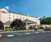
Hilton Garden Inn Philadelphia-Ft Washington
Holiday Inn Express & Suites FT. WASHINGTON - PHILADELPHIA
BEST WESTERN FORT WASHINGTON INN
DAYS INN PHILADELPHIA
ROOSEVELT INN
THE CONWELL INN
Videos from this area
These are videos related to the place based on their proximity to this place.
2009 Chrysler Town & Country Used Cars Philadelphia PA
http://www.tristateautoinc.com This 2009 Chrysler Town & Country is available from Tri-State Auto. For details, call us at 215-549-2000.
2007 Chrysler Town & Country Used Cars Philadelphia PA
http://www.tristateautoinc.com This 2007 Chrysler Town & Country is available from Tri-State Auto. For details, call us at 215-549-2000.
2006 Chrysler Town & Country Used Cars Philadelphia PA
http://www.tristateautoinc.com This 2006 Chrysler Town & Country is available from Tri-State Auto. For details, call us at 215-549-2000.
2007 Chrysler Town & Country Used Cars Philadelphia PA
http://www.tristateautoinc.com This 2007 Chrysler Town & Country is available from Tri-State Auto. For details, call us at 215-549-2000.
SEPTA AEM7-Push-Pull pre-peak hour inbound deadhead 8/16/12
SEPTA Push -Pull set being leaded by AEM7 #2305 deadheading inbound to Center City before peak hour. Watch as this train makes an unscheduled stop at Fern Rock Station.
Regional Rail at Fern Rock Transportation Center 1/20/11 - SEPTA Action Series
SEPTA Regional Rail Action at Fern Rock Transportation Center, with a SEPTA Subway Bonus toward the end (Not the last clip, you gotta watch the whole video chumps) Features Silverliner IVs,...
Videos provided by Youtube are under the copyright of their owners.
Attractions and noteworthy things
Distances are based on the centre of the city/town and sightseeing location. This list contains brief abstracts about monuments, holiday activities, national parcs, museums, organisations and more from the area as well as interesting facts about the region itself. Where available, you'll find the corresponding homepage. Otherwise the related wikipedia article.
Olney, Philadelphia
Olney is a neighborhood in the Northwest Philadelphia section of Philadelphia, Pennsylvania, United States. It is roughly bounded by Fisher Avenue to the south, Tacony Creek to the east, Godfrey Avenue to the north, and the railroad right-of-way west of Sixth Street to the west. Although Olney is primarily a quiet residential neighborhood, portions do serve as major commercial centers for many surrounding groups.
Melrose Park (SEPTA station)
Melrose Park station is a SEPTA Regional Rail station located along the SEPTA Main Line operated by the Southeastern Pennsylvania Transportation Authority. Originally known as Oak Park Station, Melrose Park is located in at the intersection of Valley Road and Mill Road in the neighborhood of Melrose Park in Cheltenham Township, Montgomery County, Pennsylvania.
East Oak Lane, Philadelphia
East Oak Lane is a neighborhood at the northern end of the North Philadelphia planning district of Philadelphia, Pennsylvania, United States. Many of the houses in the neighborhood are large single homes or twins built at a later period than much of central North Philadelphia. There is also a fair share of typical Philadelphia rowhouses. This area of Philadelphia was first settled in 1683 as William Penn's first neighborhood. In the late 19th century, this area was considered a resort.
Fern Rock Transportation Center
The Fern Rock Transportation Center is a SEPTA rail and bus transportation center located at 10th Street and Nedro Avenue in the Fern Rock neighborhood of Philadelphia, Pennsylvania. Fern Rock serves as the northern terminus and yard for SEPTA's Broad Street Line, as well as a stop for the Lansdale/Doylestown, Warminster, and West Trenton SEPTA Regional Rail Lines. Four SEPTA bus lines also serve Fern Rock Transportation Center.
Lawndale (SEPTA station)
Lawndale is a station located along SEPTA's Fox Chase Line. It is located at Robbins and Newtown Avenues and serves the Lawndale neighborhood of Northeast Philadelphia. The station has a small shelter and has no parking lot. In 2005, SEPTA segregated the freight and passenger tracks that run parallel from Newtown Junction to just south of Cheltenham. Passengers may now only board from the west side platform.
Gratz College
Gratz College is a general college of Jewish studies founded in 1895 offering a broad array of credentials and programs in virtually every area of higher Judaic learning to aspiring Jewish educators, communal professionals, lay people and others seeking to become more knowledgeable of Judaism.
Cardinal Dougherty High School
Cardinal Dougherty High School was a private, Roman Catholic high school in Philadelphia, Pennsylvania. It was located in the Roman Catholic Archdiocese of Philadelphia. At the time of its closing, it was the only Archdiocesan high school to offer Intensive Scheduling, a medical careers health academy curriculum HOSA, and a Catholic school teachers academy program.
National Register of Historic Places listings in North Philadelphia
This is a list of the National Register of Historic Places listings in North Philadelphia. This is intended to be a complete list of the properties and districts on the National Register of Historic Places in North Philadelphia, Pennsylvania, United States. The locations of National Register properties and districts for which the latitude and longitude coordinates are included below, may be seen in a Google map.


