Safety Score: 2,7 of 5.0 based on data from 9 authorites. Meaning we advice caution when travelling to United States.
Travel warnings are updated daily. Source: Travel Warning United States. Last Update: 2024-05-02 08:23:34
Delve into Round Top
Round Top in Adams County (Pennsylvania) is a city located in United States about 63 mi (or 102 km) north of Washington DC, the country's capital town.
Current time in Round Top is now 04:26 AM (Thursday). The local timezone is named America / New York with an UTC offset of -4 hours. We know of 8 airports closer to Round Top, of which 3 are larger airports. The closest airport in United States is Hagerstown Regional Richard A Henson Field in a distance of 27 mi (or 44 km), West. Besides the airports, there are other travel options available (check left side).
Also, if you like playing golf, there are some options within driving distance. In need of a room? We compiled a list of available hotels close to the map centre further down the page.
Since you are here already, you might want to pay a visit to some of the following locations: Gettysburg, Westminster, Carlisle, Frederick and Chambersburg. To further explore this place, just scroll down and browse the available info.
Local weather forecast
Todays Local Weather Conditions & Forecast: 25°C / 77 °F
| Morning Temperature | 15°C / 59 °F |
| Evening Temperature | 22°C / 72 °F |
| Night Temperature | 16°C / 62 °F |
| Chance of rainfall | 0% |
| Air Humidity | 47% |
| Air Pressure | 1015 hPa |
| Wind Speed | Gentle Breeze with 8 km/h (5 mph) from South-East |
| Cloud Conditions | Few clouds, covering 10% of sky |
| General Conditions | Sky is clear |
Thursday, 2nd of May 2024
21°C (70 °F)
12°C (53 °F)
Light rain, moderate breeze, overcast clouds.
Friday, 3rd of May 2024
11°C (51 °F)
10°C (50 °F)
Light rain, gentle breeze, overcast clouds.
Saturday, 4th of May 2024
11°C (52 °F)
11°C (52 °F)
Moderate rain, light breeze, overcast clouds.
Hotels and Places to Stay
PA Gettysburg Country Inn and Suites by Radisson
Aspire Gettysburg Hotel
Hilton Garden Inn Gettysburg
EISENHOWER HOTEL GE
Battlefield Bed & Breakfast Inn
The Swope Manor Bed & Breakfast
GETTYSBURG HOTEL EST 1797
Historic Farnsworth House Inn
1863 INN OF GETTYSBURG
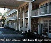
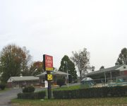
Red Carpet Inn
Videos from this area
These are videos related to the place based on their proximity to this place.
Visiting Gettysburg With Your Whole Family
How to visit Gettysburg with the whole family - see Gettysburg National Military Park, Visitor Center, gift shop and the town itself. Civil War reenactors enjoy it and there is something here...
The Angle of Gettysburg Battlefield
I am at "The Angle", where Confederate's Northern Virginia Army (aka. Pickett's Charge or Longstreet's March) temporarily penetrated the Union defense line, but was later driven back by Union's...
Demolition of Civil War battlefield tower in Gettysburg, PA - July 2000
I just stumbled across this video, which I shot on July 3, 2000 (the 135 year anniversary of the battle). The great Civil War battlefield in Gettysburg had a huge observation tower that was...
The High Water Mark, Gettysburg, Pennsylvannia
The High Water Mark, Gettysburg, was the Union defensive position on Cemetery Ridge which took the full force of Picketts Charge on 3rd July 1863. At this spot the Confederates soldiers briefly...
Living History in Gettysburg, the Confederates
We met up with the 13th New Jersey who were portraying the 1st Texas. It took them several months to prepare for this Living History encampment, doing research and obtaining the materials and...
Gettysburg Battlefield from Culps Hill
The view from the watchtower on Culps Hill showing clearly the massive scale of the Gettysburg Battlefield. Please take a look at Video History Today http://www.videohistorytoday.com , the...
Picketts Charge Gettysburg
A walk along the Picketts Charge Trail on the Gettysburg Battlefield, Pennsylvania. Please take a look at Video History Today http://www.videohistorytoday.com , the first web site to offer...
Gettysburg Battlefield - Canons - Views from the Gettysburg National Tower
A few scenes from a trip to Gettysburg National Military Park Sights and sounds from the Gettysburg National Tower built in 1974 and demolished in 2000, stood over 300 feet high. Canon...
Tripwire Social Video 1- Explosives
We are First Responders dedicated to First Responders. We believe the most highly trained create a safer America. We prepare military and first responders to protect our country by providing...
Videos provided by Youtube are under the copyright of their owners.
Attractions and noteworthy things
Distances are based on the centre of the city/town and sightseeing location. This list contains brief abstracts about monuments, holiday activities, national parcs, museums, organisations and more from the area as well as interesting facts about the region itself. Where available, you'll find the corresponding homepage. Otherwise the related wikipedia article.
Battle of Gettysburg
The Battle of Gettysburg, was fought July 1–3, 1863, in and around the town of Gettysburg, Pennsylvania. It was the battle with the largest number of casualties in the American Civil War and is often described as the war's turning point. Union Maj. Gen. George Gordon Meade's Army of the Potomac defeated attacks by Confederate Gen. Robert E. Lee's Army of Northern Virginia, ending Lee's invasion of the North.
Pickett's Charge
Main article: Battle of Gettysburg Further information: Gettysburg Battlefield, Confederate order of battle, and Union order of battle Pickett's Charge was an infantry assault ordered by Confederate Gen. Robert E. Lee against Maj. Gen. George G. Meade's Union positions on Cemetery Ridge on July 3, 1863, the last day of the Battle of Gettysburg during the American Civil War. Its futility was predicted by the charge's commander, Lt. Gen.
Little Round Top
Little Round Top is the smaller of two rocky hills south of Gettysburg, Pennsylvania—the companion to the adjacent, taller hill named Big Big] Round Top. It was the site of an unsuccessful assault by Confederate troops against the Union left flank on July 2, 1863, the second day of the Battle of Gettysburg. Considered by some historians to be the key point in the Union Army's defensive line that day, Little Round Top was defended successfully by the brigade of Col. Strong Vincent.
Devil's Den
Devils Den is a boulder-strewn Gettysburg Battlefield hill used by artillery and infantry (e.g. , snipers) during the 1863 Battle of Gettysburg, Second Day. A since the memorial association era, several boulders are worn from foot traffic and the site includes numerous cannon, memorials, and walkways, including a bridge spanning 2 boulders.
Battle of Gettysburg, Second Day
Further information: Gettysburg Battlefield, Confederate order of battle, and Union order of battle During the Second Day of the Battle of Gettysburg (July 2, 1863) Confederate Gen. Robert E. Lee attempted to capitalize on his first day's success. He launched the Army of Northern Virginia in multiple attacks on the flanks of the Union Army of the Potomac, commanded by Maj. Gen. George G. Meade.
114th Pennsylvania Infantry
The 114th Pennsylvania Volunteer Infantry Regiment was an infantry regiment that served in the Union Army during the American Civil War. They were very famous for their colorful americanized zouave dress which consisted of: a dark blue zouave jacket with sky blue cuffs and red trimmings and tombeux, a sky blue sash, madder red trousers, white gaiters, leather jamberies, and a red zouave fez with a yellow tassel that was often worn with a white turban.
Wheatfield Road
The Wheatfield Road is a Gettysburg Battlefield crossroad from the Peach Orchard east-southeastward along the north side of The Wheatfield (on the Peach Orchard-Devil's Den ridge), north of the Valley of Death, and over the north foot of Little Round Top. In addition to modern tourist use, the road is notable for Battle of Gettysburg use and postbellum trolley use associated with the 1892-1896 US v. Gettysburg Electric Ry. case of the US Supreme Court.
44th New York Monument
The 44th and 12th New York Infantry Monument http://www. hmdb. org/marker. asp?marker=15048 is a Gettysburg Battlefield memorial erected near the summit of Little Round Top to commemorate combat in the Battle of Little Round Top. The castellated building is the largest monument to a regiment on the battlefield,http://www. gettysburg. stonesentinels. com/NY/44NY.


