Safety Score: 2,7 of 5.0 based on data from 9 authorites. Meaning we advice caution when travelling to United States.
Travel warnings are updated daily. Source: Travel Warning United States. Last Update: 2024-04-28 08:22:10
Delve into Mount Vernon
Mount Vernon in Warren County (New Jersey) is located in United States about 180 mi (or 289 km) north-east of Washington DC, the country's capital town.
Current time in Mount Vernon is now 07:19 AM (Sunday). The local timezone is named America / New York with an UTC offset of -4 hours. We know of 10 airports close to Mount Vernon, of which 4 are larger airports. The closest airport in United States is Lehigh Valley International Airport in a distance of 32 mi (or 51 km), South-West. Besides the airports, there are other travel options available (check left side).
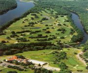
There are two Unesco world heritage sites nearby. The closest heritage site in United States is Statue of Liberty in a distance of 60 mi (or 97 km), East. Also, if you like playing golf, there are some options within driving distance. If you need a hotel, we compiled a list of available hotels close to the map centre further down the page.
While being here, you might want to pay a visit to some of the following locations: Belvidere, Newton, Easton, Milford and Flemington. To further explore this place, just scroll down and browse the available info.
Local weather forecast
Todays Local Weather Conditions & Forecast: 21°C / 70 °F
| Morning Temperature | 8°C / 47 °F |
| Evening Temperature | 23°C / 73 °F |
| Night Temperature | 16°C / 61 °F |
| Chance of rainfall | 3% |
| Air Humidity | 70% |
| Air Pressure | 1020 hPa |
| Wind Speed | Gentle Breeze with 6 km/h (4 mph) from East |
| Cloud Conditions | Overcast clouds, covering 92% of sky |
| General Conditions | Light rain |
Sunday, 28th of April 2024
26°C (79 °F)
17°C (63 °F)
Light rain, gentle breeze, clear sky.
Monday, 29th of April 2024
17°C (62 °F)
13°C (55 °F)
Moderate rain, light breeze, overcast clouds.
Tuesday, 30th of April 2024
20°C (68 °F)
13°C (56 °F)
Broken clouds, light breeze.
Hotels and Places to Stay
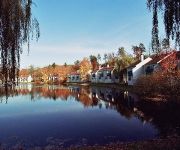
Fernwood Resort
FERNWOOD HOTEL AND RESORT
VALUE INN EAST STRO
Shawnee Inn And Golf Resort
Videos from this area
These are videos related to the place based on their proximity to this place.
THE PAULINSKILL VIADUCT Knowlton, NJ (Axis Video/Pine Barren Films)
PAULINSKILL VIADUCT: This was an impressively large structure built in 1908-1910. It took a minute to find a spot to climb to get to the top of this beast and we all slipped several times,...
Medivac Helicopter on Route 80.
This was back in 2004 when i was in NJ. I was riding my SV650S on route 80 east bound in western NJ when I came upon a huge traffic jam. I scooted between the cars and this was why. A Medivac...
Glider ride at Blairstown, New Jersey
Full footage of a glider ride from Blairstown Airport, New Jersey. The film is sped up only until we are in the cockpit, the rest is the actual speed of glider. I also didn't have the correct...
Blairstown (1N7)
Landing a Cessna 172P on runway 7 at Blairstown (1N7). Had to roll it all the way to the end of the runway because of the nose wheel shimmy. Nice little airport!
Blairstown Environmental Commission Clean Up Day - Oct 2011
On October 1, the Blairstown Environmental Commission organized volunteers to conduct a clean up operation along Route 94 between the Village center and the Lambert Road. The stalwart volunteer ...
Blairstown, New Jersey Fireworks - 2010
Fireworks on the grounds of North Warren RegionalMiddle - High School on the 4th of July. Many towns canceled their's this year, not ours :)
Blairstown Weekend Update Trailer
A preview of the upcoming exclusive Weekend Update from Blairstown, NJ featuring Pete McKenna, Patty Palin and Dirk Herrmann... with special guests: Mayor Steve Lance and Deputy Mayor Sal ...
Coppermines - Rattlesnake Swamp - njHiking.com
For hike info visit: http://www.njhiking.com/nj-hikes-coppermines-rattlesnake-swamp/. Big loop through the Delaware Water Gap that combines the Coppermines Trail, Appalachian Trail, and the...
Videos provided by Youtube are under the copyright of their owners.
Attractions and noteworthy things
Distances are based on the centre of the city/town and sightseeing location. This list contains brief abstracts about monuments, holiday activities, national parcs, museums, organisations and more from the area as well as interesting facts about the region itself. Where available, you'll find the corresponding homepage. Otherwise the related wikipedia article.
Blairstown, New Jersey
Blairstown is a township in Warren County, New Jersey, United States. As of the 2010 United States Census, the township's population was 5,967 reflecting an increase of 220 (+3.8%) from the 5,747 counted in the 2000 Census, which had in turn increased by 416 (+7.8%) from the 5,331 counted in the 1990 Census.
Tocks Island Dam Controversy
A 1950s proposal to construct a dam near Tocks Island across the Delaware River was met with considerable controversy and protest. Tocks Island is an island located in Delaware River a short distance north from Delaware Water Gap to control damaging flooding and provide clean water to supply New York City and Philadelphia, the U.S. Army Corps of Engineers proposed building a dam.
Worthington State Forest
Worthington State Forest is a state forest located within the Delaware Water Gap National Recreation Area, just above the water gap, in Warren County, New Jersey. It covers an area of 6,421 acres and stretches for more than seven miles along the Kittatinny Ridge near Columbia. The park offers hiking, camping (including a hike-in, primitive area) and canoeing and kayaking on the Delaware.
North Warren Regional High School
North Warren Regional High School is a public high school and regional school district, serving students in grades 7-12 in the townships of Blairstown, Frelinghuysen, Hardwick, and Knowlton. The school is located in Blairstown Township. The school opened in September 1970, replacing the former Blairstown High School. The school has been accredited by the Middle States Association of Colleges and Schools Commission on Secondary Schools since 1984.
Blairstown Airport
Blairstown Airport is a public-use airport located two nautical miles (3.7 km) southwest of the central business district of Blairstown, Warren County, New Jersey, United States. It is privately owned by J.D. Air Inc. Blairstown is located in the Lehigh Valley, 5 miles from the Delaware Water Gap and 65 miles from New York City. A gliding operator, Yards Creek Soaring, is located on the field.
Sunfish Pond
Sunfish Pond is a 44-acre glacial lake surrounded by a 258-acre hardwood forest located on the Kittatinny Ridge within Worthington State Forest, adjacent to the Delaware Water Gap National Recreation Area in Warren County, New Jersey. The Appalachian Trail runs alongside the western and northern edges of the pond. It was created by the Wisconsin Glacier during the last ice age. The pond was declared a National Natural Landmark in January 1970.
Hainesburg, New Jersey
Hainesburg is a hamlet and a census designated area (CDP) in Knowlton Township, New Jersey, Warren County, New Jersey, eastern United States.
Tocks Island
Tocks Island is a small island located a short distance north of the Delaware Water Gap in the Delaware River between New Jersey and Pennsylvania. It is part of Hardwick Township, in Warren County, New Jersey. The proposed construction of a dam across the Delaware River near the island by the U.S. Army Corps of Engineers caused a major environmental controversy and protests over the forced condemnation of personal property that spanned over 25 years.


