Safety Score: 2,7 of 5.0 based on data from 9 authorites. Meaning we advice caution when travelling to United States.
Travel warnings are updated daily. Source: Travel Warning United States. Last Update: 2024-04-29 08:03:39
Touring Alliance
Alliance in Salem County (New Jersey) is a town located in United States about 113 mi (or 181 km) north-east of Washington DC, the country's capital place.
Time in Alliance is now 11:33 AM (Monday). The local timezone is named America / New York with an UTC offset of -4 hours. We know of 10 airports nearby Alliance, of which 3 are larger airports. The closest airport in United States is Philadelphia International Airport in a distance of 26 mi (or 41 km), North. Besides the airports, there are other travel options available (check left side).
There are two Unesco world heritage sites nearby. The closest heritage site in United States is Independence Hall in a distance of 32 mi (or 52 km), North-East. Also, if you like the game of golf, there are several options within driving distance. Need some hints on where to stay? We compiled a list of available hotels close to the map centre further down the page.
Being here already, you might want to pay a visit to some of the following locations: Bridgeton, Woodbury, Mays Landing, Salem and Camden. To further explore this place, just scroll down and browse the available info.
Local weather forecast
Todays Local Weather Conditions & Forecast: 28°C / 82 °F
| Morning Temperature | 15°C / 59 °F |
| Evening Temperature | 25°C / 77 °F |
| Night Temperature | 19°C / 67 °F |
| Chance of rainfall | 0% |
| Air Humidity | 50% |
| Air Pressure | 1016 hPa |
| Wind Speed | Gentle Breeze with 6 km/h (3 mph) from North |
| Cloud Conditions | Scattered clouds, covering 47% of sky |
| General Conditions | Scattered clouds |
Monday, 29th of April 2024
26°C (79 °F)
19°C (66 °F)
Broken clouds, moderate breeze.
Tuesday, 30th of April 2024
24°C (75 °F)
12°C (53 °F)
Moderate rain, gentle breeze, overcast clouds.
Wednesday, 1st of May 2024
19°C (67 °F)
11°C (53 °F)
Sky is clear, gentle breeze, clear sky.
Hotels and Places to Stay
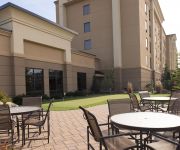
Hampton Inn and Suites - Vineland NJ
Holiday Inn Express & Suites VINELAND MILLVILLE
Rodeway Inn Vineland
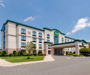
Quality Inn Vineland - Millville
WINGATE BY WYNDHAM VINELAND
DAYS INN VINELAND
Videos from this area
These are videos related to the place based on their proximity to this place.
Brent and Starr's Wedding (HD)
This wedding highlight video was made from the extended wedding movie that was produced by Micarelli Productions on September 4, 2010. Starr and Brent Cole are the joyful couple that exchanged...
Basement Waterproofing - Cheap jobs get Expensive
Another Basement Waterproofing System that Failed and caused a $28000. Foundation Repair job. Forgive me the redundancy but you need to know what I find on each Basement Waterproofing ...
Climbing with friends... Norma
Arrampicata sportiva a Norma, (LT). Via "Spigolo del congedo" (6A) zona "Placche Rosse"
509 UPPER NECK RD, PITTSGROVE, NJ Presented by Nancy Kowalik.
Click to see more: http://www.searchallproperties.com/listings/1995987/509--UPPER-NECK-RD-PITTSGROVE-NJ/auto?reqpage=video 509 UPPER NECK RD PITTSGROVE, NJ 0...
Videos provided by Youtube are under the copyright of their owners.
Attractions and noteworthy things
Distances are based on the centre of the city/town and sightseeing location. This list contains brief abstracts about monuments, holiday activities, national parcs, museums, organisations and more from the area as well as interesting facts about the region itself. Where available, you'll find the corresponding homepage. Otherwise the related wikipedia article.
Pittsgrove Township, New Jersey
Pittsgrove Township is a township in Salem County, New Jersey, United States. As of the 2010 United States Census, the township's population was 9,393, reflecting an increase of 500 (+5.6%) from the 8,893 counted in the 2000 Census, which had in turn increased by 772 (+9.5%) from the 8,121 counted in the 1990 Census.
Palace of Depression
The Palace of Depression was a building made of junk that was located in Vineland, New Jersey. Built by the eccentric and mustachioed George Daynor, a former Alaska gold miner who lost his fortune in the Wall Street Crash of 1929. This amusement was known as "The Strangest House in the World" and the "Home of Junk" and was built as a testament of willpower against the effects of The Great Depression.
Alliance Colony
The Alliance Colony was a Jewish agricultural community that was founded in Alliance, New Jersey on May 10, 1882. It was named after the Alliance Israélite Universelle of Paris and was funded by the Hebrew Immigrant Aid Society of New York and Philadelphia. and The Baron De Hirsch Fund.
WMIZ
WMIZ is a radio station broadcasting a Spanish Tropical format. Licensed to Vineland, New Jersey, USA. The station is currently owned by Clear Communications, Inc..
WVLT (FM)
WVLT (92.1 FM, "Cruisin' 92.1") is a radio station licensed to Vineland, New Jersey. The station is owned by Clear Communications, Inc. (not to be confused with Clear Channel Communications, Inc. ) It airs an Oldies music format. This station had the call letters WKQV and WKQV-FM in the late 1970s and early 1980s. Call letters were changed to WVLT on August 15, 1986.
Deerfield Township School District
The Deerfield Township School District is a community public school district that serves students in Kindergarten through 8th grade from Deerfield Township, in Cumberland County, New Jersey, United States. As of the 2007-08 school year, the district's one school had an enrollment of 339 students and 30.2 classroom teachers (on an FTE basis), for a student–teacher ratio of 11.2.
Centreville Township, New Jersey
Centreville Township was a township that existed from 1822 to 1829 in Salem County, New Jersey, United States. The township was incorporated by an Act of the New Jersey Legislature on March 4, 1822, from portions of Pittsgrove Township. Just short of its seventh anniversary, the township was dissolved and its territory restored to Pittsgrove Township from whence it came.
Brotmanville, New Jersey
Brotmanville is an unincorporated community within Pittsgrove Township, New Jersey. Exit 35 on Route 55 provides access to Brotmanville. The community of Brotmanville was originally a Jewish settlement and is currently a predominantly African American neighborhood.


