Safety Score: 2,7 of 5.0 based on data from 9 authorites. Meaning we advice caution when travelling to United States.
Travel warnings are updated daily. Source: Travel Warning United States. Last Update: 2024-05-14 08:25:02
Delve into Lanesville
Lanesville in Litchfield County (Connecticut) is a city located in United States about 264 mi (or 425 km) north-east of Washington DC, the country's capital town.
Current time in Lanesville is now 01:01 AM (Wednesday). The local timezone is named America / New York with an UTC offset of -4 hours. We know of 10 airports closer to Lanesville, of which 4 are larger airports. The closest airport in United States is Dutchess County Airport in a distance of 25 mi (or 40 km), West. Besides the airports, there are other travel options available (check left side).
There are two Unesco world heritage sites nearby. The closest heritage site in United States is Statue of Liberty in a distance of 65 mi (or 104 km), South-West. Also, if you like playing golf, there are some options within driving distance. In need of a room? We compiled a list of available hotels close to the map centre further down the page.
Since you are here already, you might want to pay a visit to some of the following locations: Carmel, Poughkeepsie, White Plains, New City and Kingston. To further explore this place, just scroll down and browse the available info.
Local weather forecast
Todays Local Weather Conditions & Forecast: 19°C / 66 °F
| Morning Temperature | 14°C / 58 °F |
| Evening Temperature | 17°C / 62 °F |
| Night Temperature | 14°C / 56 °F |
| Chance of rainfall | 1% |
| Air Humidity | 72% |
| Air Pressure | 1012 hPa |
| Wind Speed | Gentle Breeze with 6 km/h (4 mph) from North-West |
| Cloud Conditions | Overcast clouds, covering 100% of sky |
| General Conditions | Light rain |
Wednesday, 15th of May 2024
14°C (56 °F)
14°C (56 °F)
Moderate rain, moderate breeze, overcast clouds.
Thursday, 16th of May 2024
20°C (69 °F)
12°C (54 °F)
Broken clouds, gentle breeze.
Friday, 17th of May 2024
18°C (65 °F)
12°C (53 °F)
Overcast clouds, gentle breeze.
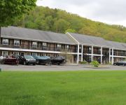
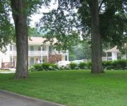
Hotels and Places to Stay
Newbury Inn
Red Carpet Inn New Milford
Twin Tree Inn
Heritage Inn Of Litchfield
HOMESTEAD INN
ROCKY RIVER INN
Videos from this area
These are videos related to the place based on their proximity to this place.
Housatonic River, New Milford CT
A few of my favorite photos of the Housatonic River in New Milford, CT.
deadly dam in new milford,ct
footage of the dangerous hydro feature at the old bleachery dam that some people have proposed changing into a kayak safe play feature http://www.ARTandWATER.com http://www.100waves.com...
Liquid Stone Finishes epoxy concrete resurfacing New Milford CT 860-919-7819
http://www.liquidstonefinishes.com Liquid Stone Finishes of Connecticut provides epoxy coating services for resurfacing concrete and other surfaces such as kitchen countertops and bartops....
CT Roofing Contractor Flying Colors Roofing testimonial New Milford Connecticut Roofer
http://www.flyingcolorsroofing.com Flying Colors Roofing is a family owned and operated business with over 12 years of experience. We are dedicated to providing the highest quality of roofing...
Gentile Tree Service New Milford CT
Gentile Tree Service New Milford CT http://local.ctpost.com/b23837856/Gentile+Tree+Service?type= Tree services, tree care, tree removal, stump grinding, land clearing, storm damage removal,...
New Milford Crash
(WTNH) -- Route 7 in New Milford was closed in both directions Thursday morning due to a car into a pole. Some power went out.
Gentile Tree Care, LLC Big Jobs New Milford CT
Gentile Tree Care, LLC Big Jobs New Milford CT http://local.ctpost.com/b23837856/Gentile+Tree+Care%2C+LLC?type= No job is too big or too small for us here at Gentile Tree Care, LLC. We...
Videos provided by Youtube are under the copyright of their owners.
Attractions and noteworthy things
Distances are based on the centre of the city/town and sightseeing location. This list contains brief abstracts about monuments, holiday activities, national parcs, museums, organisations and more from the area as well as interesting facts about the region itself. Where available, you'll find the corresponding homepage. Otherwise the related wikipedia article.
Candlewood Lake
Candlewood Lake, 8.4 sq mi (21.8 km²), is located in Fairfield and Litchfield counties of western Connecticut, in the northeastern United States. It is the largest lake in Connecticut. The lake is bordered by five towns: Brookfield, Danbury, New Fairfield, New Milford, and Sherman.
WRKI
WRKI is a mainstream rock radio station broadcasting from Brookfield, Connecticut. The station plays classic rock with a few currents as part of the music mix.
WINE (AM)
WINE is a radio station broadcasting a sports format. Licensed to Brookfield, Connecticut, USA, it serves the Danbury area. The station is currently owned by Cumulus Licensing Llc. In the 1970s and early 80s WINE was a Top 40 station. As the audience migrated to the FM band, WINE became a full-service adult contemporary station. In the 90's WINE became part of an all-news network that included WNLK, which both became newstalk a few years later.
Lover's Leap Bridge
Lover's Leap Bridge is a wrought-iron lenticular truss bridge over the Housatonic River located in Lovers Leap State Park in New Milford, Connecticut. It was built in 1895 by the Berlin Iron Bridge Company. Prior to 1977, the bridge was used by both vehicles and pedestrians but is now closed to vehicular traffic after a newer crossing just north of the bridge was constructed. The bridge was listed on the National Register of Historic Places in 1976.
Candlelight Farms Airport
Candlelight Farms Airport, is located in New Milford, Connecticut, United States.


