Safety Score: 3,0 of 5.0 based on data from 9 authorites. Meaning we advice caution when travelling to United Kingdom.
Travel warnings are updated daily. Source: Travel Warning United Kingdom. Last Update: 2024-05-02 08:23:34
Delve into Pettistree
Pettistree in Suffolk (England) is located in United Kingdom about 77 mi (or 124 km) north-east of London, the country's capital town.
Current time in Pettistree is now 01:04 AM (Friday). The local timezone is named Europe / London with an UTC offset of one hour. We know of 9 airports close to Pettistree, of which 3 are larger airports. The closest airport in United Kingdom is RAF Honington in a distance of 28 mi (or 46 km), North-West. Besides the airports, there are other travel options available (check left side).
There are several Unesco world heritage sites nearby. The closest heritage site in United Kingdom is Canterbury Cathedral, St Augustine's Abbey, and St Martin's Church in a distance of 61 mi (or 98 km), South. Also, if you like playing golf, there are some options within driving distance. If you need a hotel, we compiled a list of available hotels close to the map centre further down the page.
While being here, you might want to pay a visit to some of the following locations: Ipswich, Wrentham, Hellington, Rockland Saint Mary and Surlingham. To further explore this place, just scroll down and browse the available info.
Local weather forecast
Todays Local Weather Conditions & Forecast: 10°C / 49 °F
| Morning Temperature | 11°C / 51 °F |
| Evening Temperature | 11°C / 52 °F |
| Night Temperature | 8°C / 47 °F |
| Chance of rainfall | 2% |
| Air Humidity | 93% |
| Air Pressure | 1007 hPa |
| Wind Speed | Fresh Breeze with 13 km/h (8 mph) from North-East |
| Cloud Conditions | Overcast clouds, covering 100% of sky |
| General Conditions | Light rain |
Saturday, 4th of May 2024
13°C (56 °F)
9°C (49 °F)
Scattered clouds, gentle breeze.
Sunday, 5th of May 2024
12°C (53 °F)
9°C (49 °F)
Moderate rain, moderate breeze, overcast clouds.
Monday, 6th of May 2024
10°C (51 °F)
8°C (46 °F)
Moderate rain, moderate breeze, overcast clouds.
Hotels and Places to Stay
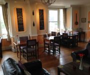
3 Tuns Inn
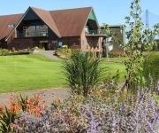
Golf and Sp Ufford Park Hotel
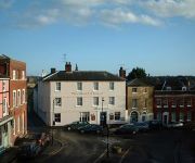
The Bull Hotel Restaurant
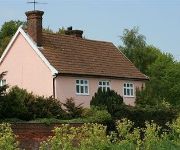
Red House Farm B&B
Videos from this area
These are videos related to the place based on their proximity to this place.
Rendlesham Forest UFO Incident 30th Anniversary Conference in Woodbridge
The event happened at the Woodbridge Community Center. On December 28th 2010. Were present : James Penniston, John Burroughs, Larry Warren, Peter Robbins, Linda Moulton Howe, Nick Pope.
Woodbridge Javelin Track Day - GKD legend follow, BMW E36. October 2014
Trying to follow a GKD Legend in my BMW E36 Coupe.
Woodbridge Javelin Track Day - S2000 follow, BMW E36. October 2014
Woodbridge Javelin Track Day - S2000 follow, BMW E36. October 2014.
Woodbridge Drain Cleaning | Woodbridge Drain Cleaners |Drain Repair
Woodbridge drain cleaning http://goldmedalservice.com/service-a... from Gold Medal Service helps people save money on Woodbridge drain cleaning. We also offer Woodbridge drain cleaning by ...
How To Join Woodbridge Dog Walking Club
Join Woodbridge Dog Training Club - http://www.woodbridgedogwalkingclub.com/contact-us/ Join our regular Woodbridge dog walking group occuring weekly. Covering a range of routes to suit all...
INAUGURAZIONE CENTRO ARDORINO DI WOODBRIDGE
Inaugurazione del Centro Missionario dei Pii OperaiCatechisti Rurali a Woodbridge (Canada). Anno 1998.
RMS Evo 6 RS - Javelin Sprintdays Trophy Woodbridge
On board the RMS Racingard Motor Sports Evo 6 RS rally car at Woodbridge, Suffolk as part of the 2014 Javelin Sprintdays Trophy. For more information on sprinting head over to www.
Woodbridge Javelin Track Day - Mosler follow, BMW E36. October 2014
Woodbridge Javelin Track Day - Mosler follow, BMW E36. October 2014.
Woodbridge Javelin Track Day - 328i - BMW E36 October 2014
Woodbridge Javelin Track Day - 328i - BMW E36 October 2014.
Sutton Hoo Wikipedia travel guide video. Created by Stupeflix.com
Create your own video on http://studio.stupeflix.com/?w=1 ! Sutton Hoo parade helmet (British Museum, restored). Although based on late Roman helmets of spangenhelm type, the immediate ...
Videos provided by Youtube are under the copyright of their owners.
Attractions and noteworthy things
Distances are based on the centre of the city/town and sightseeing location. This list contains brief abstracts about monuments, holiday activities, national parcs, museums, organisations and more from the area as well as interesting facts about the region itself. Where available, you'll find the corresponding homepage. Otherwise the related wikipedia article.
Easton, Suffolk
The former estate village of Easton in England is situated on the River Deben around three miles (5 km) south of Framlingham. Following the end of the World War 1 the British government imposed super taxes on the rich to help defray the cost of the war. Faced with these taxes and with the cost of restoring Easton from it use as a Red Cross Hospital during the war the Duchess of Hamilton and her husband, Lord James Graham decided to sell the estate.
Hacheston Halt railway station
Hacheston Halt railway station was a station located in Hacheston, Suffolk situated on the Framlingham Branch. The branch was opened in 1859, but Hacheston Halt was not opened until the early 1920s in an attempt by the Great Eastern Railway to improve the passenger receipts on the branch. This was a very basic station and did not even possess a platform so passengers had to use a ladder to get on and off the trains that called at the station.
Marlesford
Marlesford is a village and a civil parish in the Suffolk Coastal District, in the English county of Suffolk.
Pettistree
Pettistree is a village and a civil parish in the Suffolk Coastal District, in the English county of Suffolk. Pettistree House is a fine Georgian country manor house set in 13 acres of parkland. The civil parish of Pettistree comprises the manor of Pettistree, the manor of Byng, and the manor of Loudham. Byng Hall is a castellated 16th century manor house. Loudham Hall is a fine Georgian country manor house set in 69 acres.
Hacheston
Hacheston is a village and a civil parish in the Suffolk Coastal District, in the English county of Suffolk. It is located on the B1116 road between the towns of Wickham Market and Framlingham. Hacheston has a church and a village hall; it once had a railway station called Hacheston Halt railway station, but that was closed on 3 Nov 1952. In late July an annual outdoor music festival called Hachfest showcases local talent.
Wickham Market Hoard
The Wickham Market Hoard is a hoard of 840 Iron Age gold staters found in a field at Dallinghoo near Wickham Market, Suffolk, England in March 2008 by car mechanic, Michael Dark using a metal detector. After excavation of the site, a total of 825 coins were found, and by the time the hoard was declared treasure trove, 840 coins had been discovered.
Bromeswell Green
Bromeswell Green is national nature reserve, near Woodbridge in the county of Suffolk, England. Suffolk Wildlife Trust owns and manages this reserve. It is a Site of Special Scientific Interest (SSSI).
Foxburrow Farm
Foxburrow Farm is a reserve owned by the Suffolk Wildlife Trust and is its base for educational activities, such as school visits. For this reason, though a reserve, it is not classed as a County Wildlife Site. It comprises 165 acres (67 hectares).


