Safety Score: 3,0 of 5.0 based on data from 9 authorites. Meaning we advice caution when travelling to United Kingdom.
Travel warnings are updated daily. Source: Travel Warning United Kingdom. Last Update: 2024-04-30 08:30:35
Touring Kettleburgh
Kettleburgh in Suffolk (England) is a town located in United Kingdom about 78 mi (or 125 km) north-east of London, the country's capital place.
Time in Kettleburgh is now 04:37 PM (Tuesday). The local timezone is named Europe / London with an UTC offset of one hour. We know of 10 airports nearby Kettleburgh, of which 4 are larger airports. The closest airport in United Kingdom is RAF Honington in a distance of 25 mi (or 40 km), North-West. Besides the airports, there are other travel options available (check left side).
There are several Unesco world heritage sites nearby. The closest heritage site in United Kingdom is Canterbury Cathedral, St Augustine's Abbey, and St Martin's Church in a distance of 64 mi (or 103 km), South. Also, if you like the game of golf, there are several options within driving distance. Need some hints on where to stay? We compiled a list of available hotels close to the map centre further down the page.
Being here already, you might want to pay a visit to some of the following locations: Ipswich, Hellington, Wrentham, Rockland Saint Mary and Surlingham. To further explore this place, just scroll down and browse the available info.
Local weather forecast
Todays Local Weather Conditions & Forecast: 16°C / 61 °F
| Morning Temperature | 9°C / 49 °F |
| Evening Temperature | 11°C / 53 °F |
| Night Temperature | 11°C / 53 °F |
| Chance of rainfall | 0% |
| Air Humidity | 47% |
| Air Pressure | 1013 hPa |
| Wind Speed | Moderate breeze with 9 km/h (6 mph) from North-West |
| Cloud Conditions | Overcast clouds, covering 99% of sky |
| General Conditions | Light rain |
Wednesday, 1st of May 2024
14°C (57 °F)
10°C (49 °F)
Moderate rain, moderate breeze, overcast clouds.
Thursday, 2nd of May 2024
15°C (59 °F)
12°C (54 °F)
Moderate rain, moderate breeze, overcast clouds.
Friday, 3rd of May 2024
10°C (51 °F)
10°C (50 °F)
Light rain, moderate breeze, overcast clouds.
Hotels and Places to Stay
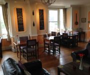
3 Tuns Inn
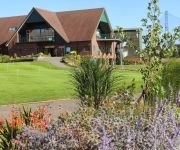
Golf and Sp Ufford Park Hotel
Videos from this area
These are videos related to the place based on their proximity to this place.
Holiday cottage in suffolk dog friendly with pool | Lodge Cottage,Hacheston,Suffolk
Click Here: http://www.holidaycottagesuffolkcoast.co.uk/ Holiday cottage in suffolk Lodge Cottage is a charming and well equipped colonial style thatched holiday cottage in Hacheston, Suffolk....
Eaux Luxury Lifestyle Magazine | Tatty Broyds Shoot | May/June 2015
Eaux Luxury Lifestyle Magazine | Tatty Broyds Shoot | May/June 2015 Suffolk Fashion Editorial Shoot for Tatty Broyds boutique in Hadleigh http://www.eaux.co.uk http://www.rossdeanphotography.com.
Plomesgate CC National Endurance Series 8km Grass Track Race
The Plomesgate CC round of the 2011 National Endurance Series, held at Bredfield, Suffolk. Tony Wilkins stirred things up a bit for the first couple of laps, after which I tried to hold the...
Plomesgate Cycling Club Grass Track - 800 metre handicap final
Fifth behind Tony Wilkins, after winning my heat. Not a good start, and I couldn't quite get it back together in time.
Putting down our first Hangi
Step by step account of cooking our first Hangi. Next time we are going for more stones and less veg! The meat cooked great but all those veg were a little too crispy!
Nestles Rowing Club - Holden Homeground Advantage
Nestles Rowing Club desperately needs funding for a new boat trailer. Here is a short video about our club.
Marc Grimston at Framlingham Castle
Marc Grimston, author of Zio The Hero re-visits Framlingham Castle in Suffolk. Framlingham is a major location for the story. Zio The Hero tells of the journey of 3 brothers as they seek...
Videos provided by Youtube are under the copyright of their owners.
Attractions and noteworthy things
Distances are based on the centre of the city/town and sightseeing location. This list contains brief abstracts about monuments, holiday activities, national parcs, museums, organisations and more from the area as well as interesting facts about the region itself. Where available, you'll find the corresponding homepage. Otherwise the related wikipedia article.
Church of St Michael the Archangel, Framlingham
St Michael the Archangel in Framlingham, Suffolk, known affectionately as St Mike's, is a Church of England church dedicated to Saint Michael the Archangel. It was the burial site of the House of Howard. The church was declared a Grade I listed building in 1966.
Easton, Suffolk
The former estate village of Easton in England is situated on the River Deben around three miles (5 km) south of Framlingham. Following the end of the World War 1 the British government imposed super taxes on the rich to help defray the cost of the war. Faced with these taxes and with the cost of restoring Easton from it use as a Red Cross Hospital during the war the Duchess of Hamilton and her husband, Lord James Graham decided to sell the estate.
Framlingham railway station
Framlingham railway station was located in Framlingham, Suffolk, UK and was the terminus station on the Framlingham Branch. It opened in 1859 and closed to passengers in 1952, and to freight in 1963. The station was served by trains that operated between Framlingham and Wickham Market operated by the Great Eastern Railway until 1922, the London and North Eastern Railway (1923 and 1947) and British Railways until the withdrawal of passenger services in November 1952.
Loes Hundred
Loes was a hundred of Suffolk, with an area of 31,321 acres . Loes Hundred was long and thin in shape, around 15 miles long and between 2 and 6 miles wide. It followed the course of the River Deben from Cretingham to Ufford where it crossed Wilford Hundred to Woodbridge where it widened considerably. The town and port of Woodbridge fell within the hundred but was detached from the main part by about three miles (5 km).
Kettleburgh
Kettleburgh is a small village in the Suffolk Coastal district, in the county of Suffolk. Kettleburgh has a church called St Andrews church and a pub. It is near the small towns of Wickham Market and Framlingham.
Monewden
Monewden is a small village and a civil parish in the hundred of Loss, in the Suffolk Coastal District, in the English county of Suffolk. Monewden has a church called St. Mary's Church and a meadow called High House Meadows. The nearest town is Wickham Market.
Saxtead Green
Saxtead Green is a village on the A1120 road and the B1119 road, near the village of Saxtead and the town of Framlingham, in the Suffolk Coastal District, in the English county of Suffolk.
Framlingham Mere
Framlingham Mere is a nature reserve in Framlingham in the county of Suffolk, England. Suffolk Wildlife Trust manages this reserve. It is owned by Framlingham College.


