Safety Score: 3,0 of 5.0 based on data from 9 authorites. Meaning we advice caution when travelling to United Kingdom.
Travel warnings are updated daily. Source: Travel Warning United Kingdom. Last Update: 2024-04-28 08:22:10
Explore Shorthampton
Shorthampton in Oxfordshire (England) is located in United Kingdom about 65 mi (or 105 km) north-west of London, the country's capital.
Local time in Shorthampton is now 08:38 PM (Sunday). The local timezone is named Europe / London with an UTC offset of one hour. We know of 10 airports in the wider vicinity of Shorthampton, of which 5 are larger airports. The closest airport in United Kingdom is Oxford (Kidlington) Airport in a distance of 9 mi (or 15 km), East. Besides the airports, there are other travel options available (check left side).
There are several Unesco world heritage sites nearby. The closest heritage site in United Kingdom is City of Bath in a distance of 35 mi (or 56 km), South. Also, if you like golfing, there is an option about 18 mi (or 28 km). away. We found 1 points of interest in the vicinity of this place. If you need a place to sleep, we compiled a list of available hotels close to the map centre further down the page.
Depending on your travel schedule, you might want to pay a visit to some of the following locations: Frilford, Hanwell, Oxford, Hannington and Bishopstone. To further explore this place, just scroll down and browse the available info.
Local weather forecast
Todays Local Weather Conditions & Forecast: 9°C / 49 °F
| Morning Temperature | 4°C / 39 °F |
| Evening Temperature | 9°C / 48 °F |
| Night Temperature | 3°C / 37 °F |
| Chance of rainfall | 30% |
| Air Humidity | 76% |
| Air Pressure | 1007 hPa |
| Wind Speed | Fresh Breeze with 14 km/h (9 mph) from South |
| Cloud Conditions | Overcast clouds, covering 85% of sky |
| General Conditions | Heavy intensity rain |
Monday, 29th of April 2024
12°C (54 °F)
9°C (48 °F)
Light rain, fresh breeze, overcast clouds.
Tuesday, 30th of April 2024
14°C (57 °F)
9°C (48 °F)
Light rain, fresh breeze, scattered clouds.
Wednesday, 1st of May 2024
14°C (58 °F)
8°C (47 °F)
Light rain, gentle breeze, overcast clouds.
Hotels and Places to Stay
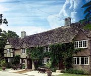
Old Swan & Minster Mill
Crown and Cushion Hotel
Crowne Plaza HEYTHROP PARK - OXFORD
Chipping Norton
Videos from this area
These are videos related to the place based on their proximity to this place.
Shipton-under-Wychwood Part One
Shipton is on the edge the ancient forest of Wychwood between Burford and Chipping Norton. An attractive Cotswold stone village with an interesting medieval church. Tower c1200-1250 with an...
Ascott under Wychwood, Oxfordshire.
Pictures taken in and from the 'allotment field' off London Lane in May 2009.
First Great Western : Adelante 180102 from Charlbury to Hanborough, Thurs 8th May 2014
First Great Western Adelante 180102 Charlbury to Hanborough, Thurs 8th May 2014 Another part of my day out on the "Cotswolds Discoverer". After getting off the bus in the lovely village...
Chipping Norton Farmers' Market
This is a monthly market run by the Thames Valley Farmers' Market Co-operative www.tvfm.org.uk. The short documentary centres on interviews with several of the regular stallholders at Chipping...
Minecraft Map Tour: BeastLand
Helloooo fellow fans! Some handy links below: Subscribe: http://bit.ly/MacSubscribe Follow: http://bit.ly/MacFollow Bitcoin: 1ASev9Nu8cGdeiCLdKpuYYJKrNjUEEEQ6D.
Experience Chipping Norton - Civic Meeting Jan 23rd 2015
The challenge is set. Prime Minister David Cameron has given Chippy's traders a resounding call to arms in a bid to keep his home town thriving. After a stunning attendance at ECN's unique...
PT1 - Race to 250! - Maplestory Kaiser - We completed the game!
Hello fellow Fans, welcome to my new series! Maplestory IGN: MacSwaggot Gamertag: Punkmilitia - feel free to follow/add me. Subscribe: http://bit.ly/MacSubscribe Follow: http://bit.ly/MacFollow...
MineCraft Fun: 50 challenges
Helloooo fellow fans! Some handy links below: Subscribe: http://bit.ly/MacSubscribe Follow: http://bit.ly/MacFollow Bitcoin: 1ASev9Nu8cGdeiCLdKpuYYJKrNjUEEEQ6D.
Minecraft 21 - The old base!
Hello fellow fans! Some handy links below: Subscribe: http://bit.ly/MacSubscribe Follow: http://bit.ly/MacFollow Last.fm: http://www.last.fm/user/shaunhoare Bitcoin: ...
Videos provided by Youtube are under the copyright of their owners.
Attractions and noteworthy things
Distances are based on the centre of the city/town and sightseeing location. This list contains brief abstracts about monuments, holiday activities, national parcs, museums, organisations and more from the area as well as interesting facts about the region itself. Where available, you'll find the corresponding homepage. Otherwise the related wikipedia article.
Wychwood
The Wychwood, or Wychwood Forest, is an area now covering a small part of rural Oxfordshire. In past centuries the forest covered a much larger area, since cleared in favour of agriculture, villages and towns. However, the forest's area has fluctuated. Parts cleared for agriculture during Britain's centuries under Roman rule later reverted to forest. It is believed that "Wych-" is derived from the Old English word Hwicce.
Ascott-under-Wychwood railway station
Ascott-under-Wychwood railway station is a railway station serving the village of Ascott-under-Wychwood in Oxfordshire, England. It is on the Cotswold Line. The station, and all trains serving it, are operated by First Great Western. West of the station is a level crossing, controlled by Ascott-under-Wychwood Signal Box, which also oversees the adjacent end of the double-tracked section of the Cotswold Line.
Charlbury railway station
Charlbury railway station is a railway station serving the town of Charlbury in Oxfordshire, England. This station and all trains serving it are operated by First Great Western. After almost 40 years as a single-platform station, the track through Charlbury station was redoubled with the recommissioning of a second platform on 6 June 2011 as part of the project to improve reliability and increase traffic capacity on the Cotswold Line.
Hawk Stone
The Hawk Stone is a neolithic standing stone just north of the hamlet of Dean, Oxfordshire, England. The name either derives from its shape, being like a hawk, or is a corruption of the word 'hoar' meaning 'old'. Local tradition has it that a cleft in the top of the stone was made by the chains of witches who were tied to the stone and burnt alive.
Knollbury
Knollbury is a scheduled neolithic enclosure to the north west of Chadlington in Oxfordshire. Believed to be defensive in nature the enclosure is rectangular (100 metres by 150 metres) formed by a two to four metre high and ten metre wide earth banks. The two gaps in the earth banks at the eastern corners are believed to be of a later date.
Cornbury Park
Cornbury Park was a former Royal estate used for hunting. It is located near, a few miles from Charlbury, near the Wychwood Forest in Oxfordshire. A two-story, eleven-bay 17th-century house stands in the grounds. The park is now the location for an annual music festuval.
Leafield Technical Centre
Leafield Technical Centre is a former radio transmission station, now turned motorsports centre of excellence, located in the hamlet of Langley, in the western part of the village of Leafield in Oxfordshire, England. Developed from 1912 as a radio transmission station by the General Post Office, it was decommissioned by successor company British Telecom in 1986. BT Group redeveloped the site as a training college, but then closed the site in 1993.


