Safety Score: 3,0 of 5.0 based on data from 9 authorites. Meaning we advice caution when travelling to United Kingdom.
Travel warnings are updated daily. Source: Travel Warning United Kingdom. Last Update: 2024-04-27 08:23:39
Explore Northmoor
Northmoor in Oxfordshire (England) is a city in United Kingdom about 56 mi (or 91 km) west of London, the country's capital.
Local time in Northmoor is now 01:16 AM (Sunday). The local timezone is named Europe / London with an UTC offset of one hour. We know of 11 airports in the vicinity of Northmoor, of which 5 are larger airports. The closest airport in United Kingdom is Oxford (Kidlington) Airport in a distance of 8 mi (or 14 km), North. Besides the airports, there are other travel options available (check left side).
There are several Unesco world heritage sites nearby. The closest heritage site in United Kingdom is City of Bath in a distance of 26 mi (or 42 km), South-West. Also, if you like golfing, there are multiple options in driving distance. If you need a place to sleep, we compiled a list of available hotels close to the map centre further down the page.
Depending on your travel schedule, you might want to pay a visit to some of the following locations: Frilford, Oxford, Farnborough, Welford and Winterbourne. To further explore this place, just scroll down and browse the available info.
Local weather forecast
Todays Local Weather Conditions & Forecast: 6°C / 42 °F
| Morning Temperature | 5°C / 40 °F |
| Evening Temperature | 9°C / 48 °F |
| Night Temperature | 3°C / 38 °F |
| Chance of rainfall | 19% |
| Air Humidity | 94% |
| Air Pressure | 1006 hPa |
| Wind Speed | Moderate breeze with 12 km/h (8 mph) from South |
| Cloud Conditions | Overcast clouds, covering 100% of sky |
| General Conditions | Moderate rain |
Monday, 29th of April 2024
12°C (54 °F)
8°C (47 °F)
Overcast clouds, fresh breeze.
Tuesday, 30th of April 2024
14°C (58 °F)
8°C (47 °F)
Light rain, fresh breeze, scattered clouds.
Wednesday, 1st of May 2024
17°C (62 °F)
12°C (54 °F)
Light rain, gentle breeze, broken clouds.
Hotels and Places to Stay
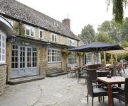
The Rose Revived
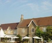
Fallowfields Country House
Chequers Inn
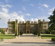
Eynsham Hall
Eynsham Hall Hotel
The Old Court Hotel
Videos from this area
These are videos related to the place based on their proximity to this place.
2013 Eynsham Scouting Reunion Web Video
Every year just before Easter, past and present members of the Eynsham Scout Group get together for a reunion. It's a chance to meet up again with old scouti...
2001 Eynsham Carnival
Short video of the 2001 Eynsham Carnival showing some of the decoraded vehicles gathering for the parade in the Back Lane car park and on the Carnival field where the Childrens Floats competition.
Catching carp in Oxfordshire pt2
My blog of carp fishing continues with a trip to linear fisheries brasenose 2 in Feburary 2012.
Brasenose One Carp Fishing - April 2013
This is a video filmed at Richworth Linear Fisheries on Brasenose One in April 2013. We had a good session catching 50 carp (including 11 twenties) between the three of us up to 29lb. Carl...
Standlake Arena 8th June 2012 - Pre 70 Under Bangers Heat One
Not a lot of action on the day, but still some epic racing from the Pre 70 Under Bangers at the Mike Hook Memorial Meeting.
Standlake Arena - Heavy Metal Classic 2014 (05/01/14)
Here are highlights featuring Under 1800cc and Unlimited Bangers with both classic races for Unders & Overs at Standlake Arena.
Standlake Arena 8th July 2012 - Pre 70 Over Bangers Dash into DD.
Jethro and Gazza's cat and mouse chase in the Over Bangers DD defiantly made up for the quiet day... Apart from when it went silent!
Videos provided by Youtube are under the copyright of their owners.
Attractions and noteworthy things
Distances are based on the centre of the city/town and sightseeing location. This list contains brief abstracts about monuments, holiday activities, national parcs, museums, organisations and more from the area as well as interesting facts about the region itself. Where available, you'll find the corresponding homepage. Otherwise the related wikipedia article.
Appleton-with-Eaton
Appleton-with-Eaton is a civil parish in the Vale of White Horse district of Oxfordshire, England, south west of Oxford. It consists of Appleton and Eaton, on the south bank (which is here actually the east bank) of the River Thames. According to the 2001 census the parish had a population of 897. It can be reached from Oxford by bus via the Whites Coaches 63 service, which runs on Tuesday, Wednesday, Friday and Saturday.
Moreton, Oxfordshire
There are several places in Oxfordshire called Moreton (meaning "habitation on a marsh"): The two neighbouring villages of North and South Moreton in the old Moreton Hundred. The current small settlement (but in previous times a larger village) of Moreton, a mile to the South-West of Northmoor, at coordinates {{#invoke:Coordinates|coord}}{{#coordinates:51|42|38|N|1|24|20|W|type:city(50)_region:GB | |name= }}. The small hamlet of Moreton, near Thame.
Newbridge, Oxfordshire
Newbridge is a 14th-century bridge carrying the A415 road over the River Thames in Oxfordshire, between Abingdon and Witney, close to the Thames' confluence with the River Windrush. It is one of the two oldest surviving bridges across the Thames and is a Grade II* listed building. There is a public house at either end of the bridge: The Rose Revived on the north bank, and The Maybush on the south bank.
Northmoor Lock
Northmoor Lock is a lock on the River Thames in Oxfordshire, England, on the northern bank about a mile from Northmoor. The lock was built in 1896 by the Thames Conservancy to replace a flash lock at Hart's Weir, also known as Ridge's Weir, about a mile upstream and another at Ark Weir downstream.
Hart's Weir Footbridge
Hart's Weir Footbridge is a single-span concrete footbridge across the River Thames in Oxfordshire, England. Locally, it is also known as Rainbow Bridge, due to its rainbow-arc appearance as seen from the horizon. It is situated on the reach above Northmoor Lock, the nearest village being Appleton, Oxfordshire to the east. The bridge was built in 1879 on the site of a weir that was removed a year later.
Bablock Hythe
Bablock Hythe is a small hamlet in Oxfordshire, situated 5 miles west of Oxford city centre. In 1974 it was transferred from Berkshire. There was formerly an important vehicular ferry across the River Thames at Bablock Hythe on the reach above Pinkhill Lock. The earliest reference to a ferry is in 1279 and later ferries continued to provide a crossing service until the mid 20th century.
Kingston Bagpuize with Southmoor
Kingston Bagpuize with Southmoor is a civil parish in the English county of Oxfordshire, England. It was formed on 1 April 1971 by merging the two villages of Kingston Bagpuize and Southmoor. In 1974 it was transferred from Berkshire.
St Giles' Church, Standlake
The Parish Church of Saint Giles, Standlake is the Church of England parish church of Standlake, a village about 5 miles southeast of Witney in Oxfordshire. Since 1976 St. Giles has been a member of the Lower Windrush Benefice along with the parishes of Northmoor, Stanton Harcourt and Yelford.


