Safety Score: 3,0 of 5.0 based on data from 9 authorites. Meaning we advice caution when travelling to United Kingdom.
Travel warnings are updated daily. Source: Travel Warning United Kingdom. Last Update: 2024-04-27 08:23:39
Touring Winteringham
Winteringham in North Lincolnshire (England) with it's 1,000 residents is a town located in United Kingdom about 152 mi (or 244 km) north of London, the country's capital place.
Time in Winteringham is now 11:55 AM (Saturday). The local timezone is named Europe / London with an UTC offset of one hour. We know of 12 airports nearby Winteringham, of which 5 are larger airports. The closest airport in United Kingdom is Humberside Airport in a distance of 13 mi (or 20 km), South-East. Besides the airports, there are other travel options available (check left side).
There are several Unesco world heritage sites nearby. The closest heritage site in United Kingdom is Saltaire in a distance of 19 mi (or 30 km), North-East. Also, if you like the game of golf, there are several options within driving distance. Need some hints on where to stay? We compiled a list of available hotels close to the map centre further down the page.
Being here already, you might want to pay a visit to some of the following locations: Whitton, Welton- East Yorkshire, Brantingham, Ellerker and Appleby. To further explore this place, just scroll down and browse the available info.
Local weather forecast
Todays Local Weather Conditions & Forecast: 9°C / 48 °F
| Morning Temperature | 3°C / 37 °F |
| Evening Temperature | 7°C / 45 °F |
| Night Temperature | 6°C / 44 °F |
| Chance of rainfall | 0% |
| Air Humidity | 64% |
| Air Pressure | 1007 hPa |
| Wind Speed | Moderate breeze with 11 km/h (7 mph) from South-West |
| Cloud Conditions | Overcast clouds, covering 100% of sky |
| General Conditions | Light rain |
Sunday, 28th of April 2024
6°C (43 °F)
4°C (39 °F)
Moderate rain, moderate breeze, overcast clouds.
Monday, 29th of April 2024
12°C (54 °F)
8°C (46 °F)
Sky is clear, moderate breeze, few clouds.
Tuesday, 30th of April 2024
17°C (62 °F)
10°C (50 °F)
Light rain, moderate breeze, clear sky.
Hotels and Places to Stay
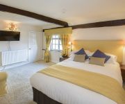
Winteringham Fields
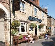
The Fox and Coney Inn
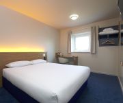
TRAVELODGE HULL SOUTH CAVE
Videos from this area
These are videos related to the place based on their proximity to this place.
70013 Oliver Cromwell
7MT class 4-6-2 locomotive Oliver Cromwell hauling the London to Scarborough 'East Riding' excursion, pictured between Brough and North Ferriby. 14th April 2012.
Insight Wedding Photography - Client Testimonials
Not everyone can boast the ability to call upon their clients to take the time to give ringing endorsements of you and your business, but for Yorkshire photographer Andy Crozier, it's easy....
Heritage Landscape Centre, East yorkshire
More at http://www.heritagelandscapecentre.co.uk Heritage Landscape Centre, located in Melton, just outside of Hull, provides quality materials to professional landscape gardeners as well...
My victory at Spout Hill, Brantingham, East Yorkshire
I am new to cycling (a gap of 20 years) and have never seen the fun of climbing hills, but lately that has changed... I now have a list of the top 20 hills on the north bank of the Humber and...
Start of Torch Relay Brough East Yorkshire
This is the start of the Torch Relay in Brough 19th June 2012.
Hawk Pond - Pike Fishing (Hull & District Angling Association)
Fishing at Hawk Pond. One of the HDAA (Hull & District Angling Association) waters, nr Brough, Hull. You can also see many other fishing videos on my Youtube Channel at ...
Brief Motorbike tour of Alkborough, N Lincs
First attempt with new (to me) digital video camera mounted on my motorbike, then edited via Cyberlink PowerDirector.
South Cave Floods
The main street has become a river, the man in the boat was rescuing stranded children from the school.
Fox Factor First Round ( week 2 )
The competition just gets better and better. The Fox Factor is the talk of South Cave and the Fox and Coney is rapidly becoming THE place to be on thursday nights. No-one wants to go out in...
Videos provided by Youtube are under the copyright of their owners.
Attractions and noteworthy things
Distances are based on the centre of the city/town and sightseeing location. This list contains brief abstracts about monuments, holiday activities, national parcs, museums, organisations and more from the area as well as interesting facts about the region itself. Where available, you'll find the corresponding homepage. Otherwise the related wikipedia article.
Winterton Rangers F.C
Winterton Rangers F.C. are a football club based in Winterton, England. They play in the Northern Counties East Football League Premier Division.
Petuaria
Petuaria (or Petuaria Parisorum) was originally a Roman fort situated where the town of Brough-on-Humber in the East Riding of Yorkshire now stands. Petuaria means something like 'quarter' or 'fourth part', incorporating the archaic Brythonic *petuar, 'four' (compare modern Welsh pedwar). It was founded in 70 AD and abandoned in about 125.
Winterton and Thealby railway station
Winterton and Thealby railway station was a station built by the North Lindsey Light Railway in Winterton, Lincolnshire, on their line from Scunthorpe to Winteringham. The station was opened on 3 September 1906 and has since been closed. The first train on the line operated from Dawes Lane as far as this station. Preceding station Disused railways Following station Normanby Park (Goods) North Lindsey Light Railway West Halton
Winteringham Haven railway station
Winteringham Haven railway station was a port facility on the south bank of the Humber Estuary, Lincolnshire, England. It was constructed by the North Lindsey Light Railway at the end of a 1/2 mile branch line from Winteringham. The railway company provided two chutes to load ships, one for coal the other for slag, a by-product of the iron and steel making process. It was opened on 15 July 1907.


