Safety Score: 3,0 of 5.0 based on data from 9 authorites. Meaning we advice caution when travelling to United Kingdom.
Travel warnings are updated daily. Source: Travel Warning United Kingdom. Last Update: 2024-04-18 08:12:24
Touring Saxby All Saints
Saxby All Saints in North Lincolnshire (England) with it's 385 residents is a town located in United Kingdom about 148 mi (or 238 km) north of London, the country's capital place.
Time in Saxby All Saints is now 09:10 PM (Thursday). The local timezone is named Europe / London with an UTC offset of one hour. We know of 12 airports nearby Saxby All Saints, of which 5 are larger airports. The closest airport in United Kingdom is Humberside Airport in a distance of 8 mi (or 12 km), South-East. Besides the airports, there are other travel options available (check left side).
There are several Unesco world heritage sites nearby. The closest heritage site in United Kingdom is Saltaire in a distance of 18 mi (or 30 km), North-East. Also, if you like the game of golf, there are several options within driving distance. Need some hints on where to stay? We compiled a list of available hotels close to the map centre further down the page.
Being here already, you might want to pay a visit to some of the following locations: Worlaby, Appleby, North Ferriby, Broughton and Welton- East Yorkshire. To further explore this place, just scroll down and browse the available info.
Local weather forecast
Todays Local Weather Conditions & Forecast: 10°C / 50 °F
| Morning Temperature | 3°C / 37 °F |
| Evening Temperature | 7°C / 45 °F |
| Night Temperature | 9°C / 49 °F |
| Chance of rainfall | 8% |
| Air Humidity | 60% |
| Air Pressure | 1020 hPa |
| Wind Speed | Moderate breeze with 13 km/h (8 mph) from East |
| Cloud Conditions | Few clouds, covering 20% of sky |
| General Conditions | Moderate rain |
Friday, 19th of April 2024
9°C (47 °F)
3°C (38 °F)
Light rain, moderate breeze, overcast clouds.
Saturday, 20th of April 2024
10°C (49 °F)
3°C (37 °F)
Overcast clouds, moderate breeze.
Sunday, 21st of April 2024
10°C (49 °F)
4°C (38 °F)
Few clouds, gentle breeze.
Hotels and Places to Stay
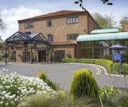
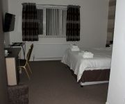
Hallmark Hotel Hull
FOREST PINES HOTEL - QHOTELS
Arties Mill
Hull West
Videos from this area
These are videos related to the place based on their proximity to this place.
North Ferriby United 3 Worcester City 0 Vanarama Conference North
North Ferriby United 3 Worcester City 0 Including a bit of commentary from BBC Hereford & Worcester in the first half.
North Ferriby 1-1 FC United 15 Mar 2011
A decent first-half performance by FC United was capped off with a good cross by Matthew Wolfenden. The resulting pressure by Mike Norton meant their keeper pushed the ball onto Sam Denton's...
70013 Oliver Cromwell
7MT class 4-6-2 locomotive Oliver Cromwell hauling the London to Scarborough 'East Riding' excursion, pictured between Brough and North Ferriby. 14th April 2012.
Archive footage of The Ropewalk in Barton upon Humber
Classic footage of Ropemaking at the Ropewalk in Barton upon Humber.
Incidental Spotting: Class 153 (15301) Northern Rail, Barton-on-Humber, 1st March, 2014
Footage taken on Panasonic Lumix TZ30 of the Northern Rail Class 153 (153301) departing Barton-on-Humber station on 1st March, 2014...
Humber Hop Launch
Coverage of the launch of the inaugural Humber Hop charity fundraiser at Water's Edge, Barton-upon-Humber with our partners from Lincoln YMCA, Humber Sports Partnership and Lincolnshire Sports.
IMG 0634
Ringing the bells fully muffled to commemorate the start of WW1 4th August 2014 St Mary's Church, Barton Upon Humber.
Weldtite Factory Tour - Life @ Weldtite Towers series
Filmed in glorious Ultra HD and narrated by Jazz FM's Ibiza chill out show - The Late Lounge presenter Claire Anderson, this is a FULL look around Weldtite's factory in Barton upon Humber!...
Videos provided by Youtube are under the copyright of their owners.
Attractions and noteworthy things
Distances are based on the centre of the city/town and sightseeing location. This list contains brief abstracts about monuments, holiday activities, national parcs, museums, organisations and more from the area as well as interesting facts about the region itself. Where available, you'll find the corresponding homepage. Otherwise the related wikipedia article.
River Ancholme
The River Ancholme is a river in North Lincolnshire, England, and a tributary of the Humber estuary. It rises south of Bishopbridge and passes through the market town of Brigg before flowing north into the Humber at South Ferriby. North of Bishopbridge, where the River Rase joins the Ancholme, the river runs in two intertwining channels.
Glanford
Glanford was, from 1974 to 1996, a local government district with borough status in the non-metropolitan county of Humberside, England.
South Humberside
South Humberside is a former postal county of England. It was introduced by the Royal Mail on 1 July 1974, when some addresses were altered in response to the changes in administration brought about under the Local Government Act 1972. The postal county corresponded approximately to the part of the new non-metropolitan county of Humberside south of the River Humber. All of the post towns included in South Humberside had formerly been part of the Lincolnshire postal county.
Glanford Brigg Rural District
Glanford Brigg was a rural district in Lincolnshire, Parts of Lindsey from 1894 to 1974. It was formed under the Local Government Act 1894 from the Glanford Brigg rural sanitary district. It entirely surrounded the borough of Scunthorpe.
Ferriby Sluice
Ferriby Sluice is a hamlet situated near the lock complex on the Humber and River Ancholme, Lincolnshire, England. It is now part of the village of South Ferriby but once stood alone in its own right. It is situated west of South Ferriby, physically separated from the bulk of the village, and once was the point of departure for the packet boats that used to ply the Humber.
Horkstow Bridge
Horkstow Bridge is a suspension bridge that spans the New River Ancholme near the village of Horkstow in North Lincolnshire. It was designed by Sir John Rennie as part of the River Ancholme Drainage Scheme, completed in 1836, and is a Grade II* listed building.


