Safety Score: 3,0 of 5.0 based on data from 9 authorites. Meaning we advice caution when travelling to United Kingdom.
Travel warnings are updated daily. Source: Travel Warning United Kingdom. Last Update: 2024-04-27 08:23:39
Delve into Keadby
Keadby in North Lincolnshire (England) with it's 2,238 habitants is a town located in United Kingdom about 146 mi (or 235 km) north of London, the country's capital town.
Time in Keadby is now 11:33 PM (Saturday). The local timezone is named Europe / London with an UTC offset of one hour. We know of 12 airports closer to Keadby, of which 5 are larger airports. The closest airport in United Kingdom is Robin Hood Doncaster Sheffield Airport in a distance of 14 mi (or 22 km), South-West. Besides the airports, there are other travel options available (check left side).
There are several Unesco world heritage sites nearby. The closest heritage site in United Kingdom is Liverpool – Maritime Mercantile City in a distance of 17 mi (or 27 km), South-West. Also, if you like the game of golf, there are some options within driving distance. In need of a room? We compiled a list of available hotels close to the map centre further down the page.
Since you are here already, you might want to pay a visit to some of the following locations: Eastoft, Scunthorpe, Belton, Crowle and Bottesford. To further explore this place, just scroll down and browse the available info.
Local weather forecast
Todays Local Weather Conditions & Forecast: 10°C / 50 °F
| Morning Temperature | 4°C / 39 °F |
| Evening Temperature | 8°C / 46 °F |
| Night Temperature | 5°C / 41 °F |
| Chance of rainfall | 0% |
| Air Humidity | 65% |
| Air Pressure | 1005 hPa |
| Wind Speed | Moderate breeze with 10 km/h (6 mph) from South-West |
| Cloud Conditions | Overcast clouds, covering 100% of sky |
| General Conditions | Light rain |
Sunday, 28th of April 2024
7°C (44 °F)
4°C (39 °F)
Moderate rain, fresh breeze, overcast clouds.
Monday, 29th of April 2024
13°C (55 °F)
9°C (49 °F)
Light rain, fresh breeze, scattered clouds.
Tuesday, 30th of April 2024
15°C (59 °F)
10°C (49 °F)
Broken clouds, fresh breeze.
Hotels and Places to Stay
TRAVELODGE SCUNTHORPE
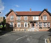
Royal Hotel
The Sheffield Arms
Videos from this area
These are videos related to the place based on their proximity to this place.
Scunthorpe United FC v Worcester City - FA Cup 2nd Round
Sunday 7th December 2014 - FA Cup 2nd Round - Worcester City travel to Scunthorpe United in the 2nd Round of the FA Cup.
Blackpool Fans at Scunthorpe
I was at this game as a scunny fan, but i gotta say that these guys were pretty awesome! Respect to them.
TERRY McGEECHAN - Scunthorpe, Lincolnshire
Terry McGeechan is a tremendous pigeon fancier who has developed a top performance loft through hard work and meticulous stockmanship. Terry has developed a winning family based on GEVAERT ...
Police Dog Show at Armed Forces Day: Scunthorpe 2013
A police dog show at Armed forces day at Glanford Park Scunthorpe.
Dying Light: How to Fast Travel
Details (Please Open) Information About This Video: Dying Light is a free running style game where jumping from rooftop to rooftop is key to getting from point A to point B but there is an...
Dying Light: How To Get The Secret Weapon / Sick Bomb Schematics Location
Details (Please Open) Blueprints are schematics needed for crafting weapons and weapon upgrades. You can acquire them as mission rewards, collect them around the city, buy them from vendors...
Videos provided by Youtube are under the copyright of their owners.
Attractions and noteworthy things
Distances are based on the centre of the city/town and sightseeing location. This list contains brief abstracts about monuments, holiday activities, national parcs, museums, organisations and more from the area as well as interesting facts about the region itself. Where available, you'll find the corresponding homepage. Otherwise the related wikipedia article.
Flixborough disaster
The Flixborough disaster was an explosion at a chemical plant close to the village of Flixborough, England, on 1 June 1974. It killed 28 people and seriously injured 36.
M181 motorway
The M181 is a motorway thatlinks the town of Scunthorpe, England, to the M180 motorway. A spur of the M180, the road is virtually straight through its entire 2-mile length. It was opened in December 1978, at the same time as the section of M180 from junction 3 to the east side of the River Trent (the bridge was not opened until late 1979).
Gunness and Burringham railway station
Gunness railway station, later suffixed "and Burringham", is a former railway station in Gunness, Lincolnshire. Today trains call at the nearby Althorpe. The station was opened by the Trent, Ancholme and Grimsby Railway and was situated on a short branch from the main line. Former Services Preceding station Disused railways Following station Terminus Trent, Ancholme & Grimsby Frodingham
Gunhouse Wharf railway station
Gunhouse Wharf railway station was a station in Gunness, Lincolnshire. It was built by the Trent, Ancholme and Grimsby Railway to serve a small wharf on the River Trent. It left the main line at Gunhouse Junction, the main line making an end-on junction with the South Yorkshire Railway's line to Doncaster which had been extended over the River Trent by means of Keadby Swing Bridge.
Keadby Bridge
Keadby Bridge, more formally known as the King George V Bridge, crosses the River Trent near Althorpe and Keadby in Lincolnshire.
St John the Baptist's Church, Burringham
St John the Baptist's Church, Burringham, is a redundant Anglican church in the village of Burringham, Lincolnshire, England. It is designated by English Heritage as a Grade II listed building, and is under the care of the Churches Conservation Trust. The church stands at the south end of the village, on the east bank of the River Trent.


