Safety Score: 3,0 of 5.0 based on data from 9 authorites. Meaning we advice caution when travelling to United Kingdom.
Travel warnings are updated daily. Source: Travel Warning United Kingdom. Last Update: 2024-04-29 08:03:39
Delve into Timberland
Timberland in Lincolnshire (England) with it's 578 habitants is located in United Kingdom about 111 mi (or 179 km) north of London, the country's capital town.
Current time in Timberland is now 10:29 AM (Monday). The local timezone is named Europe / London with an UTC offset of one hour. We know of 12 airports close to Timberland, of which 5 are larger airports. The closest airport in United Kingdom is RAF Coningsby in a distance of 7 mi (or 11 km), East. Besides the airports, there are other travel options available (check left side).
There are several Unesco world heritage sites nearby. The closest heritage site in United Kingdom is Derwent Valley Mills in a distance of 10 mi (or 15 km), South-West. Also, if you like playing golf, there are some options within driving distance. If you need a hotel, we compiled a list of available hotels close to the map centre further down the page.
While being here, you might want to pay a visit to some of the following locations: Thimbleby, Lincoln, Wold Newton, Essendine and Redbourne. To further explore this place, just scroll down and browse the available info.
Local weather forecast
Todays Local Weather Conditions & Forecast: 13°C / 55 °F
| Morning Temperature | 4°C / 39 °F |
| Evening Temperature | 13°C / 55 °F |
| Night Temperature | 9°C / 48 °F |
| Chance of rainfall | 0% |
| Air Humidity | 71% |
| Air Pressure | 1013 hPa |
| Wind Speed | Fresh Breeze with 14 km/h (9 mph) from North |
| Cloud Conditions | Broken clouds, covering 81% of sky |
| General Conditions | Broken clouds |
Tuesday, 30th of April 2024
14°C (57 °F)
8°C (47 °F)
Light rain, moderate breeze, broken clouds.
Wednesday, 1st of May 2024
16°C (60 °F)
10°C (50 °F)
Light rain, gentle breeze, overcast clouds.
Thursday, 2nd of May 2024
14°C (58 °F)
11°C (52 °F)
Overcast clouds, gentle breeze.
Hotels and Places to Stay
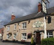
The Lincolnshire Poacher Inn
Videos from this area
These are videos related to the place based on their proximity to this place.
STEAMIN' AROUND - 1987 - NORTH INGS FARM RAILWAY
A visit in 1987 on our return from Wales etc. If you are a fellow member of the NGRS you might recognise some of the volunteers!
GTA Chinatown Wars Resolution X location
The Resolution X is a red and black sports car which can be found in a drive on beachgate. its a sports model of the hellbench car and is easily accesible, i hope this video helped you. please...
A winter walk in Nocton
Impressions of a December evening round Nocton. Recorded on my little Flip toy.
Blankney Hall Lincs REVIVALHERITAGE stables approach
Blankney Hall stables approached from the outbuildings to the SW.
Blankney Hall Lincs stables REVIVALHERITAGE quickview
Blankney Hall stable block (E.J.Wilson 1825). One of the only surviving buildings of Blankney Hall (demolished by 1961). Amateur footage Summer 2012 Lincolnshire REVIVALHERITAGE quickview.
Videos provided by Youtube are under the copyright of their owners.
Attractions and noteworthy things
Distances are based on the centre of the city/town and sightseeing location. This list contains brief abstracts about monuments, holiday activities, national parcs, museums, organisations and more from the area as well as interesting facts about the region itself. Where available, you'll find the corresponding homepage. Otherwise the related wikipedia article.
RAF Metheringham
RAF Metheringham was a Royal Air Force station situated between the villages of Metheringham and Martin and 12.1 mi south east of the county town Lincoln, Lincolnshire, England. Operated as a bomber airfield during World War II the station opened in October 1943 and was decommissioned in the spring of 1946. Although now mostly returned to agricultural and commercial uses the site retains one original runway, the eastern perimeter track and some contemporary buildings together with a No.
Catley Priory
Catley Priory was a monastic house in Walcott, Lincolnshire, England. The Gilbertine priory of Saint Mary, Catley, was founded as a double house for nuns and monks between 1154 and 1158 by Peter of Billinghay. He endowed it with the whole of the then island of Catley, the site of a grange and some arable land in Walcott, the church at Billinghay and the chapel at Walcott, pasture for four hundred sheep and right of fishing on Walcott marsh.


