Safety Score: 3,0 of 5.0 based on data from 9 authorites. Meaning we advice caution when travelling to United Kingdom.
Travel warnings are updated daily. Source: Travel Warning United Kingdom. Last Update: 2024-04-26 08:02:42
Delve into Southrop
Southrop in Gloucestershire (England) with it's 245 habitants is located in United Kingdom about 70 mi (or 112 km) west of London, the country's capital town.
Current time in Southrop is now 12:10 PM (Friday). The local timezone is named Europe / London with an UTC offset of one hour. We know of 10 airports close to Southrop, of which 5 are larger airports. The closest airport in United Kingdom is RAF Fairford in a distance of 5 mi (or 8 km), South-West. Besides the airports, there are other travel options available (check left side).
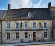
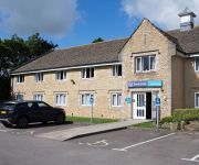
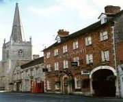
There are several Unesco world heritage sites nearby. The closest heritage site in United Kingdom is City of Bath in a distance of 24 mi (or 39 km), South. Also, if you like playing golf, there are some options within driving distance. We encountered 1 points of interest near this location. If you need a hotel, we compiled a list of available hotels close to the map centre further down the page.
While being here, you might want to pay a visit to some of the following locations: Hannington, Cricklade, Swindon, Wanborough and Bishopstone. To further explore this place, just scroll down and browse the available info.
Local weather forecast
Todays Local Weather Conditions & Forecast: 10°C / 50 °F
| Morning Temperature | 2°C / 36 °F |
| Evening Temperature | 9°C / 47 °F |
| Night Temperature | 6°C / 43 °F |
| Chance of rainfall | 0% |
| Air Humidity | 61% |
| Air Pressure | 1003 hPa |
| Wind Speed | Gentle Breeze with 7 km/h (5 mph) from South-West |
| Cloud Conditions | Broken clouds, covering 84% of sky |
| General Conditions | Broken clouds |
Saturday, 27th of April 2024
5°C (42 °F)
5°C (42 °F)
Moderate rain, moderate breeze, overcast clouds.
Sunday, 28th of April 2024
5°C (40 °F)
5°C (41 °F)
Moderate rain, moderate breeze, overcast clouds.
Monday, 29th of April 2024
13°C (55 °F)
5°C (41 °F)
Light rain, moderate breeze, few clouds.
Hotels and Places to Stay
Burford House
The Cotswold Gateway Hotel
Burford Lodge
The Bay Tree
Bull at Burford Hotel & Restaurant
Inn For All Seasons
The Golden Pheasant Inn
The Royal Oak
TRAVELODGE BURFORD COTSWOLDS
New Inn
Videos from this area
These are videos related to the place based on their proximity to this place.
B52 Bomber Landing - RAF Fairford - 10th June 2014
B52 Landing at Fairford, was quite windy, done in little Panasonic Camera, no editing, very loud as it went overhead!
B2 Stealth Bomber Landing - RAF Fairford - 10th June 2014
The awesome B2 Stealth Bomber coming into land at RAF Fairford, apologise for the wind noise but was done on little pocket Panasonic Camera.
RAF Fairford 9th December 2013
My footage from day 1 of the RAF Mildenhall based 352nd SOG [Special Operations Group] forward deployment exercise that's taking place at RAF Fairford this week [till Thursday 12th] .
HMX-1 arrives at RAF Fairford to support Barack Obama's UK trip
On the 1st September 2014 x4 MV-22B and x2 VH-60s arrive at RAF Fairford to support the US President Barack Obama as he visits the UK for the NATO summit. I was at the wrong end of the runway,...
RAF Fairford RIAT Airshow - 2011
Footage of The Royal International Air Tattoo at RAF Fairford on Saturday 16th July 2011 Aircraft at the event included: The Red Arrows Royal Netherlands Air Force AH-64D Apache Royal Air...
PC-21 approaches Fairford (RIAT 2010) - Cockpit view
Cockpit view of the landing of the Pilatus PC-21 HB-HZC in Fairford,UK for the RIAT 2010 Airshow. Recorded 13.07.2010.
Videos provided by Youtube are under the copyright of their owners.
Attractions and noteworthy things
Distances are based on the centre of the city/town and sightseeing location. This list contains brief abstracts about monuments, holiday activities, national parcs, museums, organisations and more from the area as well as interesting facts about the region itself. Where available, you'll find the corresponding homepage. Otherwise the related wikipedia article.
St John's Lock
St John's Lock is the furthest upstream lock on the River Thames in England. It is situated near the town of Lechlade, Gloucestershire. The name of the lock derives from a priory that was established nearby in 1250, but which no longer exists. The lock was built of stone in 1790 by the Thames Navigation Commission. The main weir is downstream, just below St. John's Bridge, where the River Cole and the River Leach join the Thames on opposite banks.
Thames meander
Thames meander refers to a long-distance journey over all or part of the River Thames in England. Walking the Thames Path is itself a meander, but the term usually applies to journeys using other methods such as rowing, running, or swimming. A Thames meander can be a social expedition over a few days. However more specific meanders are competitive events, or record breaking attempts.
Halfpenny Bridge
Halfpenny Bridge is a bridge across the River Thames, at Lechlade, Gloucestershire, England. It marks the start of the navigable Thames. The bow-backed bridge was built to a design of James Hollingworth in 1792. It carries the A361 from the south into Lechlade. It was called the Halfpenny bridge because that was the toll charged for pedestrians to cross it, until the toll was done away with in 1839.
St. John's Bridge, Lechlade
St John's Bridge is a road bridge across the River Thames near Lechlade, England. It carries the A417 road between Lechlade and Faringdon, and crosses the Thames just at the lower end of St John's Lock. The present bridge was built in 1886. The original bridge was built by a local prior in 1229 on the line of an old ford and there have been bridges on the site since then. For many centuries until the building of the lock, there were tolls for passing through the bridge.
RAF Southrop
RAF Southrop was a Royal Air Force station west of the village of Southrop, Gloucestershire during World War II from August 1940 to November 1947. It was used as a Relief Landing Ground for Airspeed Oxford and Harvard training aircraft for No. 23 Group RAF.
Eastleach House
Eastleach House is Grade II listed country house in Eastleach Martin, Gloucestershire, designed by the architect Walter Cave and completed in 1900.
St Michael and St Martin's Church, Eastleach Martin
St Michael and St Martin's Church, Eastleach Martin, is a redundant Anglican church in Eastleach Martin, Gloucestershire, England. It has been designated by English Heritage as a Grade I listed building, and is under the care of the Churches Conservation Trust. The church stands close to the River Leach which divides Eastleach Martin from its twin village of Eastleach Turville. Eastleach Turville's Church of St Andrew stands only 180 metres away from the Church of St Michael and St Martin.
St Peter's Church, Southrop
St Peter's Church is an Anglican church in Southrop, a Cotswolds village in the English county of Gloucestershire. It is an active parish church in the Diocese of Gloucester and the archdeaconry of Cheltenham. It has been designated a Grade I listed building by English Heritage. The church—on the site of an older structure—dates from the 12th century.


