Safety Score: 3,0 of 5.0 based on data from 9 authorites. Meaning we advice caution when travelling to United Kingdom.
Travel warnings are updated daily. Source: Travel Warning United Kingdom. Last Update: 2024-05-08 08:04:21
Delve into Orton
Orton in Cumbria (England) with it's 235 habitants is a town located in United Kingdom about 229 mi (or 368 km) north-west of London, the country's capital town.
Time in Orton is now 11:14 AM (Wednesday). The local timezone is named Europe / London with an UTC offset of one hour. We know of 8 airports closer to Orton, of which 4 are larger airports. The closest airport in United Kingdom is Carlisle Airport in a distance of 34 mi (or 54 km), North. Besides the airports, there are other travel options available (check left side).
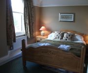
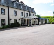
There are several Unesco world heritage sites nearby. The closest heritage site is Frontiers of the Roman Empire in Germany at a distance of 59 mi (or 96 km). The closest in United Kingdom is New Lanark in a distance of 84 mi (or 96 km), North-East. Also, if you like the game of golf, there are some options within driving distance. In need of a room? We compiled a list of available hotels close to the map centre further down the page.
Since you are here already, you might want to pay a visit to some of the following locations: Holwick, Newbiggin, Greenhead, Haltwhistle and Mickleton. To further explore this place, just scroll down and browse the available info.
Local weather forecast
Todays Local Weather Conditions & Forecast: 15°C / 59 °F
| Morning Temperature | 11°C / 53 °F |
| Evening Temperature | 13°C / 56 °F |
| Night Temperature | 10°C / 50 °F |
| Chance of rainfall | 0% |
| Air Humidity | 82% |
| Air Pressure | 1028 hPa |
| Wind Speed | Moderate breeze with 9 km/h (6 mph) from North-East |
| Cloud Conditions | Overcast clouds, covering 100% of sky |
| General Conditions | Light rain |
Thursday, 9th of May 2024
14°C (57 °F)
10°C (51 °F)
Light rain, gentle breeze, overcast clouds.
Friday, 10th of May 2024
17°C (62 °F)
12°C (53 °F)
Overcast clouds, light breeze.
Saturday, 11th of May 2024
20°C (67 °F)
15°C (58 °F)
Light rain, light breeze, scattered clouds.
Hotels and Places to Stay
The George Hotel
Tebay Services Hotel
Shap Wells
Videos from this area
These are videos related to the place based on their proximity to this place.
Howgills Mountain bike descent from Winder, Sedbergh
Coming down from Arant Haw on the Howgills, past Winder and down into Sedbergh, Cumbria. Prime mountain biking location!
Pendolino trip through Cumbria
On a Virgin Pendolino through Cumbria on what is probably the most spectacular section of the West Coast Main Line between Glasgow and London - the descent from Shap Fell through the Lune ...
Matt's Rural Guide - Using a Chainsaw in Tebay
A guide to how easy it is to move to the country, by Matt Farr.
Waterfalls of Northern England
A few hundred miles on the clock, this is our trip around the Yorkshire Dales and Lake District, in the Marillion Smart Car.
Airstream Trailer - International 684 Walkaround
Camper Community invites you to take a tour around the Airstream Trailer International 684. www.campercommunity.co.uk - P2P campervan and motorhome rentals.
Teatime for Fell Ponies.WMV
The Fell ponies have gone into the hayfield to supervise the drain digging, and found GRASS. Will they come in when they're wanted?
Appleby in Westmorland, Cumbria, UK - 4th September, 2012
Appleby-in-Westmorland is a town and civil parish in Cumbria, in North West England. It is situated within a loop of the River Eden and has a population of approximately 2500. It is in the...
West Coast Main Line Rail Traffic, Shap, Cumbria, England - 3rd September, 2014
The West Coast Main Line (WCML) is a major inter-city railway route in the United Kingdom. It is Britain's most important rail backbone in terms of population served. The route links Greater...
Rail Freight and Industry at Shap, Cumbria, UK - September 2012
Footage taken on the West Coast Main Line at Shap in Cumbria of passing rail freight, including a class 92 hauled Tesco Express container train, a DRS class 66 hauled container train, the Tata...
Wickerslack - Shap - Rheged - Glenridding: Cumbria, UK - 6th September, 2012
This footage was taken from a Flip Ultra HD secured to a car wing mirror with a Gorilla Pod, the footage has been sped up 8 times and set to the natural sounds of the Cumbrian countryside....
Videos provided by Youtube are under the copyright of their owners.
Attractions and noteworthy things
Distances are based on the centre of the city/town and sightseeing location. This list contains brief abstracts about monuments, holiday activities, national parcs, museums, organisations and more from the area as well as interesting facts about the region itself. Where available, you'll find the corresponding homepage. Otherwise the related wikipedia article.
Westmorland
Westmorland is an area of North West England and one of the 39 historic counties of England. It formed an administrative county from 1889 to 1974, after which the whole county was administered by new administrative county of Cumbria.
Gaisgill railway station
Gaisgill railway station was situated on the South Durham & Lancashire Union Railway between Tebay and Kirkby Stephen East. It served the village of Gaisgill. The station opened to passenger traffic on 8 August 1861, and closed on 1 December 1952.
Tebay rail accident
The Tebay rail accident occurred when four railway workers working on the West Coast Main Line were killed by a runaway wagon near Tebay, Cumbria, England in the early hours of 15 February 2004.
Crosby Ravensworth
Crosby Ravensworth is a village, civil parish and fell in the Eden District of Cumbria, England. The village is about 4 miles east of the M6 motorway, and Shap.
Robin Hood's Grave
Robin Hood's Grave is a name given to a number of monuments in England which is said to mark the last resting place of the legendary outlaw Robin Hood. Examples include: Cairn on Crosby Ravensworth Fell, {{#invoke:Coordinates|coord}}{{#coordinates:54.4893|N|2.5926|W||||| | |name= }} Monument in Kirklees Park Estate, West Yorkshire, England, {{#invoke:Coordinates|coord}}{{#coordinates:53.6897|N|1.736|W||||| | |name= }}.
Gilts, Cumbria
Gilts is a hamlet in the Eden District in the county of Cumbria. Situated on Crosby Ravensworth Fell.
Raisbeck
Raisbeck is a hamlet in the civil parish of Orton, in the Eden district, in the county of Cumbria, England. The surname Raisbeck originates from the hamlet. The name of the hamlet derives from Hrridarr, a personal name and beck, a stream or river, the surname is used by people such as Alex Raisbeck, Rosina Raisbeck and Bill Raisbeck. There is also the smaller hamlet of Sunbiggin nearby.
All Saints Church, Orton
All Saints Church, Orton, is located in the village of Orton, Cumbria, England. It is an active Anglican parish church in the deanery of Appleby, the archdeaconry of Carlisle, and the diocese of Carlisle. It benefice is united with those of St Oswald, Revenstonedale, and St James, Tebay. The church has been designated by English Heritage as a Grade II* listed building.


