Safety Score: 3,0 of 5.0 based on data from 9 authorites. Meaning we advice caution when travelling to United Kingdom.
Travel warnings are updated daily. Source: Travel Warning United Kingdom. Last Update: 2024-05-08 08:04:21
Discover Sandy Heath
The district Sandy Heath of Deepdale in Central Bedfordshire (England) is a district in United Kingdom about 43 mi north of London, the country's capital city.
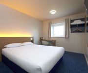
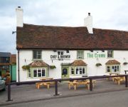
Looking for a place to stay? we compiled a list of available hotels close to the map centre further down the page.
When in this area, you might want to pay a visit to some of the following locations: Everton, Potton, Sutton, Sandy and Tempsford. To further explore this place, just scroll down and browse the available info.
Local weather forecast
Todays Local Weather Conditions & Forecast: 16°C / 61 °F
| Morning Temperature | 7°C / 44 °F |
| Evening Temperature | 18°C / 65 °F |
| Night Temperature | 13°C / 56 °F |
| Chance of rainfall | 0% |
| Air Humidity | 69% |
| Air Pressure | 1029 hPa |
| Wind Speed | Light breeze with 5 km/h (3 mph) from North |
| Cloud Conditions | Overcast clouds, covering 99% of sky |
| General Conditions | Overcast clouds |
Thursday, 9th of May 2024
17°C (62 °F)
13°C (55 °F)
Overcast clouds, gentle breeze.
Friday, 10th of May 2024
18°C (65 °F)
13°C (55 °F)
Light rain, gentle breeze, overcast clouds.
Saturday, 11th of May 2024
20°C (67 °F)
12°C (54 °F)
Light rain, gentle breeze, few clouds.
Hotels and Places to Stay
The Waterfront Hotel Spa & Golf
TRAVELODGE BEDFORD WYBOSTON
St. Neots (Colmworth Park)
St. Neots (A1/Wyboston)
Videos from this area
These are videos related to the place based on their proximity to this place.
GTA V Playthrough: Mission 1 - The Prologue
So I've managed to complete the game once through and I am now going to be recording through the second time I complete it. So it all starts here, episode one of many to come in my GTA V series....
Stoat predates a rabbit at RSPB The Lodge, Sandy - Dec 2014 *Warning, quite graphic*
Although a frightfully cold day today we ventured up to RSPB Sandy to stretch our legs. Shortly after popping the walking boots on and checking the camera was ready we popped under the shelter...
Purley, Croydon, Huntingdon, St Neots, Sandy, Bedford St Johns, Bletchley & Tring (22-06-2013
After a brief stop at Purley, we head to East Croydon, where we see Electro Diesel 73107 on a light loco move. Moving northwards we briefly stop at Huntingdon, where 66517 passes. Next is...
ECML @ Sandy 22 10 12 feat 5L21 & RHTT
A short lunchtime visit to the footbridge next to Sunderland Road Industrial Estate(Beamish Close), Sandy to get the GBRf 66's on the southern ECML water cannons and 321447 freshly overhauled...
Sandy revisited (6 years later) - HSTs at speed
A class 180 rushes through Sandy station at the beginning, then glorious HSTs, ending with a class 321 stopping at Sandy. Note the very brief glimpse of an HST at speed seen through the stopping...
Sandy: Sunderland Road Industrial Estate
A footbridge situated near to the Industrial Estate in Sandy, which crosses over the East Coast Main Line.
91007 'Skyfall' ECML Debut Run HD
91007 'Skyfall' makes its debut run on 1Z07 Kings Cross to Edinburgh seen just north of Sandy at speed with matching rake of '007' gun logo Mk4's and DVT 82231 on the rear in matching James...
66152 in new DB Colours
66152 heads north through Sandy Station with the Biggleswade to Heck Empty Plasmor train.
My Reaction on Avengers Age of Ultron First Offcial Extended Trailer
I do not own Ultron, Avengers Age of Ultron, Marvel Comics, Marvel Studios, Marvel Cinematic Universe, Marvel Universe, Disney or any of the characters involved in I do not own the pictures...
Videos provided by Youtube are under the copyright of their owners.
Attractions and noteworthy things
Distances are based on the centre of the city/town and sightseeing location. This list contains brief abstracts about monuments, holiday activities, national parcs, museums, organisations and more from the area as well as interesting facts about the region itself. Where available, you'll find the corresponding homepage. Otherwise the related wikipedia article.
River Ivel
The River Ivel is a river in the east of England. It is a tributary of the River Great Ouse.
RAF Tempsford
RAF Tempsford is a former RAF station located 2.3 miles north east of Sandy, Bedfordshire, England and 4.4 miles south of St. Neots, Cambridgeshire. The airfield was perhaps the most secret airfield in World War II. It was home to the Special Duties Squadrons, No. 138, which dropped Special Operations Executive (SOE) agents and their supplies into occupied Europe, and No. 161, which specialised in personnel delivery and retrieval by landing in occupied Europe.
Biggleswade Rural District
Biggleswade was a rural district in Bedfordshire, England from 1894 to 1974. http://www. visionofbritain. org. uk/unit_page. jsp?u_id=10093260 As initially created the district entirely surrounded but did not include Biggleswade, which was an urban district in its own right. In 1927 the parish of Sandy, which bordered Biggleswade also became an urban district, leaving an island of two urban districts within the rural district.
Biggleswade Town F.C
Biggleswade Town F.C. is an English football club based in Biggleswade. The club are currently members of Division One Central of the Southern League and play at the Carlsberg Stadium.
Potton United F.C
Potton United F.C. is an English football club based in Potton, Bedfordshire. The club are currently members of Division One of the United Counties League and play at the Hollow.
Sandy railway station
Sandy Railway Station serves the town of Sandy in Bedfordshire, England. The station is 44 miles north of London Kings Cross on the East Coast Main Line. Sandy is managed and served by First Capital Connect. Sandy station was originally built in 1850 for the Great Northern Railway; the London and North Western Railway opened an adjacent station in 1862. The stations were later merged into one, which has since undergone many changes.
Biggleswade railway station
Biggleswade Railway Station serves the town of Biggleswade in Bedfordshire, England. The station is 41 miles (66 km) north of London Kings Cross on the East Coast Main Line. Biggleswade is managed and served by First Capital Connect. Biggleswade station was originally built in 1850 for the Great Northern railway. This made Biggleswade the first town in Bedfordshire to have a mainline railway station.
Sandy Heath transmitting station
Sandy Heath transmitting station is a television broadcast station located between Sandy, Bedfordshire and Potton near the B1042. It is owned by Arqiva, formerly NTL Broadcast. It was built in 1966, originally broadcasting Anglia Television on VHF 405-lines, UHF with 625-line services of BBC2, BBC1 and Anglia Television being added by January 1971. It carried Channel 4 and Channel 5 from their launch days, Channel 5 at lower power than the other four services.
Church of St Mary, Potton
The Parish Church of St Mary is a Grade I listed church located in Potton, Central Bedfordshire, England.
The Lodge RSPB reserve
RSPB The Lodge is a nature reserve run by the RSPB, named after the building there, The Lodge, which is their headquarters. It is located south-east of the town of Sandy, Bedfordshire, in England.
The Riddy
The Riddy is a nature reserve owned by Sandy Town Council and managed by the Wildlife Trust for Bedfordshire, Cambridgeshire and Northamptonshire. and Bedfordshire Rural Communities Charity. It is situated on the banks of the River Ivel to the south of the town of Sandy in Bedfordshire.
Warren Villas
Warren Villas is a nature reserve managed by the Wildlife Trust for Bedfordshire, Cambridgeshire and Northamptonshire. It is situated by the River Ivel to the south of the town of Sandy in the county of Bedfordshire.
Potton railway station
Potton was a railway station on the Varsity Line which served the small town of the same name in Bedfordshire. Opened in 1858 as part of Sir William Peel's Sandy and Potton Railway, the station was initially situated further south near the Biggleswade Road. Upon being taken over by the Bedford and Cambridge Railway in 1862 a new station was opened which remained in service for over one hundred years before closing in 1968. The station building has survived and is now a private house.
Gamlingay Meadows
Gamlingay Meadows is managed as a nature reserve by the Wildlife Trust for Bedfordshire, Cambridgeshire and Northamptonshire. It lies north-east of Potton and south-west of the village of Gamlingay in the county of Cambridgeshire in England. The Southern part of the meadow forms part of the boundary between Cambridgeshire and Bedfordshire.
Gamlingay Cinques Common
Gamlingay Cinques Common is managed as a nature reserve by the Wildlife Trust for Bedfordshire, Cambridgeshire, Northamptonshire and Peterborough. It lies west of the village of Gamlingay in the county of Cambridgeshire.
Girtford Halt railway station
Girtford Halt was a railway station on the Varsity Line which served the hamlet of Girtford near Sandy in Bedfordshire, England. A short-lived railway halt, it was opened by the London, Midland and Scottish Railway in 1938, only to close to passenger traffic two years later in 1940. The line itself closed in 1968 and the site of the station has been obliterated by a roundabout.
Potton Sands
The Potton Sands is a geological formation in Bedfordshire, England whose strata date back to the Early Cretaceous. Dinosaur remains are among the fossils that have been recovered from the formation.
Sandy Upper School
Sandy Upper School and Community Sports College is an upper school located in Sandy, Bedfordshire, England. The school educates 13 - 16 year olds, mainly from the town of Sandy, Great Barford, Potton and the surrounding villages. In addition, the school offers further education for 16 - 18 year olds through its Sixth form department. Sandy Upper School was designated as a specialist Sports College in 2003.
Ivel Valley School
Ivel Valley School is a coeducational special school, located in Biggleswade, Bedfordshire, England. The school accepts pupils from all over the Central Bedfordshire area, and was opened in September 2010 on the site of Sunnyside School.
Tempsford railway station
Tempsford railway station was built by the Great Northern Railway to serve the village of Tempsford in Bedfordshire, England.
BigglesFM
BigglesFM is a local radio station based in Potton. It started broadcasting a full-time service on 22 April 2011. The station plays both modern and older songs. It broadcasts on 104.8 FM to Biggleswade, Potton, Sandy and surrounding villages in Mid Bedfordshire. It is also available through Wi-Fi radio and the internet.
Shortmead House
Shortmead House in Biggleswade, Bedfordshire, is a two-storey Georgian manor house, first mentioned in 1543. The Grade II listed building is lived in by the present owners as well as being used as business premises which are licensed as a wedding venue for civil ceremonies.
List of United Kingdom locations: Newton
Church of St Mary, Everton, Bedfordshire
Church of St Mary is a Grade I listed church in Everton, Bedfordshire, England. It became a listed building on 26 November 1986. Its most famous rector was John Berridge, an early Methodist leader.
Church of All Saints, Sutton, Bedfordshire
Church of All Saints is a Grade I listed church in Sutton, Bedfordshire, England. It became a listed building on 31 October 1966.


