Safety Score: 3,0 of 5.0 based on data from 9 authorites. Meaning we advice caution when travelling to United Kingdom.
Travel warnings are updated daily. Source: Travel Warning United Kingdom. Last Update: 2024-04-16 08:26:06
Delve into Great Barford
Great Barford in Bedford (England) with it's 2,003 habitants is a town located in United Kingdom about 46 mi (or 74 km) north of London, the country's capital town.
Time in Great Barford is now 12:27 AM (Wednesday). The local timezone is named Europe / London with an UTC offset of one hour. We know of 11 airports closer to Great Barford, of which 5 are larger airports. The closest airport in United Kingdom is RAF Wyton in a distance of 17 mi (or 28 km), North-East. Besides the airports, there are other travel options available (check left side).
There are several Unesco world heritage sites nearby. The closest heritage site in United Kingdom is Blenheim Palace in a distance of 25 mi (or 40 km), South-West. Also, if you like the game of golf, there are some options within driving distance. In need of a room? We compiled a list of available hotels close to the map centre further down the page.
Since you are here already, you might want to pay a visit to some of the following locations: Willington, Blunham, Roxton, Cople and Wilden. To further explore this place, just scroll down and browse the available info.
Local weather forecast
Todays Local Weather Conditions & Forecast: 11°C / 52 °F
| Morning Temperature | 6°C / 42 °F |
| Evening Temperature | 8°C / 46 °F |
| Night Temperature | 5°C / 41 °F |
| Chance of rainfall | 6% |
| Air Humidity | 74% |
| Air Pressure | 1010 hPa |
| Wind Speed | Fresh Breeze with 14 km/h (9 mph) from South-East |
| Cloud Conditions | Scattered clouds, covering 48% of sky |
| General Conditions | Moderate rain |
Wednesday, 17th of April 2024
7°C (45 °F)
2°C (36 °F)
Light rain, moderate breeze, broken clouds.
Thursday, 18th of April 2024
10°C (50 °F)
7°C (45 °F)
Light rain, gentle breeze, broken clouds.
Friday, 19th of April 2024
12°C (54 °F)
9°C (48 °F)
Light rain, moderate breeze, overcast clouds.
Hotels and Places to Stay
Barns
The Waterfront Hotel Spa & Golf
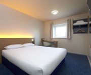
TRAVELODGE BEDFORD WYBOSTON
Tree Garth
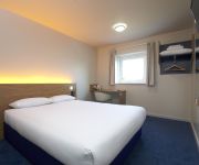
TRAVELODGE BEDFORD GOLDINGTON ROAD
St. Neots (A1/Wyboston)
St. Neots (Colmworth Park)
Bedford (Priory Marina)
Videos from this area
These are videos related to the place based on their proximity to this place.
ECML @ Sandy 22 10 12 feat 5L21 & RHTT
A short lunchtime visit to the footbridge next to Sunderland Road Industrial Estate(Beamish Close), Sandy to get the GBRf 66's on the southern ECML water cannons and 321447 freshly overhauled...
Indian cooking in Moharaja off Sandy
Watch the chefs of Moharaja in Bedfordshire as they cook various delicious dishes. Like comment and subscribe for more videos like this one.
Sandy: Sunderland Road Industrial Estate
A footbridge situated near to the Industrial Estate in Sandy, which crosses over the East Coast Main Line.
Sandy hills
I went through some of my old photo folders on my laptop and found some pictures i took from sandy hills not far from my home. please be sure to like and sub...
sandy upper 2012 final day GOULD
the graphics lot with some other just messing around on the final day of sandy upper.
91007 'Skyfall' ECML Debut Run HD
91007 'Skyfall' makes its debut run on 1Z07 Kings Cross to Edinburgh seen just north of Sandy at speed with matching rake of '007' gun logo Mk4's and DVT 82231 on the rear in matching James...
Cyclone AX3 Curcuit
A clip from the mid 90's when I was learning to fly at Sandy in Bedforshire, terrable landing, well the first one anyway, the second one was smoother {;¬)
Videos provided by Youtube are under the copyright of their owners.
Attractions and noteworthy things
Distances are based on the centre of the city/town and sightseeing location. This list contains brief abstracts about monuments, holiday activities, national parcs, museums, organisations and more from the area as well as interesting facts about the region itself. Where available, you'll find the corresponding homepage. Otherwise the related wikipedia article.
Willington Dovecote and Stables
Willington Dovecote & Stables is a National Trust property located in Willington, near Bedford, Bedfordshire, England. The property is a 16th-century stable and stone dovecote, which contains nesting boxes for over 1500 pigeons. The dovecote and stables themselves were commissioned by Sir John Gostwick.
Cople Pits
Cople Pits is managed as a nature reserve by the Wildlife Trust for Bedfordshire, Cambridgeshire and Northamptonshire. It is located north of Cople village in the county of Bedfordshire.
Blunham railway station
Blunham was a railway station on the Varsity Line which served the small village of the same name in Bedfordshire. Opened in 1862, the station was located in a rural area and saw little passenger traffic; it closed together with the line in 1968.
Willington railway station (Bedfordshire)
Willington was a railway station on the Varsity Line which served the small village of the same name in Bedfordshire. Opened in 1903, the station was located in a rural area and saw little passenger traffic; it closed together with the line in 1968.
Church of All Saints, Cople
Church of All Saints is a Grade I listed church in Cople, Bedfordshire, England. It became a listed building on 13 July 1964. The church, dedicated to All Saints, is constructed of sandstone and Dunstable clunch, in the Early English Period and Perpendicular styles. It contains a chancel with side chapels, nave with clerestory, aisles, south porch and a tower containing 5 bells. On the north side of the chancel, there is a marble altar tomb. The nave and chancel have been restored since 1877.


