Safety Score: 3,0 of 5.0 based on data from 9 authorites. Meaning we advice caution when travelling to Italy.
Travel warnings are updated daily. Source: Travel Warning Italy. Last Update: 2024-04-26 08:02:42
Explore Piampaludo
Piampaludo in Provincia di Savona (Liguria) with it's 61 inhabitants is located in Italy about 266 mi (or 428 km) north-west of Rome, the country's capital.
Local time in Piampaludo is now 12:50 AM (Saturday). The local timezone is named Europe / Rome with an UTC offset of 2 hours. We know of 9 airports in the wider vicinity of Piampaludo, of which 5 are larger airports. The closest airport in Italy is Genova / Sestri Cristoforo Colombo Airport in a distance of 13 mi (or 21 km), East. Besides the airports, there are other travel options available (check left side).
There are several Unesco world heritage sites nearby. The closest heritage site in Italy is Genoa: Le Strade Nuove and the system of the Palazzi dei Rolli in a distance of 18 mi (or 28 km), East. We found 6 points of interest in the vicinity of this place. If you need a place to sleep, we compiled a list of available hotels close to the map centre further down the page.
Depending on your travel schedule, you might want to pay a visit to some of the following locations: Urbe, San Pietro d'Olba, Tiglieto, Casavecchia and Sassello. To further explore this place, just scroll down and browse the available info.
Local weather forecast
Todays Local Weather Conditions & Forecast: 12°C / 54 °F
| Morning Temperature | 11°C / 51 °F |
| Evening Temperature | 11°C / 53 °F |
| Night Temperature | 10°C / 51 °F |
| Chance of rainfall | 7% |
| Air Humidity | 85% |
| Air Pressure | 1011 hPa |
| Wind Speed | Moderate breeze with 9 km/h (6 mph) from West |
| Cloud Conditions | Overcast clouds, covering 100% of sky |
| General Conditions | Moderate rain |
Saturday, 27th of April 2024
12°C (53 °F)
12°C (53 °F)
Light rain, gentle breeze, overcast clouds.
Sunday, 28th of April 2024
16°C (60 °F)
12°C (53 °F)
Moderate rain, moderate breeze, overcast clouds.
Monday, 29th of April 2024
20°C (67 °F)
15°C (59 °F)
Broken clouds, moderate breeze.
Hotels and Places to Stay
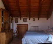
La Casa Inglese
Videos from this area
These are videos related to the place based on their proximity to this place.
Pasqua 2013 Hotel Astigiana Varazze Promozione
Elisa presenta, nella prima newsletter multimediale dell'Hotel Astigiana, la speciale offerta di Pasqua 2013 a Varazze. Non sveliamo nulla e buona visione. Visitate il nostro sito (http://www.hot...
Funghi in Liguria 2013
Davide e Alberto (la Poiana e il Falco de Zena.. prima uscita stagionale nei boschi del Sassello (Sv) in Liguria.
Scogliere coralline del rio Zunini (SV)
Il Rio Zunini presso il paese di Sassello (SV) (famoso per i suoi amaretti)è una località classica per i suoi frangenti corallini fossili che in molti punti rivestono ancora la roccia,l'antica...
U14 Cogoleto Amatori 18 2 2012
Rugby Under 14 Cogoleto Rugby - Amatori Rugby Genova Cogoleto, 18-2-2012.
Claudio Ulivi del CFFS Cogoleto Basket parla del Liguria Summer League e dell' All Stars Game
Claudio Ulivi parla delle due grosse manifestazioni organizzate dal CFFS Cogoleto.
L'ECONOMIA DELLA FELICITA' di Sara Tullo
Conferenze con dibattito organizzate da A.C.C.O con Cogoleto Live - 1a serata porta a cena la cultura " L'ECONOMIA DELLA FELICITA' " presso Sant'Anna Golf Cogoleto Lerca relatore SARA TULLO...
Video tour GIESSE Technology
Video tour della GIESSE Technology HI-TECH BIOMEDICAL INDUSTRY Pratozanino - Cogoleto - Genova.
Videos provided by Youtube are under the copyright of their owners.
Attractions and noteworthy things
Distances are based on the centre of the city/town and sightseeing location. This list contains brief abstracts about monuments, holiday activities, national parcs, museums, organisations and more from the area as well as interesting facts about the region itself. Where available, you'll find the corresponding homepage. Otherwise the related wikipedia article.
Monte Beigua
Monte Beigua is a mountain in the Ligurian Apennines in Liguria, northern Italy, between the two communes of Varazze and Sassello. It is included in the eponymous Regional Park, and, at 1,287 m is the highest peak in the so-called Gruppo del Beigua including Monte Grosso (1,265 m), Monte Ermetta (1,267 m) and Bric Veciri (1,263). It has been hypothized that it was a sacred mountain to the Liguri tribe living here in pre-Roman times, together with the Mont Bégo and Monte Sagro.


