Safety Score: 3,0 of 5.0 based on data from 9 authorites. Meaning we advice caution when travelling to Germany.
Travel warnings are updated daily. Source: Travel Warning Germany. Last Update: 2024-05-18 08:26:29
Touring Leuna-Ockendorf
The district Leuna-Ockendorf of Rössen in Saxony-Anhalt is a subburb located in Germany about 102 mi south-west of Berlin, the country's capital place.
Need some hints on where to stay? We compiled a list of available hotels close to the map centre further down the page.
Being here already, you might want to pay a visit to some of the following locations: Merseburg, Schkopau, Goseck, Schoenburg and Wiedemar. To further explore this place, just scroll down and browse the available info.
Local weather forecast
Todays Local Weather Conditions & Forecast: 14°C / 57 °F
| Morning Temperature | 12°C / 54 °F |
| Evening Temperature | 13°C / 55 °F |
| Night Temperature | 12°C / 53 °F |
| Chance of rainfall | 0% |
| Air Humidity | 82% |
| Air Pressure | 1010 hPa |
| Wind Speed | Gentle Breeze with 6 km/h (4 mph) from North-East |
| Cloud Conditions | Overcast clouds, covering 100% of sky |
| General Conditions | Overcast clouds |
Sunday, 19th of May 2024
19°C (65 °F)
13°C (55 °F)
Light rain, gentle breeze, overcast clouds.
Monday, 20th of May 2024
21°C (70 °F)
15°C (58 °F)
Light rain, light breeze, scattered clouds.
Tuesday, 21st of May 2024
25°C (77 °F)
17°C (62 °F)
Light rain, moderate breeze, overcast clouds.
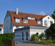
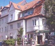
Hotels and Places to Stay
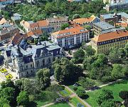
Radisson Blu
Best Western Hotel Halle-Merseburg
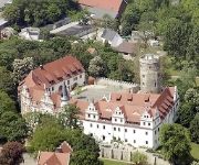
Schlosshotel Schkopau
SKYHOTEL
Check Inn
Am Park
Alte Apotheke
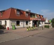
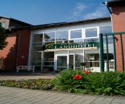
Landhotel Bad Dürrenberg
SKYAPPART
Hostel Altes Salzamt
Videos from this area
These are videos related to the place based on their proximity to this place.
Flug vom Flugplatz Merseburg - Schkopau - Waldbad Leuna [HD]
Denkt daran den Film in HD QUALITÄT zu schauen. Falls er euch gefällt: Kommentieren, Daumen HOCH, teilen und ABONNIEREN! Danke! Flug vom Flugplatz Merseburg - Schkopau - Waldbad Leuna ...
GoPro 3: Simsontreffen Merseburg 2014 Beschleunigungsrennen 21.06.2014 | KC-Racing
Hier ein kurzer Zusammenschnitt von den Beschleunigungsrennen beim Simsontreffen in Merseburg. Es wurde im KO-System gefahren. Wer noch mehr über uns wissen möchte, kann bei Facebook ...
Unternehmernetzwerk Saalekreis, Standort Domstadt Merseburg www.un-sk.info.
Werbetrailer Nicky Schuchardt www.un-sk.info www.ukd69.de www.schuchardt-group.com.
Bibliothek HS Merseburg - Kommunikationspunkt Hochschule
Imagefilm der Bibliothek HS Merseburg von Patrick Richter & Danilo Halle 2012.
Merseburg * Dom und Bischofsstadt an der Saale in Sachsen-Anhalt
Merseburg-Dom und Bischofsstadt an der Saale in Sachsen-Anhalt. Merseburg ist eine Dom- und Hochschulstadt an der Saale im südlichen Sachsen-Anhalt. Sie ist Verwaltungssitz des Landkreises...
LeTigre & Chibi-Rangfar in Merseburg
This is a litte Video from the Fursuitouting in Merseburg (near Halle Saale) from my mate LeTigre (with LeTigre) and me (with Chibi-Rangfar).
Merseburg Dom Stadion SV99 Krankenhaus aus der Luft in [HD]
Denkt daran den Film in HD QUALITÄT zu schauen. Falls er euch gefällt: Kommentieren, Daumen HOCH, teilen und ABONNIEREN! Danke!
Videos provided by Youtube are under the copyright of their owners.
Attractions and noteworthy things
Distances are based on the centre of the city/town and sightseeing location. This list contains brief abstracts about monuments, holiday activities, national parcs, museums, organisations and more from the area as well as interesting facts about the region itself. Where available, you'll find the corresponding homepage. Otherwise the related wikipedia article.
Battle of Lützen (1632)
The Battle of Lützen (1632) was one of the most decisive battles of the Thirty Years' War. It was a Protestant victory, but cost the life of one of the most important leaders of the Protestant alliance, Gustavus Adolphus of Sweden, which caused the Protestant campaign to lose direction.
Merseburg-Querfurt
Merseburg-Querfurt was a district (Kreis) in the south of Saxony-Anhalt, Germany. Neighboring districts were (from northwest clockwise) Sangerhausen, Mansfelder Land, Saalkreis, the district-free city Halle, the districts Delitzsch and Leipziger Land in Saxony, the districts Weißenfels and Burgenlandkreis, and the Kyffhäuserkreis in Thuringia.
Wettin, Saxony-Anhalt
Wettin is a small town and a former municipality in the Saalekreis district of Saxony-Anhalt, Germany, situated on the River Saale north of Halle. Since 1 January 2011, it is part of the town Löbejün-Wettin. It is known for Wettin Castle, the ancestral seat of the House of Wettin, ruling dynasty of Saxony and Poland. Wettin sights include the Tower of Bismarck, the town hall, and the castle (used as the Burggymnasium).
Weisse Elster
The White Elster or Weisse Elster is a 257 kilometres long river in central Europe, right tributary of the Saale. Its source is in the westernmost part of the Czech Republic, near Aš. After a few kilometres, it flows into eastern Germany. In Germany, it flows through the states of Saxony, Thuringia and Saxony-Anhalt.
Kurt-Wabbel-Stadion
The Kurt-Wabbel-Stadion is a multi-purpose stadium in Halle (Saale), Germany. It is currently used mostly for football matches and has a capacity of 23,860.
Lützen-Wiesengrund
Lützen-Wiesengrund was a Verwaltungsgemeinschaft ("collective municipality") in the district Burgenlandkreis, in Saxony-Anhalt, Germany. It was situated east of Weißenfels. The seat of the Verwaltungsgemeinschaft was in Lützen. It was disbanded in January 2011.
Saaletal
Saaletal is a former Verwaltungsgemeinschaft ("collective municipality") in the district Burgenlandkreis in Saxony-Anhalt, Germany. It was situated north of Weißenfels. The seat of the Verwaltungsgemeinschaft was in Großkorbetha. It was disbanded in September 2010. The Verwaltungsgemeinschaft Saaletal consisted of the following municipalities: Burgwerben Großkorbetha Reichardtswerben Schkortleben Storkau Tagewerben Uichteritz
Schkopau Power Station
The Schkopau Power Station is a lignite-fuelled power station near the Korbetha part of the municipality of Schkopau in the district of Merseburg-Querfurt, Germany, which was built in 1995/1996. It has two units with a total capacity of 916 megawatts (MW), from which are 110 MW for traction current. The power station has 200 metres high chimney. It is owned and operated by E. ON AG.
Frankleben hoard
The Frankleben hoard is a significant hoard deposit of the European Bronze Age, associated with the Unstrut group (associated with the Tumulus or early Urnfield culture . The site is in the Geisel valley, formed by a minor tributary of the Saale River. It was discovered in 1946 in a brown coal pit near Frankleben, now a part of Braunsbedra municipality, Saxony-Anhalt, Germany. The hoard consists of three ceramic vessels, buried alongside one another.
Weißenfelser Land
Weißenfelser Land is a former Verwaltungsgemeinschaft ("collective municipality") in the Burgenlandkreis (district), in Saxony-Anhalt, Germany. The seat of the Verwaltungsgemeinschaft was in Weißenfels. It was disbanded in September 2010. The Verwaltungsgemeinschaft Weißenfelser Land consisted of the following municipalities: Leißling
Delitz am Berge
Delitz am Berge is a former municipality in the Saalekreis district, Saxony-Anhalt, Germany. Since January 2008, it is part of the town Bad Lauchstädt.
Bad Dürrenberg (Verwaltungsgemeinschaft)
Bad Dürrenberg was a Verwaltungsgemeinschaft ("collective municipality") in the Saalekreis district, in Saxony-Anhalt, Germany. The seat of the Verwaltungsgemeinschaft was in Bad Dürrenberg. It was disbanded on 1 January 2010. The Verwaltungsgemeinschaft Bad Dürrenberg consisted of the following municipalities: Bad Dürrenberg Nempitz
Merseburg (Verwaltungsgemeinschaft)
Merseburg was a Verwaltungsgemeinschaft ("collective municipality") in the Saalekreis district, in Saxony-Anhalt, Germany. The seat of the Verwaltungsgemeinschaft was in Merseburg. It was disbanded on 1 January 2010. The Verwaltungsgemeinschaft Merseburg consisted of the following municipalities: Geusa
Leuna-Kötzschau
Leuna-Kötzschau was a Verwaltungsgemeinschaft ("collective municipality") in the Saalekreis district, in Saxony-Anhalt, Germany. The seat of the Verwaltungsgemeinschaft was in Leuna. It was disbanded in January 2010. The Verwaltungsgemeinschaft Leuna-Kötzschau consisted of the following municipalities: Friedensdorf Leuna
Merseburg Cathedral
Merseburg Cathedral is the proto-cathedral of the former Bishopric of Merseburg in Merseburg, Germany. Construction on the Gothic cathedral was begun by Bishop Thietmar of Merseburg in 1015. It was consecrated in 1021 in the presence of Henry II. The cathedral was renovated in the Renaissance style from 1510-17. It is considered an artistic and historical highlight in southern Saxony-Anhalt. Since the Reformation it hasn't been the seat of a bishop anymore.
Zschorgula
Zschorgula is part of the small village Schkölen located in the province of Thuringia in East Germany. The Zschorgula has a population of about 80. The village is surrounded by beautiful farms and hills. There is a church in the village. The closest airport is AOC - Altenburg Nobitz, located 45.5 km east of Zschorgula. More nearby airports include LEJ - Leipzig Halle 50.0 km north east, ERF - Erfurt 64.2 km west, HOQ - Hof Plauen 84.7 km south, BYU - Bayreuth 119.6 km south,
Geiseltalsee Solarpark
Geiseltalsee Solarpark, also known as Geiseltalsee, is a 4 MWp photovoltaic power plant located in Merseburg, Germany. The power plant was constructed by BP Solar using 24,864 BP solar modules. The power station was completed in 2004
89.0 RTL
89.0 RTL is a German radio channel whose studios are located in Halle (Saale). It aims at the 14-29 age bracket. It aired first on 24 August 2003 and replaced the radio channel Project 89.0 Digital. While it is licensed to Saxony-Anhalt, the exposed position of the Brocken at 3,743 ft allows the channel to cover large parts of central Germany, including Lower Saxony, Thuringia, Brandenburg and Saxony. The channel can be received on FM 89.0 and on DAB channel 12C.
Halle Central Station
Halle Central Station (Halle Hauptbahnhof) is the main railway station in the city of Halle in southern part of the German state of Saxony-Anhalt. The station is situated east of the city centre and is a category 2 station.
Geisel valley
The Geisel valley is a valley in Saxony-Anhalt, Germany, situated west of Merseburg, Saalekreis district. It is named after the River Geisel which rises in Mücheln and is a tributary of the Saale, just under 25 km long. Its main settlements are Braunsbedra and Mücheln, which in future will merge into the 'collective municipality' of Geiseltal. The Geisel valley was quarried for coal from the 17th century until 1994. The valley is notable for its fossil record.
Georg-Cantor-Gymnasium
The Georg-Cantor-Gymnasium is a German gymnasium in Halle (Saale) with a special focus on mathematics and the sciences. The all-day school was founded in 1989. It is attended by just over 500 students and has a staff of about 60 teachers.
Geisel (river)
Geisel is a river of Saxony-Anhalt, Germany.
Luppe (river)
Luppe is a river of Saxony and Saxony-Anhalt, Germany.
Marktkirche Unser Lieben Frauen
The Marktkirche Unser Lieben Frauen ("Market Church of Our Dear Lady") in the city of Halle, Saxony-Anhalt was built between 1529 and 1554 and is the most recent of its medieval churches. In German, its official name is shortened to Liebfrauenkirche but it is also referred to as Marienkirche (St. Mary's Church) and the Marktkirche (Market Church). The church was built between 1529 and 1554, replacing two former churches but keeping their towers.
Erdgas Sportpark
Erdgas Sportpark, is a stadium in Halle, Germany. It has a capacity of 15,057 spectators. It is the home of Hallescher FC and replaced Kurt-Wabbel-Stadion.







!['Flug vom Flugplatz Merseburg - Schkopau - Waldbad Leuna [HD]' preview picture of video 'Flug vom Flugplatz Merseburg - Schkopau - Waldbad Leuna [HD]'](https://img.youtube.com/vi/vps4AD9n6AQ/mqdefault.jpg)


!['Merseburg Dom Stadion SV99 Krankenhaus aus der Luft in [HD]' preview picture of video 'Merseburg Dom Stadion SV99 Krankenhaus aus der Luft in [HD]'](https://img.youtube.com/vi/fjop5SEMvUM/mqdefault.jpg)