Safety Score: 3,0 of 5.0 based on data from 9 authorites. Meaning we advice caution when travelling to Germany.
Travel warnings are updated daily. Source: Travel Warning Germany. Last Update: 2024-05-02 08:23:34
Delve into Waldleiningen
Waldleiningen in Rhineland-Palatinate with it's 453 habitants is located in Germany about 323 mi (or 520 km) south-west of Berlin, the country's capital town.
Current time in Waldleiningen is now 04:20 PM (Thursday). The local timezone is named Europe / Berlin with an UTC offset of 2 hours. We know of 12 airports close to Waldleiningen, of which 5 are larger airports. The closest airport in Germany is Zweibrücken Airport in a distance of 25 mi (or 41 km), South-West. Besides the airports, there are other travel options available (check left side).
There are several Unesco world heritage sites nearby. The closest heritage site in Germany is Speyer Cathedral in a distance of 26 mi (or 42 km), East. If you need a hotel, we compiled a list of available hotels close to the map centre further down the page.
While being here, you might want to pay a visit to some of the following locations: Hochspeyer, Elmstein, Fischbach, Enkenbach-Alsenborn and Mehlingen. To further explore this place, just scroll down and browse the available info.
Local weather forecast
Todays Local Weather Conditions & Forecast: 12°C / 53 °F
| Morning Temperature | 12°C / 54 °F |
| Evening Temperature | 9°C / 49 °F |
| Night Temperature | 8°C / 46 °F |
| Chance of rainfall | 9% |
| Air Humidity | 97% |
| Air Pressure | 1001 hPa |
| Wind Speed | Moderate breeze with 12 km/h (8 mph) from East |
| Cloud Conditions | Overcast clouds, covering 100% of sky |
| General Conditions | Moderate rain |
Friday, 3rd of May 2024
12°C (54 °F)
8°C (46 °F)
Light rain, moderate breeze, overcast clouds.
Saturday, 4th of May 2024
14°C (58 °F)
8°C (47 °F)
Light rain, gentle breeze, overcast clouds.
Sunday, 5th of May 2024
13°C (55 °F)
8°C (47 °F)
Light rain, gentle breeze, broken clouds.
Hotels and Places to Stay
Barbarossahof
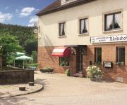
Klosterhof Landgasthaus - Pension
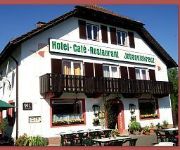
Johanniskreuz
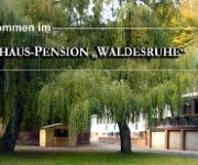
Waldesruhe Gasthaus Pension
Videos from this area
These are videos related to the place based on their proximity to this place.
Wanderung durch das Leinbachtal
Wanderung duch das Leinbachtal bei Frankenstein / Pfalz. Ein herrliches langgezogenes Tal mit kleinen Seitentäler die man unbedingt besuchen sollte. An den Hängen findet man viele ...
[HQ] meinerouten.de ~ Suzuki GS 500 E ~ Bad Dürkheim - Hochspeyer
Streckenabschnitt: Bad Dürkheim - Frankenstein - Hochspeyer Motorrad: Suzuki GS 500 E Helmkamera: BlickVang 420 Musik: Rise Against - Ready to Fall Mehr auf www.meinerouten.de ;-)
Gibt es doch noch Höhlenmenschen ? Gedreht wurde mit der Samsung NV 24 HD
Immer wieder entdecken wir bei unseren Exkursionen im Pfälzer Wald Höhlen die scheinbar bewohnt sind....wer mag hier hausen !
Rennrad Rollwiderstand vs. Mountainbike aerodynamische Sitzposition plus Power;-) HD
Rennradtour durch das Elmsteiner Tal (L499) von Johanniskreuz nach Elmstein. Hier zeigt sich mal wieder dass man mit dem MTB ganz gut mit Rennradler fahren kann;-) Einfach bergab die Rübe...
Street View ( Eine Fahrt durch den Pfälzer Wald )
Street View Eine Fahrt durch den Pfälzer Wald, von Elmstein bis nach Weidenthal.
Mountainbike Singletrail Parcours Hochspeyer - Slalomtrail orange Erstbefahrung
www.singletrail.cc Mountainbiketouren - Fahrtechnik - Verleih www.mountainbikepark-pfaelzerwald.de.
Gespann RUKO K1300S Hochspeyer nach Johanniskreuz
Fahrt mit einem RUKO BMW K1300S Gespann von Hochspeyer nach Johanniskreuz.
Videos provided by Youtube are under the copyright of their owners.
Attractions and noteworthy things
Distances are based on the centre of the city/town and sightseeing location. This list contains brief abstracts about monuments, holiday activities, national parcs, museums, organisations and more from the area as well as interesting facts about the region itself. Where available, you'll find the corresponding homepage. Otherwise the related wikipedia article.
Hochspeyer (Verbandsgemeinde)
Hochspeyer is a Verbandsgemeinde ("collective municipality") in the district of Kaiserslautern, Rhineland-Palatinate, Germany. The seat of the Verbandsgemeinde is in Hochspeyer. The Verbandsgemeinde Hochspeyer consists of the following Ortsgemeinden ("local municipalities"): Fischbach Frankenstein Hochspeyer
Hochspeyerbach
The Hochspeyerbach is a 21 km long river in the Palatinate forest in Rhineland-Palatinate and a left tributary of the Speyerbach.


!['[HQ] meinerouten.de ~ Suzuki GS 500 E ~ Bad Dürkheim - Hochspeyer' preview picture of video '[HQ] meinerouten.de ~ Suzuki GS 500 E ~ Bad Dürkheim - Hochspeyer'](https://img.youtube.com/vi/eryloSoBniA/mqdefault.jpg)


