Safety Score: 3,0 of 5.0 based on data from 9 authorites. Meaning we advice caution when travelling to Germany.
Travel warnings are updated daily. Source: Travel Warning Germany. Last Update: 2024-05-02 08:23:34
Discover Münchhof
Münchhof in Rhineland-Palatinate is a city in Germany about 320 mi (or 516 km) south-west of Berlin, the country's capital city.
Local time in Münchhof is now 02:29 AM (Friday). The local timezone is named Europe / Berlin with an UTC offset of 2 hours. We know of 12 airports in the vicinity of Münchhof, of which 5 are larger airports. The closest airport in Germany is Worms Airport in a distance of 24 mi (or 38 km), North-East. Besides the airports, there are other travel options available (check left side).
There are several Unesco world heritage sites nearby. The closest heritage site in Germany is Speyer Cathedral in a distance of 26 mi (or 41 km), East. We discovered 1 points of interest in the vicinity of this place. Looking for a place to stay? we compiled a list of available hotels close to the map centre further down the page.
When in this area, you might want to pay a visit to some of the following locations: Hochspeyer, Fischbach, Enkenbach-Alsenborn, Waldleiningen and Mehlingen. To further explore this place, just scroll down and browse the available info.
Local weather forecast
Todays Local Weather Conditions & Forecast: 14°C / 56 °F
| Morning Temperature | 8°C / 47 °F |
| Evening Temperature | 13°C / 55 °F |
| Night Temperature | 7°C / 44 °F |
| Chance of rainfall | 6% |
| Air Humidity | 56% |
| Air Pressure | 1013 hPa |
| Wind Speed | Moderate breeze with 11 km/h (7 mph) from North-East |
| Cloud Conditions | Overcast clouds, covering 94% of sky |
| General Conditions | Moderate rain |
Saturday, 4th of May 2024
9°C (48 °F)
9°C (48 °F)
Moderate rain, light breeze, overcast clouds.
Sunday, 5th of May 2024
15°C (59 °F)
11°C (52 °F)
Light rain, gentle breeze, broken clouds.
Monday, 6th of May 2024
13°C (55 °F)
11°C (52 °F)
Moderate rain, light breeze, overcast clouds.
Hotels and Places to Stay
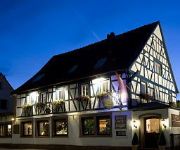
Kölbl
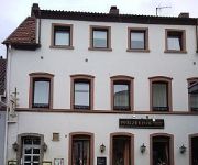
Pfälzer Hof
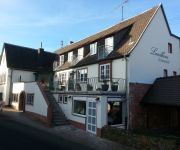
Grinnerhof Landhaus
Barbarossahof
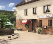
Klosterhof Landgasthaus - Pension
Videos from this area
These are videos related to the place based on their proximity to this place.
Druckprodukte Werbedrucksachen Vereinsdrucksachen Kleinoffsetdruckerei E. Kutas GmbH Mehlingen
Um die Bedürfnisse unserer Kunden optimal abzudecken, bieten wir die Personalisierung Ihrer Briefe, Anschreiben und Postkarten sowie Adressierungen in unserem Hause an. Kuvertieren und ...
Rasentraktor-Rennen Sembach 2014
Großer Preis von Sembach. Rasentraktor-Rennen 2014 vom 18.07.-20.07.2014.
Alsenborn von Oben Erleben Sonnenuntergang
Da mir mal gerade danach war machte ich ein paar tolle aufnahmen.
Rasentraktor-Rennen Sembach 2014
Großer Preis von Sembach. Rasentraktor-Rennen 2014 vom 18.07.-20.07.2014.
Sembach Air Base: Ghosts of the Cold War
Here is a walkthrough of the former flight line of Sembach Air Base, Germany. The flight line was closed in 1995, although the annex area, about a mile from the former flight line, is still...
Burg Frankenstein in Rheinland Pfalz
Die Ruine der Burg Frankenstein steht auf einem Bergsporn oberhalb der Gemeinde Frankenstein in Rheinland-Pfalz und gehört zu dem Typus der Spornburgen. Ihren Namen erhielt sie von dem dort.
Rund um die Burg Frankenstein in der Pfalz
Wandern rund um die Burg Frankenstein beim gleichnamigen Ort Frankenstein in der Pfalz. Eine alte Burg, ein noch älterer Steinbruch und eine Fantaflasche aus den 80 zigern.
Pfalz - Diemerstein & Frankenstein
Besuch der Burgen Diemerstein und Frankenstein in der Pfalz von Stephan W. Neubauer - Intro, Foto´s, Video´s und Texte von Stephan W. Neubauer - musikalische Untermalung mit lizensfreien...
Bad Dürkheim Wanderung Rußhütte Erlenbach Isenach Quelle Frankenstein
Von der Rußhütte in Frankenstein den Erlenbach entlang zur Wattenheimer Hütte Amtmannsplatz den gelbweissen Pfad zum Ursprung der Isenach. Von der Quelle ins Tal und nach rechts Richtung...
Steam locomotive 01 045 - Frankenstein, 27th September 2009
Steam locomotive 01 045 passes through Frankenstein (Pfalz) shortly after 3pm on Sunday 27th September 2009 during the Reisen wie vor 50 Jahren (Travel as 50 years ago) plandampf to celebrate...
Videos provided by Youtube are under the copyright of their owners.
Attractions and noteworthy things
Distances are based on the centre of the city/town and sightseeing location. This list contains brief abstracts about monuments, holiday activities, national parcs, museums, organisations and more from the area as well as interesting facts about the region itself. Where available, you'll find the corresponding homepage. Otherwise the related wikipedia article.
Hochspeyer (Verbandsgemeinde)
Hochspeyer is a Verbandsgemeinde ("collective municipality") in the district of Kaiserslautern, Rhineland-Palatinate, Germany. The seat of the Verbandsgemeinde is in Hochspeyer. The Verbandsgemeinde Hochspeyer consists of the following Ortsgemeinden ("local municipalities"): Fischbach Frankenstein Hochspeyer
823d Tactical Missile Squadron
The 823d Tactical Missile Squadron is an inactive United States Air Force unit. Its last assignment was with the 38th Tactical Missile Wing, based at Sembach Air Base, West Germany. It was inactivated on 25 September 1966.
Franzosenwoog
Franzosenwoog is a lake in Pfälzerwald, Rhineland-Palatinate, Germany. At an elevation of, its surface area is ca. 8900 m².
Hochspeyerbach
The Hochspeyerbach is a 21 km long river in the Palatinate forest in Rhineland-Palatinate and a left tributary of the Speyerbach.


