Safety Score: 3,0 of 5.0 based on data from 9 authorites. Meaning we advice caution when travelling to Germany.
Travel warnings are updated daily. Source: Travel Warning Germany. Last Update: 2024-04-29 08:03:39
Discover Mückenwiese
Mückenwiese in Rhineland-Palatinate is a town in Germany about 325 mi (or 523 km) south-west of Berlin, the country's capital city.
Current time in Mückenwiese is now 05:37 PM (Monday). The local timezone is named Europe / Berlin with an UTC offset of 2 hours. We know of 12 airports near Mückenwiese, of which 5 are larger airports. The closest airport in Germany is Zweibrücken Airport in a distance of 24 mi (or 39 km), South-West. Besides the airports, there are other travel options available (check left side).
There are several Unesco world heritage sites nearby. The closest heritage site in Germany is Speyer Cathedral in a distance of 25 mi (or 41 km), East. Looking for a place to stay? we compiled a list of available hotels close to the map centre further down the page.
When in this area, you might want to pay a visit to some of the following locations: Waldleiningen, Elmstein, Hochspeyer, Fischbach and Esthal. To further explore this place, just scroll down and browse the available info.
Local weather forecast
Todays Local Weather Conditions & Forecast: 18°C / 64 °F
| Morning Temperature | 8°C / 46 °F |
| Evening Temperature | 17°C / 63 °F |
| Night Temperature | 10°C / 51 °F |
| Chance of rainfall | 0% |
| Air Humidity | 53% |
| Air Pressure | 1020 hPa |
| Wind Speed | Light breeze with 4 km/h (2 mph) from North-West |
| Cloud Conditions | Overcast clouds, covering 95% of sky |
| General Conditions | Overcast clouds |
Tuesday, 30th of April 2024
20°C (68 °F)
14°C (57 °F)
Light rain, gentle breeze, few clouds.
Wednesday, 1st of May 2024
20°C (68 °F)
14°C (57 °F)
Light rain, moderate breeze, overcast clouds.
Thursday, 2nd of May 2024
10°C (50 °F)
8°C (46 °F)
Moderate rain, moderate breeze, overcast clouds.
Hotels and Places to Stay
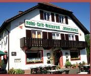
Johanniskreuz
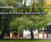
Waldesruhe Gasthaus Pension
Videos from this area
These are videos related to the place based on their proximity to this place.
Bowhunter Elmstein mit Kurt de Kill www.trabow.de
3D Bogenschiessen in Elmstein mit Kurt "de Kill" weitere Info Internet: www.trabow.de.
Rennrad Rollwiderstand vs. Mountainbike aerodynamische Sitzposition plus Power;-) HD
Rennradtour durch das Elmsteiner Tal (L499) von Johanniskreuz nach Elmstein. Hier zeigt sich mal wieder dass man mit dem MTB ganz gut mit Rennradler fahren kann;-) Einfach bergab die Rübe...
Street View ( Eine Fahrt durch den Pfälzer Wald )
Street View Eine Fahrt durch den Pfälzer Wald, von Elmstein bis nach Weidenthal.
Demo Langerkopf Germany von Initiative pro Pfälzerwald T7/8 8.4.2014
Auszug aus der HP: http://propfaelzerwald.de/?page_id=137 Demonstration im zentralen Pfälzerwald ... denn die LANDESREGIERUNG fördert dort am Mosisberg den Bau von Windrädern! 08.04.14...
Demo Langerkopf Germany von Initiative pro Pfälzerwald T6/8 8.4.2014
Auszug aus der HP: http://propfaelzerwald.de/?page_id=137 Demonstration im zentralen Pfälzerwald ... denn die LANDESREGIERUNG fördert dort am Mosisberg den Bau von Windrädern! 08.04.14...
Demo Langerkopf Germany von Initiative pro Pfälzerwald T5/8 8.4.2014
Auszug aus der HP: http://propfaelzerwald.de/?page_id=137 Demonstration im zentralen Pfälzerwald ... denn die LANDESREGIERUNG fördert dort am Mosisberg den Bau von Windrädern! 08.04.14...
Demo Langerkopf Germany von Initiative pro Pfälzerwald T8/8 8.4.2014
Auszug aus der HP: http://propfaelzerwald.de/?page_id=137 Demonstration im zentralen Pfälzerwald ... denn die LANDESREGIERUNG fördert dort am Mosisberg den Bau von Windrädern! 08.04.14...
Demo Langerkopf Germany von Initiative pro Pfälzerwald T1/8 8.4.2014
Auszug aus der HP: http://propfaelzerwald.de/?page_id=137 Demonstration im zentralen Pfälzerwald ... denn die LANDESREGIERUNG fördert dort am Mosisberg den Bau von Windrädern! 08.04.14...
Videos provided by Youtube are under the copyright of their owners.
Attractions and noteworthy things
Distances are based on the centre of the city/town and sightseeing location. This list contains brief abstracts about monuments, holiday activities, national parcs, museums, organisations and more from the area as well as interesting facts about the region itself. Where available, you'll find the corresponding homepage. Otherwise the related wikipedia article.
Speyerbach
The Speyerbach is a left tributary of the Rhine in the Palatinate part of Rhineland-Palatinate. In Speyer, the river split into Gießhübelbach and Woogbach. The Woogbach changes its name to Nonnenbach, then flows into Gießhübelbach shortly before the latter flows into the Rhine.
Erlenbach (Speyerbach)
The Erlenbach is a river in the Palatinate Forest, in the (Palatinate region of Rhineland-Palatinate. It is the strongest headwater of the Speyerbach, which is the largest river in the Anterior Palatinate. The Erlenbach rises at a height of about 460 m on the eastern slope of Mount Eschkopf, hence on the eastern side of the Palatinate watershed. If flows generally to the north and after only 5 km flows into the Speyerbach shortly after the latter's nominal spring at Speyerbrunn.


