Safety Score: 3,0 of 5.0 based on data from 9 authorites. Meaning we advice caution when travelling to Germany.
Travel warnings are updated daily. Source: Travel Warning Germany. Last Update: 2024-05-01 08:01:32
Discover Schlaifhausen
Schlaifhausen in Upper Franconia (Bavaria) is a city in Germany about 218 mi (or 351 km) south-west of Berlin, the country's capital city.
Local time in Schlaifhausen is now 07:28 AM (Thursday). The local timezone is named Europe / Berlin with an UTC offset of 2 hours. We know of 11 airports in the vicinity of Schlaifhausen, of which 4 are larger airports. The closest airport in Germany is Nuremberg Airport in a distance of 15 mi (or 24 km), South. Besides the airports, there are other travel options available (check left side).
There are several Unesco world heritage sites nearby. The closest heritage site in Germany is Town of Bamberg in a distance of 17 mi (or 28 km), North-West. We discovered 1 points of interest in the vicinity of this place. Looking for a place to stay? we compiled a list of available hotels close to the map centre further down the page.
When in this area, you might want to pay a visit to some of the following locations: Leutenbach, Wiesenthau, Kirchehrenbach, Kunreuth and Pinzberg. To further explore this place, just scroll down and browse the available info.
Local weather forecast
Todays Local Weather Conditions & Forecast: 16°C / 61 °F
| Morning Temperature | 12°C / 54 °F |
| Evening Temperature | 14°C / 56 °F |
| Night Temperature | 10°C / 50 °F |
| Chance of rainfall | 0% |
| Air Humidity | 75% |
| Air Pressure | 1001 hPa |
| Wind Speed | Gentle Breeze with 8 km/h (5 mph) from East |
| Cloud Conditions | Scattered clouds, covering 44% of sky |
| General Conditions | Light rain |
Friday, 3rd of May 2024
11°C (53 °F)
8°C (46 °F)
Moderate rain, gentle breeze, overcast clouds.
Saturday, 4th of May 2024
15°C (59 °F)
10°C (51 °F)
Overcast clouds, calm.
Sunday, 5th of May 2024
14°C (57 °F)
8°C (46 °F)
Light rain, gentle breeze, overcast clouds.
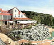
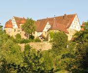
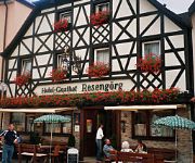
Hotels and Places to Stay
Ehrenbürg
Schlosshotel
Brennereihotel Sponsel
Franken
Resengoerg
Sonne29
Videos from this area
These are videos related to the place based on their proximity to this place.
Ampel / Verkehrsampelmodernisierung auf dem Verkehrsübungsplatz in Forchheim - Teil 2
Unsere private Lichtsignalanlagenumrüstungsaktion auf dem Verkehrsübungsplatz in Forchheim... http://www.fahrenübenohneführerschein.de.
Der Nussknacker
Ein weiteres Video zu unserer How to Climb Folge. Viel spass beim anschauen und nachmachen.
Wandern in Deutschland: Dieses mal geht es zum Walberla bei Forchheim
Ich hoffe es hat euch Gefallen ist mein aller erstes Wandervideo das ich vertont habe... seid nicht zu Streng mit mir... Ihr findet mich auch bei Facebook: https://www.facebook.com/TobiasGuentherFo...
Gosberg 950 Jahre - Historischer Festumzug (Teil 2)
Im Jahr 1062 schenkte der damals zwölfjährige König Heinrich IV. Gosberg (Gozzespuhel = Hügel des Götz) und 35 weitere Dörfer in der Fränkischen Schweiz dem Bistum Bamberg. Am 13.7.1062...
Gosberg 950 Jahre - Historischer Festumzug (Teil 1)
Im Jahr 1062 schenkte der damals zwölfjährige König Heinrich IV. Gosberg (Gozzespuhel = Hügel des Götz) und 35 weitere Dörfer in der Fränkischen Schweiz dem Bistum Bamberg. Am 13.7.1062...
Wandern Franken: von Gaiganz nach Schlaifhausen beim Rodenstein im Herbst
Herrliche Herbstwanderung mit ständig schönem Panorama von Hetzles, Rodenstein, Schlaifhausen... Tour- Beschreibung und GPS- Daten bei gps-tour.info.
Die Kirschblüte bei Leutenbach am Walberla - Fränkische Schweiz
http://fraenkische-schweiz.bayern-online.de/die-region/staedte-gemeinden/leutenbach/ Unser Video entstand zu Beginn der Kirschblüte bei Leutenbach in der Fränkischen Schweiz. Leutenbach...
Wandern Franken: Ehrenbachtal bei Leutenbach im Spätherbst
Von Leutenbach auf schönem Weg bis kurz vor Kirchehrenbach und westlich des Ehrenbachs zurück nach Leutenbach.
Videos provided by Youtube are under the copyright of their owners.
Attractions and noteworthy things
Distances are based on the centre of the city/town and sightseeing location. This list contains brief abstracts about monuments, holiday activities, national parcs, museums, organisations and more from the area as well as interesting facts about the region itself. Where available, you'll find the corresponding homepage. Otherwise the related wikipedia article.
Ehrenbürg
The Ehrenbürg is a double-peaked butte on the edge of the Franconian Jura in Bavaria, Germany. It is in the district of Forchheim in Upper Franconia, in the municipalities of Kirchehrenbach, Leutenbach and Wiesenthau. The north peak is the 513.9 m Walberla, the south peak the 531.7 m Rodenstein (previously known as the Bodenstein). The entire mountain is popularly known as the Walberla.


