Safety Score: 2,7 of 5.0 based on data from 9 authorites. Meaning we advice caution when travelling to United States.
Travel warnings are updated daily. Source: Travel Warning United States. Last Update: 2024-04-29 08:03:39
Touring Calvert Hills
Calvert Hills in Blair County (Pennsylvania) is a town located in United States about 134 mi (or 215 km) north-west of Washington DC, the country's capital place.
Time in Calvert Hills is now 09:45 AM (Monday). The local timezone is named America / New York with an UTC offset of -4 hours. We know of 13 airports nearby Calvert Hills, of which 5 are larger airports. The closest airport in United States is Altoona Blair County Airport in a distance of 16 mi (or 26 km), South. Besides the airports, there are other travel options available (check left side).
Also, if you like the game of golf, there are several options within driving distance. We collected 1 points of interest near this location. Need some hints on where to stay? We compiled a list of available hotels close to the map centre further down the page.
Being here already, you might want to pay a visit to some of the following locations: Hollidaysburg, Ebensburg, Huntingdon, Bedford and Clearfield. To further explore this place, just scroll down and browse the available info.
Local weather forecast
Todays Local Weather Conditions & Forecast: 25°C / 77 °F
| Morning Temperature | 15°C / 58 °F |
| Evening Temperature | 21°C / 69 °F |
| Night Temperature | 17°C / 62 °F |
| Chance of rainfall | 3% |
| Air Humidity | 50% |
| Air Pressure | 1016 hPa |
| Wind Speed | Gentle Breeze with 7 km/h (4 mph) from East |
| Cloud Conditions | Overcast clouds, covering 85% of sky |
| General Conditions | Moderate rain |
Monday, 29th of April 2024
22°C (71 °F)
15°C (58 °F)
Moderate rain, gentle breeze, overcast clouds.
Tuesday, 30th of April 2024
22°C (71 °F)
16°C (61 °F)
Sky is clear, gentle breeze, clear sky.
Wednesday, 1st of May 2024
21°C (69 °F)
15°C (58 °F)
Scattered clouds, gentle breeze.
Hotels and Places to Stay
Hotel Shakti Continental
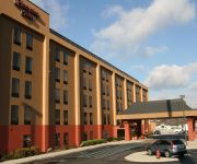
Hampton Inn Altoona
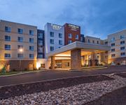
Fairfield Inn & Suites Altoona
TownePlace Suites Altoona
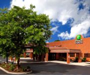
Courtyard Altoona
Quality Inn & Suites Altoona
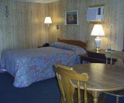
Cedar Grove Motel
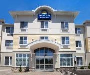
Days Inn & Suites Altoona
Wingate by Wyndham Altoona
Econo Lodge Altoona
Videos from this area
These are videos related to the place based on their proximity to this place.
(7) The Pennsylvanian Arriving & Departing Altoona Oct. 27 2014
The east bound Pennsylvanian, Amtrak 42 arrives and departs the station in Altoona, Pennsylvania. October 27 2014.
(4) NS 261 @Altoona Oct. 27 2014
After two SD40E helper sets head off to their next assignments a west bound roadrailer train, NS 261 comes through Altoona. October 27 2014.
(2) NS 60Z & 64C @ Altoona Oct. 27 2014
A west bound loaded steel slab train, NS 60Z comes through Altoona with four SD40E helpers on the rear end as they begin their journey over the Allegheny Mountains. As the helpers pass by an...
(5) NS 64K @ Altoona Oct. 27 2014
An east bound ethanol train, NS 64K comes through Altoona after successfully crossing the Allegheny Mountains on Norfolk Southerns Pittsburgh Line. The SD40 helper set that was on the rear...
(12) NS 13G @ Altoona Oct. 26 2014
SD40E helper sets on the point and on the rear end bring NS 13G through Altoona. The helpers were just added to this west bound mixed freight so it could successfully accomplish its Allegheny...
(17) NS SD40E's @ Altoona Oct. 26 2014
A SD40E helper set travels west through Altoona. October 26 2014.
(1) NS 25W @ Altoona Oct. 27 2014
After the SD40E helper sets go by a west bound train of bare tables, NS 25W comes through Altoona. October 27 2014.
(6) NS 24Z @ Altoona Oct. 27 2014
An east bound Double stack container train, NS 24Z comes through Altoona. October 27 2014.
(11) Undoing The Bottleneck @ Altoona Sept. 6 2014
Upon arriving at the Altoona Railwalk this is what was happening. I couldn't get my gear set up in time to catch the head end of the first stack train that was heading west. There was a bit...
(14) NS 25T @ Altoona Oct. 26 2014
A Union Pacific SD70M lends its support to two Norfolk Southern GE's as this west bound double stack container train, NS 25T comes through Altoona with two SD40E helper locomotives on the rear...
Videos provided by Youtube are under the copyright of their owners.
Attractions and noteworthy things
Distances are based on the centre of the city/town and sightseeing location. This list contains brief abstracts about monuments, holiday activities, national parcs, museums, organisations and more from the area as well as interesting facts about the region itself. Where available, you'll find the corresponding homepage. Otherwise the related wikipedia article.
Altoona, Pennsylvania
Altoona is a third class city in Blair County, Pennsylvania, United States. It is the principal city of the Altoona Metropolitan Statistical Area (MSA). The population was 46,320 at the time of the 2010 Census, making it the tenth most populous city in Pennsylvania. The Altoona MSA includes all of Blair County and was recorded as having a population of 127,089 at the 2010 Census, around 100,000 of which live within a 5-mile radius of the Altoona city center according to U.S.
Altoona Area High School
Altoona Area High School is the public high school for the Altoona Area School District in Altoona, Pennsylvania. The high school serves the communities of Altoona, Logan Township, and a small portion of Tyrone Township. The school is located at 1415 Sixth Avenue, in the downtown section of Altoona, PA 16602. The school district is the eighteenth largest in the state, and the high school is one of the largest and well known in the state.
Altoona Transportation Center
The Altoona Transportation Center is an intermodal passenger facility built in 1986 providing local bus, intercity bus, and rail services. It is located at 1231 11th Avenue in downtown Altoona, Pennsylvania. AMTRAN is the local public transit provider in the greater Altoona area. The primary user of the Altoona Transportation Center, almost all regular AMTRAN bus routes and selected "Tripper" routes stop at the center. The Transportation Center is considered the AMTRAN system's primary hub.
Veterans Memorial Field
Veterans Memorial Field is a stadium in Altoona, Pennsylvania. It is primarily used for baseball and was the home of Altoona Rail Kings. The ballpark has a capacity of 3,000.
WRTA (AM)
WRTA is a News/Talk/Sports formatted broadcast radio station licensed to Altoona, Pennsylvania, serving Altoona and Blair County, Pennsylvania. WRTA is owned and operated by Sherlock Broadcasting, Inc.
Railroaders Memorial Museum
The Railroaders Memorial Museum (RMM) is a railroad museum in Altoona, Pennsylvania. The museum is dedicated to revealing, interpreting, commemorating and celebrating the significant contributions of railroaders and their families to American life and industry. Altoona is one of the hubs of the area's growing tourist industry. Many significant cultural resources are within the city itself, and most of these resources are linked directly to the city's long history as a railroad center.
War Governors' Conference
The Loyal War Governors' Conference was an important political event of the American Civil War. It was held at the Logan House Hotel in Altoona, Pennsylvania on September 24 and 25, 1862. Thirteen governors of Union states came together to discuss the war effort, state troop quotas, and the ultimate support of President Abraham Lincoln and his Emancipation Proclamation. The leaders also suggested the removal of General George B. McClellan as commander of the Army of the Potomac.
WMES-LP
WMES-LP is a religious (Catholic) radio station serving the Altoona, PA market. The station broadcasts current and previous Catholic masses and is strongly geared towards the Catholic religion.
Greater Altoona Career and Technology Center
Greater Altoona Career and Technology Center is a vocational school that serves the area around Blair County, Pennsylvania.
Altoona Alliance Church
Altoona Alliance Church is a mid-sized church associated with the Christian and Missionary Alliance located in Altoona, Pennsylvania Founded in 1891 by Rev. Frederick Senft, who would one day go on to become president of the Christian and Missionary Alliance. Over the 119 years of its existence the Altoona Alliance Church has had 26 pastors and has been located in at least 17 different locations throughout the city. Currently the Altoona Alliance Church is led by Rev. Tim McGarvey.
Jaffa Shrine Center
The Jaffa Shrine Center is a 3,200-seat multipurpose arena located in Altoona, Pennsylvania. The current Shrine Center, headquarters to the Jaffa Shriners, was built in 1930, opening on September 25 of that year. It was the largest convention center in Blair County until the Blair County Convention Center was built. The Shrine Center building is a bilevel building measuring 216 feet by 206 feet .


