Safety Score: 2,7 of 5.0 based on data from 9 authorites. Meaning we advice caution when travelling to United States.
Travel warnings are updated daily. Source: Travel Warning United States. Last Update: 2024-04-25 08:17:04
Explore Maspeth
Maspeth in Queens County (New York) with it's 48,325 inhabitants is located in United States about 208 mi (or 335 km) north-east of Washington DC, the country's capital.
Local time in Maspeth is now 12:41 AM (Friday). The local timezone is named America / New York with an UTC offset of -4 hours. We know of 9 airports in the wider vicinity of Maspeth, of which 4 are larger airports. The closest airport in United States is La Guardia Airport in a distance of 4 mi (or 7 km), North-East. Besides the airports, there are other travel options available (check left side).
There are two Unesco world heritage sites nearby. The closest heritage site in United States is Statue of Liberty in a distance of 3 mi (or 5 km), South-West. Also, if you like golfing, there are multiple options in driving distance. We found 10 points of interest in the vicinity of this place. If you need a place to sleep, we compiled a list of available hotels close to the map centre further down the page.
Depending on your travel schedule, you might want to pay a visit to some of the following locations: Manhattan, Brooklyn, Queens, The Bronx and Jersey City. To further explore this place, just scroll down and browse the available info.
Local weather forecast
Todays Local Weather Conditions & Forecast: 14°C / 56 °F
| Morning Temperature | 7°C / 44 °F |
| Evening Temperature | 13°C / 55 °F |
| Night Temperature | 10°C / 49 °F |
| Chance of rainfall | 0% |
| Air Humidity | 32% |
| Air Pressure | 1032 hPa |
| Wind Speed | Gentle Breeze with 8 km/h (5 mph) from North |
| Cloud Conditions | Clear sky, covering 0% of sky |
| General Conditions | Sky is clear |
Friday, 26th of April 2024
13°C (56 °F)
12°C (53 °F)
Overcast clouds, moderate breeze.
Saturday, 27th of April 2024
15°C (59 °F)
15°C (59 °F)
Light rain, gentle breeze, overcast clouds.
Sunday, 28th of April 2024
19°C (67 °F)
14°C (58 °F)
Light rain, gentle breeze, overcast clouds.
Hotels and Places to Stay
The Paper Factory Hotel
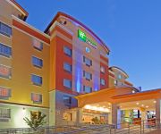
Holiday Inn Express QUEENS - MASPETH
Habitat 101
Home2 Suites by Hilton New York Long Island City NY
Courtyard Long Island City/New York Manhattan View
Hilton Garden Inn Long Island City-Manhattan View
Fairfield Inn & Suites New York Queens/Queensboro Bridge
RNYNY - RED CARPET INN BROOKLYN
Henry Norman Hotel
Fairfield Inn New York Long Island City/Manhattan View
Videos from this area
These are videos related to the place based on their proximity to this place.
Signal Problems
December 11, 2013 00:32 Signal problems on the 7 line caused major headaches to riders all day. Train service resumed, but signals had to be configured to allow trains to pass them until the...
Snowbirds! Train of R62A Cars Pass 46th Street on the Express Track
Under a Winter Plan 4, NYC Transit puts as many trains as possible into underground tunnels in order to prevent ice and snow from building up around critical components. This ensures the trains...
MTA New York City Bus: New Flyer XD40 #7204 B13 @ Palmetto Street & Myrtle Avenue (Ridgewood Term)!
Wyckoff Avenue-DeKalb Avenue/Wyckoff Heights Hospital bound #7204 B13 New Flyer XD40 bus leaves bus stop @ Palemetto Street and Myrtle Avenue (Ridgewood Bus Terminal)! P.S. This video ...
New York City: Report about the former NYC EMS - Part 9 - Dispatch Center
I will show parts of my offical report about the former NYC EMS ( New York City Emergency Medical Service ), since 1996 part of FDNY. I'd done this report summer 1993. Part 9: take a look...
Baby Mario at Fresh Pond Road
Metropolitan Avenue-bound M shuttle train of R160As arriving at, stopping, and leaving Fresh Pond Road.
BMT Myrtle Aveue Local: Brooklyn bound R-160A-1 M local train @ Fresh Pond Road!
Brooklyn bound M local arrives and leaves Fresh Pond Road! Due to weekend construction M trains are extended to Chambers Street! P.S. This video was taken on Sunday October 19th, 2014! Local...
MTA NYCT Bus: 2004 Orion VII Q55 Bus #6490 (WITH A WHITEBACK) at Cypress Hills St-Myrtle Ave
Note: Orion VII OG #6490 has finally been repainted and with a WHITEBACK. It along with #6701 was the only MTA NYCT Bus with a BLACKBACK. Richmond Hill-Jamaica Ave bound Orion VII OG Q55 ...
MTA NYCT Bus: 2009 Orion VII NG #3982 Q55 Bus at Forest-Myrtle Aves (New Paint Scheme)
Note: Like #3851, #4392, #4002, #4407, #4474, #4533,& #4618 this Orion VII NG #3982 also now have a white face & a new paint scheme. Richmond Hill-Jamaica Ave bound Orion VII NG Q55 Bus #3982...
BMT Myrtle Ave Line: R160A-1 M Shuttle Train at Seneca Ave (Weekend)
Middle Village-Metropolitan Ave bound R160A-1 M Shuttle Train coming from Myrtle-Wyckoff Aves station and entering at Seneca Ave. Then Middle Village-Metropolitan Ave bound M Shuttle Train...
MTA Bus MCI 102DL3 1884
Ex NYCT MCI 102DL3 1884 seen here in MTA Bus service on the QM24 Downtown taken on Eliot Ave and 69 St in Middle Village scetion of Queens. Please note that @ the end of June, the QM24 ...
Videos provided by Youtube are under the copyright of their owners.
Attractions and noteworthy things
Distances are based on the centre of the city/town and sightseeing location. This list contains brief abstracts about monuments, holiday activities, national parcs, museums, organisations and more from the area as well as interesting facts about the region itself. Where available, you'll find the corresponding homepage. Otherwise the related wikipedia article.
Newtown Creek
Newtown Creek is a 3.5 mi estuary that forms part of the border between the boroughs of Brooklyn and Queens, in New York City, New York, United States. It derives its name from New Town (Nieuwe Stad), which was the name for the Dutch and British settlement in what is now Elmhurst, Queens.
Maspeth, Queens
Maspeth is a small middle class, and working class and commercial community in the New York City borough of Queens. Neighborhoods sharing borders with Maspeth are Woodside and Sunnyside to the north, Long Island City to the northwest, Greenpoint, Brooklyn to the west, East Williamsburg, Brooklyn to the southwest, Fresh Pond and Ridgewood to the south, and Middle Village and Elmhurst to the east.
WQEW
WQEW (1560 kHz) is a Radio Disney affiliate licensed to New York City. Its transmitter is located in Maspeth, Queens. WQEW has a transmitter power of 50,000 watts and is listed as a Clear-channel station. On some nights, WQEW can be picked up loud and clear as far West as Cleveland, Ohio, where it out performs WWMK AM 1260 in its distance areas, and as far North as Ottawa, Canada.
Metropolitan Oval
The Metropolitan Oval, also known as Met Oval, is a soccer complex located in Maspeth, Queens in New York City. Village Voice named the complex, which takes up 4.2 acres, the "Best full soccer field in the middle of a residential neighborhood" in 2004, for its "pristine" playing surface and the view of the Manhattan skyline.
Anthony Bleecker
Anthony Bleecker (October 1770 – 13 March 1827) was a lawyer and author who was friends with Washington Irving and William Cullen Bryant.
Arbitration Rock
The Arbitration Rock was set in 1769 as the boundary marker between the two Long Island townships of Newtown and Bushwick. Since Newtown was in Queens County and Bushwick in Kings County, this rock the size of a Volkswagen Beetle also served to mark the dividing line between these two colonial New York counties. An acrimonious dispute over the boundary lines between the two townships had started as far back as 1661.
Grand Street and Grand Avenue
Grand Street and Grand Avenue are the respective names of a street which runs through the boroughs of Brooklyn and Queens, New York City, United States. Originating in Williamsburg, Brooklyn, Grand Street runs roughly northeast until crossing the English Kills into Queens, whereupon Grand Street becomes Grand Avenue, continuing through Maspeth where it is a main shopping street, until reaching its northern end at Queens Boulevard, Elmhurst.
Martin Luther High School (New York City)
Martin Luther High School is a co-educational Lutheran high school located in the neighborhood of Maspeth, in the borough of Queens, New York City.
Grover Cleveland High School (New York City)
Grover Cleveland High School is a large, comprehensive high school in Ridgewood, Queens. Grover Cleveland High School, Bayside High School, Samuel J. Tilden High School, Abraham Lincoln High School, John Adams High School, Walton High School, and Andrew Jackson High School were all built during the Great Depression from one set of blueprints, in order to save money.
Mount Zion Cemetery (New York City)
Mount Zion Cemetery is a Jewish cemetery located in the Maspeth neighborhood of New York City. It was founded in 1893 and has more than 210,000 burials. It is noted for its memorial to the Triangle Shirtwaist Factory fire.
Metropolitan Avenue
Metropolitan Avenue is a major east-west street in Queens and northern Brooklyn. Its western end is at the East River in Williamsburg, Brooklyn, and the eastern end at Jamaica Avenue in Jamaica, Queens. Metropolitan Avenue runs mainly through the neighborhoods of Williamsburg, East Williamsburg in Brooklyn and Ridgewood, Maspeth, Middle Village, Glendale, Forest Hills, Kew Gardens, Richmond Hill and Jamaica in Queens.
Laurel Hill (LIRR station)
Laurel Hill was a railroad station on the Montauk Branch of the Long Island Rail Road in Long Island City, New York. It was located on Clifton Street south of Clinton Place, neither of which exist today. Clifton Street is now 46th Street, and is a dead end street that doesn't reach the vicinity of the Montauk Branch. Laurel Hill Station was located a few blocks west of the point where the former junction between the New York and Flushing Railroad and South Side Railroad of Long Island existed.


