Safety Score: 2,7 of 5.0 based on data from 9 authorites. Meaning we advice caution when travelling to United States.
Travel warnings are updated daily. Source: Travel Warning United States. Last Update: 2024-04-19 08:03:45
Explore Brevoort Houses
Brevoort Houses in Kings County (New York) is a city in United States about 206 mi (or 332 km) north-east of Washington DC, the country's capital.
Local time in Brevoort Houses is now 03:52 PM (Friday). The local timezone is named America / New York with an UTC offset of -4 hours. We know of 9 airports in the vicinity of Brevoort Houses, of which 4 are larger airports. The closest airport in United States is La Guardia Airport in a distance of 7 mi (or 12 km), North. Besides the airports, there are other travel options available (check left side).
There are two Unesco world heritage sites nearby. The closest heritage site in United States is Statue of Liberty in a distance of 2 mi (or 3 km), West. Also, if you like golfing, there are multiple options in driving distance. We found 10 points of interest in the vicinity of this place. If you need a place to sleep, we compiled a list of available hotels close to the map centre further down the page.
Depending on your travel schedule, you might want to pay a visit to some of the following locations: Brooklyn, Queens, Manhattan, Jersey City and The Bronx. To further explore this place, just scroll down and browse the available info.
Local weather forecast
Todays Local Weather Conditions & Forecast: 11°C / 52 °F
| Morning Temperature | 7°C / 45 °F |
| Evening Temperature | 10°C / 50 °F |
| Night Temperature | 10°C / 49 °F |
| Chance of rainfall | 0% |
| Air Humidity | 57% |
| Air Pressure | 1020 hPa |
| Wind Speed | Moderate breeze with 11 km/h (7 mph) from North-West |
| Cloud Conditions | Broken clouds, covering 50% of sky |
| General Conditions | Scattered clouds |
Friday, 19th of April 2024
13°C (56 °F)
10°C (49 °F)
Light rain, strong breeze, overcast clouds.
Saturday, 20th of April 2024
11°C (52 °F)
12°C (53 °F)
Broken clouds, moderate breeze.
Sunday, 21st of April 2024
12°C (54 °F)
13°C (56 °F)
Sky is clear, moderate breeze, clear sky.
Hotels and Places to Stay
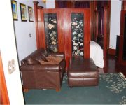
THE MISSING LANTERN
Gabbs Apartment
Kosciuszko Street Apartment
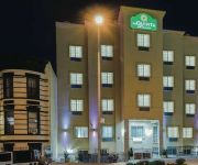
La Quinta Inn and Suites Brooklyn East
Arlington Place Bed & Breakfast
BEST WESTERN PLUS ARENA HOTEL
RNYNY - RED CARPET INN BROOKLYN
Brooklyn Houze - Hostel
The Missing Lantern
Sumner Hotel
Videos from this area
These are videos related to the place based on their proximity to this place.
Manhattan-bound R62 3 Train Ride (Crown Heights/Utica Avenue-Franklin Avenue)
Here's my nice lonesome ride on the Manhattan-bound R62 3 train ride from Crown Heights/Utica Avenue to Franklin Avenue on the IRT Eastern Parkway Line in Brooklyn Train Transfers at Franklin...
Manhattan-bound R160A M Train@Myrtle Avenue/Bway (Street Level)
Here's a wonderful screechin' symphony as the Manhattan-bound R160A M train enter the vincinity of Myrtle Avenue/Bway Train Transfers:J Train to Jamaica Center-Parsons/Archer Bus Transfers:B46.
MTA New York City Subway (J). The crazy line.
The "J" Subway, with A & C lines, is one of the most used by the Brooklyn's people. In all subways around the world, people use the trains like a stage to take few dollars. When they have a...
VERY RARE PURPLE FDNY VAN NEAR LAFAYETTE STREET IN LITTLE ITALY AREA OF MANHATTAN IN NEW YORK CITY.
HERE YOU WILL SEE A VERY RARE PURPLE FDNY VAN NEAR LAFAYETTE STREET IN THE LITTLE ITALY AREA OF MANHATTAN IN NEW YORK CITY. IN LOVING MEMORY OF MY LITTLE ...
FDNY EMS AMBULANCE RESPONDING NEAR CHURCH ST. & DUANE ST. IN TRIBECA, MANHATTAN, NEW YORK CITY.
HERE YOU WILL SEE A FDNY EMS AMBULANCE RESPONDING NEAR CHURCH STREET AND DUANE STREET IN THE TRIBECA AREA OF MANHATTAN IN NEW YORK CITY. IN LOVING ...
BMT Myrtle Ave Line: R160A-1 M Shuttle Trains at Central Ave (Weekend)
Myrtle Ave bound R160A-1 M Shuttle Train coming from Myrtle-Wyckoff Aves and bypassing Knickerbocker Ave. Note: Due to Station work M Trains in both direction are not stopping at Knickerbocker...
BMT Myrtle Ave Line: R160A-1 M Trains at Central Ave-Myrtle Ave
Note: As you know this is the last day for Central Ave for train service. As of 3-9-13 until 8-9-13 this station will be closed for major station construction/repairs just like when Knickerbocker...
BMT Canarsie Line: R143 L Train at Halsey St-Wyckoff Ave (Weekend)
Manhattan bound R143 L Train coming from Wilson Ave station and entering at Halsey St. Then Manhattan bound L Train leaves Halsey St heading towards Myrtle Ave-Wyckoff Ave as its next station...
BMT Myrtle Ave Line: R160A-1 M Trains at Knickerbocker Ave (Re-Open & New Look)
Note: After 5 months of repair & repaint on this station. Knickerbocker Ave station has re-open but it's been a week since it re-open. Note: Come March through August of 2013 Central Ave...
IRT Eastern Parkway Line: Crown Heights/Utica Avenue
Woodlawn-Bound R142A 4 Train Leaves Crown Heights/Utica Avenue. Shot With A Sony Cyber-Shot DSC-W350 Camera. Local Station: Crown Heights/Utica Avenue Cross Streets: Utica ...
Videos provided by Youtube are under the copyright of their owners.
Attractions and noteworthy things
Distances are based on the centre of the city/town and sightseeing location. This list contains brief abstracts about monuments, holiday activities, national parcs, museums, organisations and more from the area as well as interesting facts about the region itself. Where available, you'll find the corresponding homepage. Otherwise the related wikipedia article.
Crown Heights – Utica Avenue (IRT Eastern Parkway Line)
Crown Heights – Utica Avenue is an express station on the IRT Eastern Parkway Line of the New York City Subway. Located under Eastern Parkway near Utica Avenue in Crown Heights, Brooklyn, it is served by the 4 train at all times and the 3 train at all times except late nights. There is also sporadic 2 and 5 service during rush hours. Despite its name, this station has no exit to the corner of Utica Avenue and Eastern Parkway.
Atlantic Avenue (New York City)
Atlantic Avenue is an important street in the New York City boroughs of Brooklyn and Queens. It stretches from the Brooklyn waterfront on the East River all the way to Jamaica, Queens. Atlantic Avenue runs parallel to Fulton Street for much of its course through Brooklyn, where it serves as a border between the neighborhoods of Prospect Heights and Fort Greene and between Bedford-Stuyvesant and Crown Heights.
Fulton Street (Brooklyn)
Fulton Street, named after Robert Fulton, is a long east-west street in northern Brooklyn. A street of the same name in Manhattan was linked to this street by Fulton with his steam ferries. This street begins at the intersection of Adams Street and Joralemon Street in Brooklyn Heights. For a hundred years before the Fulton Ferry monopoly, Fulton Street was the Ferry Road through Jamaica Pass and, in the centuries before any ferry service, Indian path to the Hempstead Plains.
Utica Avenue (IND Fulton Street Line)
Utica Avenue is an express station on the IND Fulton Street Line of the New York City Subway. The tile color is Pomegranate red with a Tuscan red border. The station has been renovated with new old-fashioned light fixtures with modern sodium-vapor lamps in them. They are suspended on long rods from the high, vaulted ceilings. There is a free crossover. It is served by the A train at all times and the C train at all times except late nights. It has four tracks and two island platforms.
Ralph Avenue (IND Fulton Street Line)
Ralph Avenue is a local station on the IND Fulton Street Line of the New York City Subway. Located in Brooklyn at the intersection of Ralph Avenue and Fulton Street, it is served by the C train at all times except late nights, when it is replaced by the A train. This underground station, opened on April 9, 1936, has four tracks and two side platforms. The two express tracks are used by the A train during daytime hours.
Rockaway Avenue (IND Fulton Street Line)
Rockaway Avenue is a local station on the IND Fulton Street Line of the New York City Subway, located at the intersection of Rockaway Avenue and Fulton Street in Brooklyn. It is served by the C train all times except late nights when the A train takes over service.
Chauncey Street (BMT Jamaica Line)
Chauncey Street is a renovated skip-stop station on the BMT Jamaica Line of the New York City Subway. Located at the intersection of Chauncey Street and Broadway in Brooklyn, it is served by the Z train during rush hours in the peak direction and the J train at all other times. The southeast exit leads to Marion and Chauncey Streets and is only used for emergencies. The northwest exit has a crossunder and a metal mezzanine. It leads to Rockaway Avenue and Broadway.
Halsey Street (BMT Jamaica Line)
Halsey Street is a skip-stop station on the BMT Jamaica Line of the New York City Subway. Located at Halsey Street and Broadway at the border of Bedford-Stuyvesant and Bushwick, Brooklyn, it is served at all times by the J train while the Z bypasses this station when it operates. This elevated station, opened on August 19, 1885, has two side platforms and three tracks. The center express track is not used in revenue service.
Gates Avenue (BMT Jamaica Line)
Gates Avenue is a skip-stop station on the elevated BMT Jamaica Line of the New York City Subway, located at the intersection of Gates Avenue and Broadway in Bushwick, Brooklyn. It is served by the Z train during rush hours in the peak direction and the J train at all other times. It is notable for being the oldest existing station in the entire New York City Subway system; It has been in continuous operation for over 127 years.
Kosciuszko Street (BMT Jamaica Line)
Kosciuszko Street is a skip-stop station on the BMT Jamaica Line of the New York City Subway. It is served at all times by the J train. The Z train bypasses this station when it operates. The south exit has a crossunder and leads to Kosciuszko Street while the north exit is an emergency exit and leads to DeKalb Avenue. The artwork here is called Euphorbias by Ronald Calloway and has a floral theme.
Zion Triangle
Zion Park is a small park in the Brownsville, Brooklyn section of Brooklyn, New York notable for the Brownsville War Memorial. The Memorial to the fallen of the First World War was created by sculptor Charles Cary Rumsey (1879–1922) and dedicated in 1925. The bas relief sculptures are mounted on a limestone stele and side pylons by architect Henry Beaumont Herts. The park is formed by the junction of Legion Street, and Pitkin Avenue and East New York Avenue at the junction of Eastern Parkway.
Boys and Girls High School
Boys and Girls High School, the oldest public high school in Brooklyn, is a comprehensive high school in Bedford–Stuyvesant, Brooklyn, New York. The 3,600 student body school is located at 1700 Fulton Street. Brooklyn's first public high school, the Central Grammar School (named "Central" rather than "Free" to avoid controversy over providing free "higher education" for poor children), opened, September 1878 in a rented building on Court & Livingston Streets.


