Safety Score: 2,7 of 5.0 based on data from 9 authorites. Meaning we advice caution when travelling to United States.
Travel warnings are updated daily. Source: Travel Warning United States. Last Update: 2024-04-25 08:17:04
Delve into Washington Heights
Washington Heights in New York County (New York) with it's 152,613 habitants is a city located in United States about 213 mi (or 342 km) north-east of Washington DC, the country's capital town.
Current time in Washington Heights is now 08:58 PM (Thursday). The local timezone is named America / New York with an UTC offset of -4 hours. We know of 9 airports closer to Washington Heights, of which 4 are larger airports. The closest airport in United States is La Guardia Airport in a distance of 6 mi (or 10 km), South-East. Besides the airports, there are other travel options available (check left side).
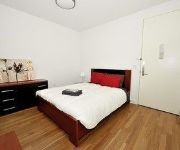
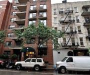
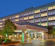
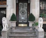
There are two Unesco world heritage sites nearby. The closest heritage site in United States is Statue of Liberty in a distance of 11 mi (or 18 km), South. Also, if you like playing golf, there are some options within driving distance. We saw 10 points of interest near this location. In need of a room? We compiled a list of available hotels close to the map centre further down the page.
Since you are here already, you might want to pay a visit to some of the following locations: The Bronx, Manhattan, Hackensack, Jersey City and Queens. To further explore this place, just scroll down and browse the available info.
Local weather forecast
Todays Local Weather Conditions & Forecast: 14°C / 58 °F
| Morning Temperature | 7°C / 44 °F |
| Evening Temperature | 14°C / 57 °F |
| Night Temperature | 10°C / 50 °F |
| Chance of rainfall | 0% |
| Air Humidity | 25% |
| Air Pressure | 1032 hPa |
| Wind Speed | Gentle Breeze with 8 km/h (5 mph) from North |
| Cloud Conditions | Clear sky, covering 0% of sky |
| General Conditions | Sky is clear |
Friday, 26th of April 2024
14°C (58 °F)
12°C (53 °F)
Overcast clouds, moderate breeze.
Saturday, 27th of April 2024
15°C (59 °F)
16°C (60 °F)
Light rain, gentle breeze, overcast clouds.
Sunday, 28th of April 2024
20°C (69 °F)
15°C (60 °F)
Light rain, gentle breeze, overcast clouds.
Hotels and Places to Stay
Luxury Suites Upper West Brownstone
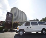
DoubleTree by Hilton Fort Lee - George Washington Bridge
La Maison d'Art
The Sylvan Guest House
The Park Ave North
Market Rentals Downtown Apartments
Market Rentals Uptown
Holiday Inn GW BRIDGE-FORT LEE NYC AREA
New York Renaissance Home and Guest House
Sugar Hill Harlem Inn
Videos from this area
These are videos related to the place based on their proximity to this place.
2015 PSAL City Championship - Boys 300m Dash Final - SCHOOL RECORD
Heat 2 of 2 - Kevon White - Lane 5 - 34.79.
2015 PSAL City Championship - Boys 4x400
Heat 2 of 3 - Kevon White, Munir Ibrahim, Marlon Smith and Tyreke Theobalds - 3:33.78.
2015 PSAL City Championship - Girls 4x200 Final
Heat 1 of 2 - Keanna McKnight, Angelique Owens, Immani West, Katriel Perrier - 1:48.64.
The Evening Commute from Jersey - A TIME-LAPSE COMEDY
This is a timelapse featuring an evening commute from Englewood Cliffs, NJ to Merrick, NY on Long Island via New York City utilizing US Route 9W, the Palisades Interstate Parkway, the George...
George Washington Bridge, New York City, NY, USA Collage Video - youtube.com/tanvideo11
Powered by http://www.tanmarket.com - The George Washington Bridge (known informally as the GW Bridge, the GWB, the GW, or the George) is a double-decked suspension bridge spanning the ...
MNRR Express trains from Highbridge Park
5/25/13 Rainy Saturday morning so I decided up the hill from my house to Highbridge Park, which has great views of the Hudson Line. Caught a New Haven unit as well. Enjoy! 1. Metro North...
Metro North Express from Highbridge Park
4/1/13 Went for a walk to find the 'Washington Heights' rock from the MTV show. While standing up there the view is amazing(pics on facebook [url]https://www.facebook.com/monica.matos?ref=tn_tnmn)...
2015 Millrose Games Trials - PSAL Girls 4x400 - SCHOOL RECORD
Heat 6 of 7 - Angellica Malcolm, Katie Alvarez, Katriel Perrier and Keanna McKnight - 4:09.84.
New York City - Video tour of a furnished apartment in Washington Heights (Uptown Manhattan)
Welcome to another New York Habitat video tour of a furnished apartment in New York ( http://www.nyhabitat.com ). Today, we will be touring a nice fully furnished one-bedroom apartment at Broadway.
Videos provided by Youtube are under the copyright of their owners.
Attractions and noteworthy things
Distances are based on the centre of the city/town and sightseeing location. This list contains brief abstracts about monuments, holiday activities, national parcs, museums, organisations and more from the area as well as interesting facts about the region itself. Where available, you'll find the corresponding homepage. Otherwise the related wikipedia article.
Bennett Park (New York City)
Bennett Park (James Gordon Bennett Park) is a public park in New York City, named for James Gordon Bennett, Sr. , the newspaper publisher who launched the New York Herald in 1835. It is located between Pinehurst and Fort Washington Avenues and West 183rd and 185th Streets in the Hudson Heights neighborhood of Washington Heights in northern Manhattan, on land purchased by Bennett in 1871, the year before his death.
George Washington Bridge Bus Station
The George Washington Bridge Bus Station is a commuter bus terminal located at the east end of the George Washington Bridge in the Washington Heights area of Manhattan in New York City, New York. The bus station is owned and operated by the Port Authority of New York and New Jersey. According to the Port Authority's website, on a typical weekday, approximately 17,000 passengers on about 950 buses use the bus station.
181st Street (IND Eighth Avenue Line)
181st Street is a station on the IND Eighth Avenue Line of the New York City Subway. It is located on Fort Washington Avenue and 181st Street, one of the main shopping districts of the Hudson Heights neighborhood of Washington Heights, and served by the A train at all times. This underground station, opened on September 10, 1932, has two tracks and two side platforms and is deep below the surface due to the area's hills.
181st Street (IRT Broadway – Seventh Avenue Line)
181st Street is a local station on the IRT Broadway – Seventh Avenue Line of the New York City Subway. Located at the intersection of St. Nicholas Avenue and 181st Street in the Manhattan neighborhood of Washington Heights, it is served by the 1 train at all times. This deep station, 120 feet below the surface, has four elevators, and a bridge connecting the two side platforms. There is only a set of emergency stairs for a fire, causing all riders to take an elevator at all times.
Hudson Heights (Manhattan)
Hudson Heights is a neighborhood in the Washington Heights area of Upper Manhattan, New York City. As its name implies, it is a high area overlooking Hudson River, and the neighborhood includes the highest natural point in Manhattan, in Bennett Park. Hudson Heights is bounded by the Hudson River to the west, Broadway to the east, 173rd Street to the south, and Fort Tryon Park to the north.
Battle of Fort Washington
The Battle of Fort Washington was fought in New York on November 16, 1776 during the American Revolutionary War between the United States and Great Britain. It was a decisive British victory that gained the surrender of the entire garrison of Fort Washington near the north end of Manhattan Island.
Yeshiva Rabbi Samson Raphael Hirsch
Yeshiva Rabbi Samson Raphael Hirsch (YRSRH, also known as Breuer's, after its creator) was founded in New York City in 1944, as a means of reestablishing the Orthodox Jewish community of Frankfurt, Germany in the United States. The school, founded by Rabbi Joseph Breuer, is run according to the philosophy of Rabbi Breuer's grandfather, Rabbi Samson Raphael Hirsch. It is located in the Upper Manhattan neighborhood of Washington Heights.
Khal Adath Jeshurun
Khal Adath Jeshurun (KAJ) is an Orthodox German Jewish Ashkenazi congregation in the Washington Heights neighborhood, in the New York City borough of Manhattan. It has established an offshoot in the heavily Orthodox Jewish neighborhood of Monsey, New York, as well as Paramus, New Jersey.
Fort Washington (New York)
Fort Washington was a fortified position near the north end of Manhattan Island (now part of New York City) and was located at the highest point on the island. The Fort Washington Site is listed on the U.S. National Register of Historic Places.
Audubon Avenue
Audubon Avenue is an avenue in the Washington Heights neighborhood in Upper Manhattan that runs north-south, west of and parallel to Amsterdam Avenue. Its southern terminus is at West 165th Street and St. Nicholas Avenue, and its northern terminus is at Fort George Avenue, just north of West 193 Street. It crosses over the Trans-Manhattan Expressway, just to the east of where it enters the tunnel. Audubon Avenue is named for naturalist John James Audubon, who owned a farm in the area.
James Striar School of General Jewish Studies
The James Striar School of General Jewish Studies, informally known as the Mechinah Program, is a comprehensive program in Jewish studies for students seeking to improve and further their basic skills and knowledge of Jewish studies. JSS is the only school in the country designed for college-age students who wish to pursue Jewish studies on either beginning or intermediate level while taking a regular college program simultaneously on the same campus.
St. Teresa of Avila's Church (New York City)
The Church of St. Teresa of Avila is a former Roman Catholic parish church under the authority of the Roman Catholic Archdiocese of New York, located at 184th Street at Broadway in Manhattan, New York City. The parish was established in 1933 and staffed by the Vincentian Fathers; the parish is now closed.


