Safety Score: 2,7 of 5.0 based on data from 9 authorites. Meaning we advice caution when travelling to United States.
Travel warnings are updated daily. Source: Travel Warning United States. Last Update: 2024-05-04 08:22:41
Delve into Red Hook
The district Red Hook of Red Hook Houses in Kings County (New York) is a district located in United States about 202 mi north-east of Washington DC, the country's capital town.
In need of a room? We compiled a list of available hotels close to the map centre further down the page.
Since you are here already, you might want to pay a visit to some of the following locations: Brooklyn, Jersey City, Manhattan, Staten Island and Queens. To further explore this place, just scroll down and browse the available info.
Local weather forecast
Todays Local Weather Conditions & Forecast: 16°C / 60 °F
| Morning Temperature | 12°C / 53 °F |
| Evening Temperature | 13°C / 55 °F |
| Night Temperature | 11°C / 52 °F |
| Chance of rainfall | 0% |
| Air Humidity | 54% |
| Air Pressure | 1027 hPa |
| Wind Speed | Moderate breeze with 9 km/h (6 mph) from North-West |
| Cloud Conditions | Overcast clouds, covering 100% of sky |
| General Conditions | Overcast clouds |
Sunday, 5th of May 2024
10°C (50 °F)
13°C (55 °F)
Moderate rain, moderate breeze, overcast clouds.
Monday, 6th of May 2024
16°C (61 °F)
16°C (61 °F)
Light rain, light breeze, overcast clouds.
Tuesday, 7th of May 2024
16°C (61 °F)
16°C (60 °F)
Light rain, light breeze, overcast clouds.
Hotels and Places to Stay
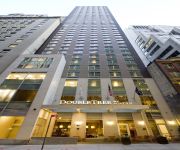
DoubleTree by Hilton New York City - Financial District
New York Marriott at the Brooklyn Bridge
Union Hotel Brooklyn
Hotel Le Bleu
WYNDHAM GARDEN BROOKLYN SUNSET
Hilton Brooklyn New York
RED CARPET INN BROOKLYN CONEY ISLAND
Hampton Inn Manhattan-Downtown-Financial District NY
Hilton Garden Inn Financial Center-Manhattan Downtown NY
Fairfield Inn & Suites New York Brooklyn
Videos from this area
These are videos related to the place based on their proximity to this place.
Brooklyn IKEA Installs Solar Panels But Can't Turn Them On
http://onearth.org New York City's first IKEA furniture store came with an unusual accessory: a field of rooftop solar panels. (IKEA has another store with solar panels in Pittsburgh and is...
Why New Yorkers Love Passive House
Floris Keverling Buisman gives us a brief example of the amazing sound damping abilities of a home that is airtight and highly insulated. This is a historic masonry home in Park Slope, Brooklyn...
RARE OEM COMMAND CENTER BUS, OFFICE OF EMERGENCY MANAGEMENT ON SOUTH ST. IN LOWER MANHATTAN, NYC.
HERE YOU WILL SEE A RARE GLIMPSE OF THE NEW YORK CITY INTERAGENCY COMMAN CENTER OR "OEM COMMAND CENTER BUS" FROM THE NYC OFFICE OF EMERGENCY ...
It's My Park: Red Hook Food Vendors
The pan-latin food vendors of Red Hook Park serve up a fiesta every weekend from May to October. Produced by Adrian Sas.
NYC Stroll: RED HOOK. Waterfront Museum and Showboat Barge
New York City Stroll:Red Hook, Brooklyn, The Waterfront Museum and Showboat Barge. Built in 1914 Lehigh Valley Railroad Barge Number 79 is the only surviving all-wooden example of the Hudson...
Fairway Market - With Love on Valentine's Day from Fairway Red Hook
Fairway Red Hook is officially reopening for business on March 1, 2013! Take a preview of some of the changes we have made to create a better Fairway Market for you! Happy Valentine's Day!...
Fairway Market - Red Hook to Reopen March 1!
Fairway Market, like no other market. Fairway Red Hook got hit hard by Sandy. After months of hard work, our Red Hook store is reopening on March 1!
Red Hook Design LLC - Wet Cutting Concrete Pavers
This is the wet cutting process for masonry pavers to be installed on a elevated patio surface. The saw being used is a vintage Clipper Select-A-Notch and the pavers are Hanover Pedestal 2'...
Fairway Markets Red hook store rebuilds after hurricane sandy
Fairway Market Red hook store rebuilds after hurricane sandy. The store and neighborhood were hit hard by the storm and now the rebuild process begins.
Videos provided by Youtube are under the copyright of their owners.
Attractions and noteworthy things
Distances are based on the centre of the city/town and sightseeing location. This list contains brief abstracts about monuments, holiday activities, national parcs, museums, organisations and more from the area as well as interesting facts about the region itself. Where available, you'll find the corresponding homepage. Otherwise the related wikipedia article.
Carroll Gardens, Brooklyn
Carroll Gardens is a neighborhood in the Brooklyn borough of New York City, USA. The area is named for Charles Carroll, a revolutionary war veteran who was also the only Roman Catholic signer of the Declaration of Independence. Carroll Park is a block-long area of playgrounds, walkways and sitting areas between Court and Smith Streets, with Carroll Street as its southern boundary and President Street on the northern side.
Gowanus Canal
The Gowanus Canal, also known as the Gowanus Creek Canal, is a canal in the New York City borough of Brooklyn, geographically on the westernmost portion of Long Island. Connected to Gowanus Bay in Upper New York Bay, the canal borders the neighborhoods of Red Hook and South Brooklyn to the west and Park Slope to the east — as well as the neighborhoods of Red Hook to the north and Sunset Park to the south.
Buttermilk Channel
In New York City, Buttermilk Channel is a small tidal strait in Upper New York Bay, approximately one mile long and one-fourth of a mile wide (1.6 by 0.4 km), separating Governors Island from Brooklyn. Origins of the name are uncertain but it is alleged to be a reference to the dairy farmers who used to cross this channel by boat to sell their milk in Manhattan markets.
Red Hook, Brooklyn
Red Hook is a neighborhood in the New York City borough of Brooklyn, U.S.A. The neighborhood is part of Brooklyn Community Board 6. It is also the location where the transatlantic liner RMS Queen Mary 2 docks in New York City.
Gowanus, Brooklyn
Gowanus is a neighborhood in the New York City borough of Brooklyn. The neighborhood is part of Brooklyn Community Board 6. The Gowanus area has been an active center of industrial and shipping activity since the 1860s. It is zoned for light to mid-level manufacturing (M1, M2, and M3).
Carroll Street (IND Culver Line)
Carroll Street is a local station on the IND Culver Line of the New York City Subway, located in the neighborhood of Carroll Gardens, Brooklyn, at Carroll and Smith Streets. It is served by the F and G trains at all times. This underground station, opened on October 7, 1933, has four tracks and two side platforms. The two unused center express tracks are at a much lower level than the local tracks at the north end. They ramp up throughout the station to the same level by the southern end.
Rocky Sullivan's
Rocky Sullivan's is a New York City Irish style pub opened in 1996 by musician Chris Byrne (Seanchai and the Unity Squad, Black 47 and Paddy-A-Go-Go) and journalist Patrick Farrelly. Entertainment includes a pub quiz on Thursdays, Irish language classes on Tuesdays and live music on Mondays, Tuesdays, Wednesdays and Saturdays.
Fort Columbus
Fort Columbus was the name of a fortification and later the army post that developed around it from 1806 to 1904. Located on Governors Island in New York Harbor, a half mile from Lower Manhattan, it was originally constructed as Fort Jay about 1794 and named in honor of New York Governor, later Secretary of State and Chief Justice of the Supreme Court, John Jay.
Prospect Avenue (BMT Fourth Avenue Line)
Prospect Avenue is a local station on the BMT Fourth Avenue Line in Brooklyn of the New York City Subway. Located at Prospect Avenue and Fourth Avenue near the border of Sunset Park and Park Slope, it is served by the R train at all times except late nights, when the D and N assume local service along Fourth Avenue. This station has four tracks and two side platforms with a full curtain wall separating the local and express tracks.
Smith–Ninth Streets (IND Culver Line)
Smith–Ninth Streets is a local station on the IND Culver Line of the New York City Subway. It is located over the Gowanus Canal between Smith and Ninth Streets in Gowanus, Brooklyn and is served by the F and G trains at all times. This elevated station, opened on October 7, 1933, has four tracks and two side platforms. The center express tracks are not used in revenue service. With an elevation of 87.5 feet, this station is the highest subway station in the world.
25th Street (BMT Fourth Avenue Line)
25th Street is a local station on the BMT Fourth Avenue Line of the New York City Subway. Located at the intersection of 25th Street and Fourth Avenue in Sunset Park, Brooklyn, it is served by the R train at all times except late nights, when the D and N trains assume local service along Fourth Avenue. This underground station, opened on September 13, 1915, has four tracks and two side platforms. The two center tracks are used by the D and N trains during daytime hours.
Red Hook Park
Red Hook Park and Recreation Area is a 58.503-acre public park in the New York City borough of Brooklyn located in the Red Hook neighborhood. The park contains a paved path, benches, a flagpole with a yardarm, a drinking fountain, handball courts, softball fields, a soccer and football field, a track and field, picnic tables, the adjacent Sol Goldman Pool, and new trees and plantings. The park is maintained and operated by the New York City Department of Parks and Recreation.
Metropolitan Detention Center, Brooklyn
The Metropolitan Detention Center, Brooklyn (MDC Brooklyn) is a United States federal administrative detention facility in Brooklyn, New York which holds male and female prisoners of all security levels. It is operated by the Federal Bureau of Prisons, a division of the United States Department of Justice. Most prisoners held at MDC Brooklyn have pending cases in the United States District Court for the Eastern District of New York. MDC Brooklyn also holds prisoners serving brief sentences.
Brooklyn Cruise Terminal
The Brooklyn Cruise Terminal is one of three terminals for ocean-going cruise ships in the metropolitan New York City area, USA. The terminal is located at Red Hook Pier 12, which forms the south side of the Atlantic Basin at Pioneer and Imlay Streets in the Red Hook section of Brooklyn, New York. The terminal opened on April 15, 2006, with the arrival of the RMS Queen Mary 2.
Fourth Avenue / Ninth Street (New York City Subway)
Fourth Avenue / Ninth Street is a New York City Subway station complex shared by the elevated IND Culver Line and the underground BMT Fourth Avenue Line. It is located at the intersection of Ninth Street and Fourth Avenue in Park Slope, Brooklyn and served by the: F and G trains at all times R train at all times except late nights D and N trains late nights
BoCoCa
BoCoCa is a portmanteau word combining the names of three adjacent neighborhoods in Brooklyn, New York: Boerum Hill, Cobble Hill, and Carroll Gardens. BoCoCa, therefore, is not an actual neighborhood, but an umbrella term for the small region of Brooklyn directly south and southwest of Downtown Brooklyn. The relatively new name is not widely used, but is gaining greater currency, even outside the United States.
Red Hook graving dock
The Red Hook graving dock, initially known as "Graving Dock One", was a 730-foot-long New York graving dock located at the Vigor Shipyards in Red Hook, Brooklyn. In its time, the dock was considered to have contributed to making Red Hook the "center of the shipping industry in New York" and was part of the city's largest dry dock and shipping dock.
The Real World: Brooklyn
The Real World: Brooklyn is the twenty-first season of MTV's reality television series The Real World, which focuses on a group of diverse strangers living together for several months in a different city each season, as cameras document their lives and interpersonal relationships.
South Brooklyn Community High School
South Brooklyn Community High School (SBCHS) is a public transfer high school in Red Hook, Brooklyn offering students who are truant or have dropped out a second chance to earn a high school diploma The school is a partnership between the NYCDOE and Good Shepherd Services, a youth development, education and family service agency.
Segal Lock and Hardware Company
The Segal Lock and Hardware Company of Manhattan, New York was a leading manufacturer of hardware merchandise and razor blades in the 1920s and 1930s. First established in Connecticut and Manhattan, the firm relocated to Brooklyn, New York in the mid-1920s. The Segal Safety Razor Corporation was a subsidiary of the Segal Lock and Hardware Company. The business was at first known as the Burglar-Proof Lock Company.
The Gowanus Yacht Club
The Gowanus Yacht Club is a beer garden located in the Carroll Gardens region of Brooklyn, New York City,located on the corner of Smith Street and President Street.
Liggett Hall
Liggett Hall was a barracks building designed by McKim, Mead & White and built in 1929 at Fort Jay on Governors Island, a long time U.S. Army post and administrative center in New York Harbor. The building follows along a design from a master plan for Fort Jay that the architectural firm developed for the island army post at the request of Secretary of War Elihu Root in 1904.
Carroll Park Methodist Episcopal Church
Carroll Park Methodist Episcopal Church is a former Methodist church in Brooklyn, New York, formerly located at 295 Carroll Street, Carroll Gardens, Brooklyn, New York City. The Victorian Gothic edifice was erected c.1890 and located within the Carroll Gardens historic district. It was reused as Norwegian Methodist Episcopal Church, reflecting the large Scandinavian population in Brooklyn between the 1890s and 1949.
Church of the Sacred Hearts of Jesus and Mary (Brooklyn, New York)
The Church of the Sacred Hearts of Mary and Jesus was a former Roman Catholic parish church, primarily serving Italian Americans, that was demolished. The church was first located on President Street off of Van Brunt Street and then on Degraw and Hicks Streets, Brooklyn Heights, New York City. The Catholic Mission of the Italian Colony of the City of Brooklyn was established in 1882 by Fr. Joseph Fransioli (sometimes spelled Francioli) in St. Peter’s Church (corner of Warren and Hicks Streets).
Defonte's
Defonte's is a famous and historic sandwich shop in the Red Hook, Brooklyn section of New York. It is known for large Italian heroes with ham, provolone, salami, roast beef, mozzarella and fried eggplant. There is also a steak pizzaiola sandwich. The eatery was featured on Diners, Drive-Ins and Dives on February 20, 2012 in the Long Standing Legacies episode. There is also a Gramercy location in Manhattan where offering include prepared dinners.


