Safety Score: 2,7 of 5.0 based on data from 9 authorites. Meaning we advice caution when travelling to United States.
Travel warnings are updated daily. Source: Travel Warning United States. Last Update: 2024-05-11 07:34:58
Explore Gerritsen Beach
The district Gerritsen Beach of Gerritsen in Kings County (New York) is located in United States about 203 mi north-east of Washington DC, the country's capital.
If you need a place to sleep, we compiled a list of available hotels close to the map centre further down the page.
Depending on your travel schedule, you might want to pay a visit to some of the following locations: Brooklyn, Queens, Manhattan, Jersey City and Staten Island. To further explore this place, just scroll down and browse the available info.
Local weather forecast
Todays Local Weather Conditions & Forecast: 14°C / 57 °F
| Morning Temperature | 9°C / 49 °F |
| Evening Temperature | 12°C / 54 °F |
| Night Temperature | 11°C / 52 °F |
| Chance of rainfall | 0% |
| Air Humidity | 45% |
| Air Pressure | 1011 hPa |
| Wind Speed | Moderate breeze with 10 km/h (6 mph) from North-West |
| Cloud Conditions | Few clouds, covering 22% of sky |
| General Conditions | Few clouds |
Sunday, 12th of May 2024
9°C (49 °F)
10°C (50 °F)
Moderate rain, moderate breeze, overcast clouds.
Monday, 13th of May 2024
14°C (58 °F)
14°C (57 °F)
Sky is clear, fresh breeze, clear sky.
Tuesday, 14th of May 2024
18°C (64 °F)
16°C (60 °F)
Light rain, fresh breeze, overcast clouds.
Hotels and Places to Stay
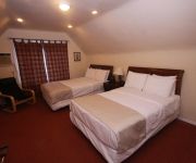
Lefferts Manor Bed & Breakfast
Midwood Suites Brooklyn
Delz Bed & Breakfast
Avenue Plaza Hotel
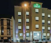
La Quinta Inn and Suites Brooklyn East
Eve's Place
Loralei Bed and Breakfast
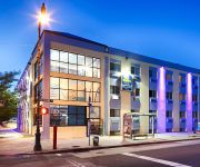
Lxure Brooklyn Suites
BEST WESTERN PLUS BROOKLYN BAY
Serenity at Home Guest House
Videos from this area
These are videos related to the place based on their proximity to this place.
24 Hour Plumber Manhattan Beach Brooklyn 718-925-4052 Brooklyn NY Plumbing Service
24 Hour Plumber Manhattan Beach Brooklyn 718-925-4052 Brooklyn Repairs, Installation, Maintenance We offer a wide range of services to handle your large or small plumbing, drain cleaning,...
MTA NYCT Bus: 1998 Nova-RTS B49 Bus #9420 at Kingsborough CC-Oriental Blvd
Bay Ridge-4th Ave bound Nova-RTS B1 Bus #9420 on Oriental Blvd (Manhattan Beach) at its first bus stop at Kingsborough Community College and leaving its first bus stop heading towards Shore...
Jason Eppink Joins Reactor
Thursday 14th October 2011 Rockaway Beach to Breezy Point, Queens, NYC. As part of Congress of Collectives at Flux Factory, Reactor invited individuals and groups to become guest members...
Sandy Hurricane 10.29.2012 Jeep Wrangler SCARY
We were rescued by the Jeep wrangler! Water started to rise at 7.20 and streets became completely flooded in 30-35 minutes! Cars are floating! If you wish to licence this footage please contact...
MTA New York City Transit: On Board 2011 New Flyer XD40 #4888
On board a New Flyer Xcelsior on the B3 heading to Nostrand Avenue via Avenue U. 2011 New Flyer XD40 "Xcelsior" Low Floor Engine: Cummins ISL-9 EPA 10 Transmission: Allison World B400R ...
NYC DEP Oyster Restoration Pilot, Gerritsen Creek: 8/23/11
NYC DEP Oyster Restoration Pilot Gerritsen Crek, Oyster Balls Jamaica Bay, NYC 08/23/2011.
NYC DEP Oyster Restoration Pilot, Gerritsen Creek: 06/08/11 (3)
NYC DEP Oyster Restoration Pilot Gerritsen Creek, Oyster Balls Jamaica Bay, NYC 06/08/2011.
NYC DEP Oyster Restoration Pilot, Gerritsen Creek: 06/08/11 (1)
NYC DEP Oyster Restoration Pilot Gerritsen Creek, Oyster Balls Jamaica Bay, NYC 06/08/2011.
Videos provided by Youtube are under the copyright of their owners.
Attractions and noteworthy things
Distances are based on the centre of the city/town and sightseeing location. This list contains brief abstracts about monuments, holiday activities, national parcs, museums, organisations and more from the area as well as interesting facts about the region itself. Where available, you'll find the corresponding homepage. Otherwise the related wikipedia article.
Floyd Bennett Field
Floyd Bennett Field was New York City's first municipal airport, later a naval air station, and is now a park. While no longer used as an operational commercial, military or general aviation airfield, it is still used as a helicopter base by the New York Police Department (NYPD).
Rockaway Inlet
Rockaway Inlet is a strait connecting Jamaica Bay, wholly within New York City, with the Atlantic Ocean. It separates the Rockaway Peninsula in Queens from the Floyd Bennett Field in Brooklyn. Rockaway Inlet is bounded by Brooklyn to the north and Rockaway Peninsula to the south. It is the entrance to Jamaica Bay, and most of the inlet is within the boundary of Gateway National Recreation Area. Its entrance is marked by a light on a jetty extending southward from Rockaway Point.
Gerritsen Beach, Brooklyn
Gerritsen Beach is a small town/community in the New York City borough of Brooklyn, located between Sheepshead Bay to the west and Marine Park to the east. The area is served by Brooklyn Community Board 15.
Sheepshead Bay, Brooklyn
Sheepshead Bay is a bay separating the mainland of Brooklyn, New York City, from the eastern portion of Coney Island, the latter originally a barrier island but now effectively an extension of the mainland with peninsulas both east (the neighborhood of Manhattan Beach) and west (the neighborhoods of Coney Island and Sea Gate). The mouth of the bay is about a mile (1.6 km) southwest of Marine Park, Brooklyn.
Manhattan Beach, Brooklyn
Manhattan Beach is a residential neighborhood in the New York City borough of Brooklyn. It is bounded by the Atlantic Ocean to the south and east, by Sheepshead Bay on the north, and Brighton Beach to the west. Traditionally known as an Italian and Ashkenazi Jewish neighborhood, it is also home to a sizable community of Sephardi Jews and a large Russian Jewish immigrant presence.
Kingsborough Community College
Kingsborough Community College (KBCC), part of the City University of New York (CUNY) system, is the only community college in Brooklyn, New York. The campus is located at Manhattan Beach, which is at the eastern end of Coney Island. The 71-acre (283,000 m²) campus overlooks Sheepshead Bay, Jamaica Bay, and the Atlantic Ocean. In its early years, it also had an annex, known as the "Mid-Brooklyn campus".
Breezy Point, Queens
Breezy Point is a neighborhood in the New York City borough of Queens, located on the western end of the Rockaway peninsula, between Rockaway Inlet and Jamaica Bay on the landward side, and the Atlantic Ocean. The neighborhood is governed by Queens Community Board 14. The community is run by the Breezy Point Cooperative, in which all residents pay the maintenance, security, and community-oriented costs involved with keeping the community private.
Mill Basin, Brooklyn
Mill Basin is a neighborhood in New York City in the southern portion of the borough of Brooklyn lying along Jamaica Bay and bounded to the north by Avenue U, and to the east, south, and west by the Mill Basin/Mill Island Inlet. The area is part of Brooklyn Community Board 18.
Marine Park (Brooklyn)
Marine Park is a public park located in the borough of Brooklyn in New York City. Its 798 acres surround the westernmost inlet of Jamaica Bay. Most of the land for Marine Park was donated to New York City to be turned into public park land by the Whitney family in 1920 and by Frederic B. Pratt and Alfred T. White, who jointly donated 150 acres in 1917. The land donated consists of the area between the current day Fillmore Avenue and Gerritsen Avenue and East 38th Street.
Sheepshead Bay (BMT Brighton Line)
Sheepshead Bay is an express station on the BMT Brighton Line of the New York City Subway. It is located in the Sheepshead Bay neighborhood of Brooklyn. It is served by the Q train at all times and by the B train on weekdays. The station has four tracks and two island platforms. It was renovated by New York City Transit’s in-house MOW forces in 1997-98.
Neck Road (BMT Brighton Line)
Neck Road is a local station on the BMT Brighton Line of the New York City Subway. Served by the Q train at all times, it is located at Gravesend Neck Road between East 15th and East 16th Streets in Homecrest, Brooklyn. This station opened in 1908, has two side platforms and four tracks. The center tracks are used by the B express train when it operates on weekdays. Like the rest of the Brighton Line between Avenue H and Sheepshead Bay, it is situated on an embankment.
Homecrest, Brooklyn
Homecrest is a neighborhood situated in the New York City borough of Brooklyn. It borders Kings Highway to the north, Avenue X to the south, Coney Island Avenue to the west, and Ocean Avenue to the east. Homecrest uses the ZIP Code, 11229. The area is served by Brooklyn Community Board 15. Homecrest is served by the NYPD's 61st Precinct.
Aviator Sports and Recreation
Aviator Sports and Events Center http://www. aviatorsports. com is a concession for the National Park Servicehttp://www. nps. gov/ operating in New York City's historic first municipal airport, Floyd Bennett Field, which opened its hangars in 1931 and was decommissioned in 1972. Floyd Bennett Field (FBF) in Southeast Brooklyn is now part of the 4th most visited unit of the National Park System: Gateway National Recreation Area.
Dead Horse Bay
Dead Horse Bay is a small water body off Barren Island between the Gerritsen Inlet and Rockaway Inlet in the New York City borough of Brooklyn. During the seventeenth century, Dutch settlers built tide mills to grind wheat into flour. A remaining millstone can still be found along the Millstone trail.
WKRB
WKRB (90.3 MHz) is an FM station based in New York City, New York. It is a music based station based at and controlled by Kingsborough Community College in Brooklyn. It also is the official station of the Brooklyn Cyclones, and is a broadcast partner of the New York Islanders hockey club. In 2006, WKRB changed its frequency from 90.9 MHz to 90.3 MHz, but kept its call letters.
Lundy's Restaurant
Lundy's Restaurant, also known as Lundy Brothers Restaurant, was an historic American seafood restaurant in the Sheepshead Bay neighborhood of the New York City borough of Brooklyn. A local institution, it operated from 1934 or 1935 (accounts vary) to 1977 or 1979 (accounts vary), and then again from 1997 to early 2007.
Kings Plaza
Kings Plaza is a shopping center that opened in 1970, within the Marine Park/Mill Basin section of Brooklyn, east of Flatbush Avenue. The mall was originally owned by a joint venture between RH Macy's and Alexander's and is currently owned and managed by The Macerich Company. Kings Plaza originally hosted the now-defunct Alexander's, as well as Macy's department store chains.
The Leon M. Goldstein High School for the Sciences
The Leon M. Goldstein High School for the Sciences at Kingsborough Community College, CUNY, formerly Kingsborough High School for the Sciences at Kingsborough Community College, CUNY from 1993 to 1999 is a four year high school (grades 9 -12), located in Manhattan Beach, Brooklyn, New York. Leon M. Goldstein High School is a public school under the administration of the New York City Department of Education. LMGHS was opened in September 1993 by Mayor David Dinkins and Leon M.
Sheepshead Bay High School
Sheepshead Bay High School is a public high school in Brooklyn, New York City, New York.
St. Edmund Preparatory High School (Brooklyn)
St. Edmund Preparatory High School is a private, Roman Catholic high school in Brooklyn, New York. It is located within the Roman Catholic Diocese of Brooklyn.
New York City DOE District 22
New York City DOE District 22 was a district in New York City encompassing New York City Public Schools in Brooklyn. However, districts were abolished in 2002 when the school system was reorganized.
Sheepshead Bay Houses
The Sheepshead Bay/Nostrand Houses housing projects are located in the Sheepshead Bay section of Brooklyn, New York, bounded by Nostrand Avenue, Bragg St. , Avenue V and Avenue X. Avenue W and Batchelder Street run through the development to divide it into a four block complex. All of its 34 buildings are six stories high. Some have lobbies, others do not.
Plumb Beach, Brooklyn
Plum Beach (sometimes spelled "Plumb") is a beach and surrounding neighborhood along the north shore of Rockaway Inlet, in the New York City borough of Brooklyn. It is located near the neighborhoods of Sheepshead Bay and Gerritsen Beach, just off the Belt Parkway. Originally an island, Hog Creek was filled in during the late 1930's.
Sheepshead Bay Maritime Service Training Station
The United States Maritime Service Training Station at Sheepshead Bay was opened on September 1, 1942. It closed on February 28, 1954. The station was the largest maritime training station during World War II and was equipped to train 30,000 merchant seamen each year. The site is now occupied by Kingsborough Community College, and has been since the mid 1960s.
Jans Martense Schenck house
Jan Martense Schenck, (1631 in Amersfoort, Utrecht, Netherlands - Aug, 27 1687) arrived in New Netherlands on June 28, 1650, on the ship De Valckener (the Falconer) with his sister Annetje and brother Roelof. He bought a parcel of land on Molen Eylandt (Mill Island) in the Dutch town of Nieuw Amersfoort in what is now the Mill Basin section of Brooklyn, New York.


